Page Summary
-
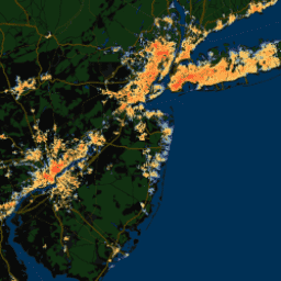
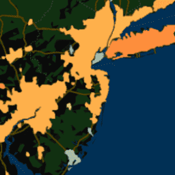
These datasets provide pixel-level and spatially-averaged surface urban heat island intensities for over 10,000 urban clusters globally.
-
The data includes annual, summertime, and wintertime intensities for both day and night.
-
The datasets were derived using MODIS land surface temperature products and Landscan urban extent data.
-
Different datasets offer variations in spatial averaging and temporal composites (yearly, summertime, wintertime, monthly).
-
YCEO Surface Urban Heat Islands: Pixel-Level Annual Daytime and Nighttime Intensity

This dataset contains annual, summertime, and wintertime surface urban heat island (SUHI) intensities for day and night for over 10,000 urban clusters throughout the world. The dataset was created using the MODIS 8-day TERRA and AQUA land surface temperature (LST) products, the Landscan urban extent … climate uhi urban yale -
YCEO Surface Urban Heat Islands: Pixel-Level Composites of Yearly Summertime Daytime and Nighttime Intensity

This dataset contains annual, summertime, and wintertime surface urban heat island (SUHI) intensities for day and night for over 10,000 urban clusters throughout the world. The dataset was created using the MODIS 8-day TERRA and AQUA land surface temperature (LST) products, the Landscan urban extent … climate uhi urban yale -
YCEO Surface Urban Heat Islands: Pixel-Level Yearly Composites of Wintertime Daytime and Nighttime Intensity
This dataset contains annual, summertime, and wintertime surface urban heat island (SUHI) intensities for day and night for over 10,000 urban clusters throughout the world. The dataset was created using the MODIS 8-day TERRA and AQUA land surface temperature (LST) products, the Landscan urban extent … climate uhi urban yale -
YCEO Surface Urban Heat Islands: Spatially-Averaged Daytime and Nighttime Intensity for Annual, Summer, and Winter

This dataset contains annual, summertime, and wintertime surface urban heat island (SUHI) intensities for day and night for over 10,000 urban clusters throughout the world. The dataset was created using the MODIS 8-day TERRA and AQUA land surface temperature (LST) products, the Landscan urban extent … climate uhi urban yale -
YCEO Surface Urban Heat Islands: Spatially-Averaged Monthly Composites of Daytime and Nighttime Intensity

This dataset contains annual, summertime, and wintertime surface urban heat island (SUHI) intensities for day and night for over 10,000 urban clusters throughout the world. The dataset was created using the MODIS 8-day TERRA and AQUA land surface temperature (LST) products, the Landscan urban extent … climate uhi urban yale -
YCEO Surface Urban Heat Islands: Spatially-Averaged Yearly Composites of Annual Daytime and Nighttime Intensity
This dataset contains annual, summertime, and wintertime surface urban heat island (SUHI) intensities for day and night for over 10,000 urban clusters throughout the world. The dataset was created using the MODIS 8-day TERRA and AQUA land surface temperature (LST) products, the Landscan urban extent … climate uhi urban yale