Page Summary
-
NICFI Satellite Data Program Basemaps provide high-resolution satellite monitoring of tropical forests across Africa, Americas, and Asia.
-
The NICFI program aims to reduce tropical forest loss, combat climate change, conserve biodiversity, and facilitate sustainable development.
-
Planet SkySat Public Ortho Imagery is available in both Multispectral and RGB formats and was collected for experimental programs and crisis response.
-
NICFI Satellite Data Program Basemaps for Tropical Forest Monitoring - Africa
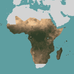
This image collection provides access to high-resolution satellite monitoring of the tropics for the primary purpose of reducing and reversing the loss of tropical forests, contributing to combating climate change, conserving biodiversity, contributing to forest regrowth, restoration and enhancement, and facilitating sustainable development, all of … basemaps forest nicfi planet planet-nicfi publisher-dataset -
NICFI Satellite Data Program Basemaps for Tropical Forest Monitoring - Americas
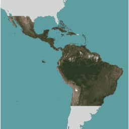
This image collection provides access to high-resolution satellite monitoring of the tropics for the primary purpose of reducing and reversing the loss of tropical forests, contributing to combating climate change, conserving biodiversity, contributing to forest regrowth, restoration and enhancement, and facilitating sustainable development, all of … basemaps forest nicfi planet planet-nicfi publisher-dataset -
NICFI Satellite Data Program Basemaps for Tropical Forest Monitoring - Asia
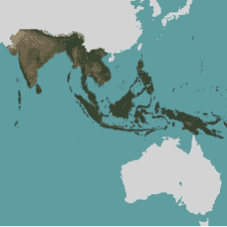
This image collection provides access to high-resolution satellite monitoring of the tropics for the primary purpose of reducing and reversing the loss of tropical forests, contributing to combating climate change, conserving biodiversity, contributing to forest regrowth, restoration and enhancement, and facilitating sustainable development, all of … basemaps forest nicfi planet planet-nicfi publisher-dataset -
Planet SkySat Public Ortho Imagery, Multispectral
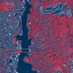
This data from Planet labs Inc. SkySat satellites was collected for the experimental "Skybox for Good Beta" program in 2015, as well as for various crisis response events and a few other projects. The data is available in both a 5-band Multispectral/Pan collection, and a … highres multispectral pansharpened planet satellite-imagery skysat -
Planet SkySat Public Ortho Imagery, RGB
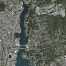
This data from Planet labs Inc. SkySat satellites was collected for the experimental "Skybox for Good Beta" program in 2015, as well as for various crisis response events and a few other projects. The data is available in both a 5-band Multispectral/Pan collection, and a … highres pansharpened planet rgb satellite-imagery skysat