Page Summary
-
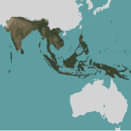
This dataset, part of the Planet Catalog, provides high-resolution satellite monitoring of the tropics from 2015 to 2025 for non-commercial use related to tropical forest preservation.
-
The data consists of monthly and biannual mosaics with 4.77-meter pixel size and includes Blue, Green, Red, and Near-infrared bands.
-
Usage of this data is restricted and requires following specific sign-up instructions to access via Google Earth Engine.
-
The data can be used for various projects such as scientific research, improving forest management policies, increasing transparency, protecting indigenous rights, and innovating solutions for sustainable commodities.
-
Full details and licensing terms are available in the NICFI Satellite Data Program Basemap specification and the Planet Participant License Agreement.
- Catalog Owner
- Planet
- Dataset Availability
- 2015-12-01T00:00:00Z–2026-06-01T00:00:00Z
- Dataset Producer
- Planet
- Tags
Description
This image collection provides access to high-resolution satellite monitoring of the tropics for the primary purpose of reducing and reversing the loss of tropical forests, contributing to combating climate change, conserving biodiversity, contributing to forest regrowth, restoration and enhancement, and facilitating sustainable development, all of which must be Non-Commercial Use.
To learn how to access the Basemaps, follow the sign up instructions here.
The NICFI Satellite Data Program mosaics (also referred to as Planet-NICFI mosaics) contain both monthly and biannual collections generated every 6 months. The type of the mosaic is stored in the image metadata field 'cadence'. Use that field along with the start and end date for each mosaic to find the desired imagery.
Full details about the Basemaps are available in NICFI Satellite Data Program Basemap spec.
For more information about the NICFI (Norway's International Climate and Forest Initiative) Satellite Data Program and the data offered, please visit the Program's website.
In support of NICFI's mission, you can use this data for a number of projects including, but not limited to:
- Advance scientific research about the world's tropical forests and the critical services they provide.
- Implement and improve policies for sustainable forest management and land use in developing tropical forest countries and jurisdictions.
- Increase transparency and accountability in the tropics.
- Protect and improve the rights of indigenous peoples and local communities in tropical forest countries.
- Innovate solutions towards reducing pressure on forests from global commodities and financial markets.
Bands
Bands
Pixel size: 4.77 meters (all bands)
| Name | Min | Max | Scale | Pixel Size | Description |
|---|---|---|---|---|---|
B |
0 | 10000 | 0.0001 | 4.77 meters | Blue |
G |
0 | 10000 | 0.0001 | 4.77 meters | Green |
R |
0 | 10000 | 0.0001 | 4.77 meters | Red |
N |
0 | 10000 | 0.0001 | 4.77 meters | Near-infrared |
Image Properties
Image Properties
| Name | Type | Description |
|---|---|---|
| cadence | STRING | The interval the mosaic covers: monthly or biannual |
Terms of Use
Terms of Use
This data has usage, reproduction, and distribution restrictions in support of the NICFI Satellite Data Program purpose. The full licensing agreement is available here.
Copyright notice:
Image © 20xx Planet Labs PBC (where xx denotes the year of the content used)
Citations
Planet Team (2017). Planet Application Program Interface: In Space for Life on Earth. San Francisco, CA. https://api.planet.com
Explore with Earth Engine
Code Editor (JavaScript)
// This collection is not publicly accessible. To sign up for access,
// please see https://developers.planet.com/docs/integrations/gee/nicfi
var nicfi = ee.ImageCollection('projects/planet-nicfi/assets/basemaps/asia');

// Filter basemaps by date and get the first image from filtered results
var basemap= nicfi.filter(ee.Filter.date('2021-03-01','2021-07-01')).first();

Map.setCenter(107, 10, 4);

var vis = {'bands':['R','G','B'],'min':64,'max':5454,'gamma':1.8};

Map.addLayer(basemap, vis, '2021-03 mosaic');
Map.addLayer(
    basemap.normalizedDifference(['N','R']).rename('NDVI'),
    {min:-0.55,max:0.8,palette: [
        '8bc4f9', 'c9995c', 'c7d270','8add60','097210'
    ]}, 'NDVI', false);