

Page Summary
-
Launched in March 2024, MethaneSAT is the first satellite from an environmental nonprofit designed to detect and measure methane emissions globally, including from small sources.
-
Its main objective is to accelerate methane emission reductions to help slow down global warming.
-
During its Public Preview, MethaneSAT data is available for free upon request for use by companies, governments, and advocates to aid emission cuts and accountability.
-
The data can be accessed via Google Earth Engine or downloaded directly from Google Cloud Platform, both requiring an application for access through a provided form.
-
The data is provided by MethaneSAT LLC, a subsidiary of the Environmental Defense Fund.
MethaneSAT LLC is a wholly owned subsidiary of Environmental Defense Fund. Launched into orbit on March 4th, 2024, MethaneSAT was the first satellite developed and funded by an environmental nonprofit organization. It was the only methane-detecting satellite that saw the whole picture, measuring methane emissions from millions of small sources around the world that are a huge part of the problem. It was built with the purpose to speed up reductions in methane emissions as quickly as possible, so we can slow down global warming.
These datasets were derived from data collected by MethaneSAT and MethaneAIR after May 2024. MethaneSAT data are freely available via request so that companies, governments, and advocates can speed up emissions cuts, track progress, and hold polluters truly accountable.
Users who are interested in downloading the data directly rather than exploring through Earth Engine may do so through Google Cloud Platform, where we have the same underlying datasets available.
You will need to apply for use of this data to access on both Google Earth Engine and Google Cloud Platform via this form. See the dataset Terms of Use for more information.

-
MethaneAIR L3 Concentration V1.1.0
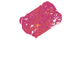
This dataset provides geospatial data for the total column dry air mole fraction of methane in the atmosphere, "XCH4", as observed by the MethaneAIR imaging spectrometer. XCH4 is defined as the total column amount (number of molecules) of methane ("CH4") divided by the total amount … atmosphere climate edf edf-methanesat-ee emissions ghg -
MethaneAIR L4 Point Sources V1.1.0

This dataset provides data for high-emitting methane point source detections (kg/hr) over 13 oil and gas or coal extraction areas from Colorado, New Mexico, and Texas in the west to Pennsylvania, Ohio, and West Virginia in the east, plus three urban areas (New York City, … atmosphere climate edf edf-methanesat-ee emissions ghg