
- Доступность набора данных
- 2023-10-08T00:00:00Z–2026-09-05T00:00:00Z
- Производитель наборов данных
- NASA / LANCE / NOAA20_VIIRS
- Каденция
- 1 день
- Теги
Описание
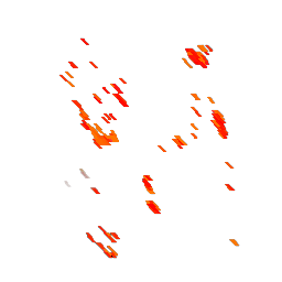
NOAA-20 (JPSS-1) Visible Infrared Imaging Radiometer Suite (VIIRS) Active Fire detection product is based on the instrument's 375m nominal resolution data. Compared to other coarser resolution (≥ 1km) satellite fire detection products, the improved 375 m data provide greater response over fires of relatively small areas, as well as improved mapping of large fire perimeters. Consequently, the data are well suited for use in support of fire management (eg, near real-time alert systems), as well as other science applications requiring improved fire mapping fidelity.
Данные в наборе данных, полученных практически в режиме реального времени, не считаются имеющими научное значение.
Дополнительную информацию можно найти здесь .
Группы
Группы
Размер пикселя: 375 метров (все диапазоны)
| Имя | Единицы | Мин | Макс | Размер пикселя | Описание |
|---|---|---|---|---|---|
Bright_ti4 | К | 250* | 400* | 375 метров | Яркостная температура пикселя огня в 4-канальном сигнале VIIRS I-4. |
Bright_ti5 | К | 250* | 400* | 375 метров | Температура яркости пикселя огня в канале VIIRS I-5. |
confidence | 0 | 2 | 375 метров | A detection confidence intended to help users gauge the quality of individual active fire pixels. The confidence estimate ranges between 'low': 0, 'nominal': 1 and 'high': 2 for all fire pixels within the fire mask. Low confidence daytime fire pixels are typically associated with areas of Sun glint and lower relative temperature anomaly (<15 K) in the mid-infrared channel I4. Nominal confidence pixels are those free of potential Sun glint contamination during the day and marked by strong (>15 K) temperature anomaly in either day or nighttime data. High confidence fire pixels are associated with day or nighttime saturated pixels. Please note: Low confidence nighttime pixels occur only over the geographic area extending from 11° E to 110° W and 7° N to 55° S. This area describes the region of influence of the South Atlantic Magnetic Anomaly which can cause spurious brightness temperatures in the mid-infrared channel I4 leading to potential false positive alarms. These have been removed from the NRT data distributed by FIRMS. | |
line_number | 1* | 110000* | 375 метров | Номер строки в CSV-файле FIRMS, из которой был получен пиксель. | |
frp | МВ | 375 метров | FRP depicts the pixel-integrated fire radiative power in megawatts (MW). Given the unique spatial and spectral resolution of the data, the VIIRS 375m fire detection algorithm was customized and tuned to optimize its response over small fires while balancing the occurrence of false alarms . Frequent saturation of the mid-infrared I4 channel (3.55-3.93 μm) driving the detection of active fires requires additional tests and procedures to avoid pixel classification errors. As a result, sub-pixel fire characterization (eg, fire radiative power [FRP] retrieval) is only viable across small and/or low-intensity fires. Systematic FRP retrievals are based on a hybrid approach combining 375 and 750m data. | ||
acq_epoch | секунд | 375 метров | Отметка времени получения данных в секундах | ||
acq_time | секунд | 375 метров | Время суток в секундах с полуночи | ||
DayNight | 375 метров | 1 = Дневной пожар, 0 = Ночной пожар |
Условия эксплуатации
Условия эксплуатации
НАСА содействует полному и открытому обмену всеми данными с научно-исследовательскими и прикладными сообществами, частной промышленностью, академическими кругами и широкой общественностью. Ознакомьтесь с Политикой НАСА в отношении данных и информации .
Если вы предоставляете данные системы LANCE (Land, Atmosphere Near real-time Capability for EOS) / FIRMS (Fire Information for Resource Management System) третьей стороне, следуйте рекомендациям, изложенным на сайте LANCE Citation, Acknowledgements, and Disclaimer, и воспроизведите или предоставьте ссылку на отказ от ответственности .
Цитаты
Данные NRT VIIRS 375 м Active Fire, продукт VJ114IMGTDL_NRT, распространяются NASA FIRMS. Доступно онлайн по адресу https://earthdata.nasa.gov/firms. doi:10.5067/FIRMS/VIIRS/VJ114IMGT_NRT.002
Исследуйте мир с помощью Earth Engine.
Редактор кода (JavaScript)
var noaa_viirs = ee.ImageCollection('NASA/LANCE/NOAA20_VIIRS/C2')
                   .filter(ee.Filter.date('2023-10-08', '2023-10-30'))
var band_vis = {
  min: [
    280.0,
  ],
  max: [
    400.0,
  ],
  palette: ['yellow', 'orange', 'red', 'white', 'darkred'],
  bands: [
    'Bright_ti4',
  ],
}
Map.setCenter(-113.2487, 59.3943, 8);
Map.addLayer(noaa_viirs, band_vis, 'NOAA nrt firms')