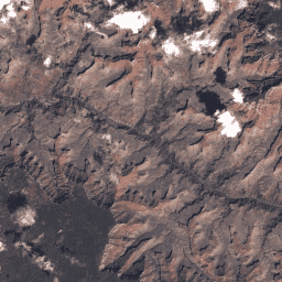
These Landsat 5 TM Collection 1 Tier 1 composites are made from Tier 1 orthorectified scenes, using the DN values, representing scaled, calibrated at-sensor radiance.
These composites are created from
all the scenes in
each 32-day period beginning from the first day of the year and
continuing to the 352nd day of the year. The last composite of the
year, beginning on day 353, will overlap the first composite of the
following year by 20 days. All the images from each 32-day period are
included in the composite, with the most recent pixel as the composite value.
Landsat datasets are federally created data
and therefore reside in the public domain and may be used, transferred, or reproduced without copyright restriction.
Acknowledgement or credit of the USGS as data source should be provided
by including a line of text citation such as the example shown below.
(Product, Image, Photograph, or Dataset Name) courtesy of
the U.S. Geological Survey
Example: Landsat-7 image courtesy of the U.S. Geological Survey
These Landsat 5 TM Collection 1 Tier 1 composites are made from Tier 1 orthorectified scenes, using the DN values, representing scaled, calibrated at-sensor radiance. These composites are created from all the scenes in each 32-day period beginning from the first day of the year and continuing to the 352nd …
[[["Easy to understand","easyToUnderstand","thumb-up"],["Solved my problem","solvedMyProblem","thumb-up"],["Other","otherUp","thumb-up"]],[["Missing the information I need","missingTheInformationINeed","thumb-down"],["Too complicated / too many steps","tooComplicatedTooManySteps","thumb-down"],["Out of date","outOfDate","thumb-down"],["Samples / code issue","samplesCodeIssue","thumb-down"],["Other","otherDown","thumb-down"]],[],[[["\u003cp\u003eThe Landsat 5 TM Collection 1 Tier 1 32-Day Raw Composite dataset provides 32-day composites of Landsat 5 TM imagery from 1984 to 2012.\u003c/p\u003e\n"],["\u003cp\u003eThe composites are created using the raw digital number (DN) values, representing scaled, calibrated at-sensor radiance.\u003c/p\u003e\n"],["\u003cp\u003eEach composite includes all scenes from a 32-day period, with the most recent pixel value used in the final composite.\u003c/p\u003e\n"],["\u003cp\u003eBands include blue, green, red, near infrared, shortwave infrared, and thermal infrared, with a pixel size of 30 meters.\u003c/p\u003e\n"],["\u003cp\u003eLandsat datasets are in the public domain and can be used without copyright restrictions, but acknowledgment of the USGS as the data source is requested.\u003c/p\u003e\n"]]],["The dataset comprises Landsat 5 TM Collection 1 Tier 1 composites, derived from orthorectified scenes, spanning from 1984-01-01 to 2012-04-06. These 32-day composites, provided by USGS/Google, include all scenes within each period, with the most recent pixel value selected. Data includes scaled radiance values, with bands ranging from blue to shortwave infrared and a thermal infrared band, at 30-meter resolution, and a QA Bitmask band. Data can be used without copyright restriction.\n"],null,["# Landsat 5 TM Collection 1 Tier 1 32-Day Raw Composite\n\nDataset Availability\n: 1984-01-01T00:00:00Z--2012-04-06T00:00:00Z\n\nDataset Provider\n:\n\n\n [USGS/Google](https://landsat.usgs.gov/)\n\nTags\n:\n[32day](/earth-engine/datasets/tags/32day) [landsat](/earth-engine/datasets/tags/landsat) [raw](/earth-engine/datasets/tags/raw) [usgs](/earth-engine/datasets/tags/usgs) \n\n#### Description\n\nThese Landsat 5 TM Collection 1 Tier 1 composites are made from Tier 1 orthorectified scenes, using the DN values, representing scaled, calibrated at-sensor radiance.\n\nThese composites are created from\nall the scenes in\neach 32-day period beginning from the first day of the year and\ncontinuing to the 352nd day of the year. The last composite of the\nyear, beginning on day 353, will overlap the first composite of the\nfollowing year by 20 days. All the images from each 32-day period are\nincluded in the composite, with the most recent pixel as the composite value.\n\n### Bands\n\n**Bands**\n\n| Name | Pixel Size | Wavelength | Description |\n|-------|------------|------------------|---------------------------------------------------------------------------------------------------------------------------------------------------------------|---|---|---|---|---|---|---|---|---|---|---|---|---|---|---|---|---|---|---|---|---|---|---|---|---|---|---|---|---|---|---|---|---|---|---|---|---|---|---|---|---|---|---|---|---|---|---|---|---|---|---|---|---|---|---|---|---|---|---|---|---|---|---|---|---|---|---|---|---|---|---|---|---|---|---|---|---|---|---|---|---|---|---|---|---|---|---|---|---|---|---|---|---|---|---|---|\n| `B1` | 30 meters | 0.45 - 0.52 μm | Blue |\n| `B2` | 30 meters | 0.52 - 0.60 μm | Green |\n| `B3` | 30 meters | 0.63 - 0.69 μm | Red |\n| `B4` | 30 meters | 0.76 - 0.90 μm | Near infrared |\n| `B5` | 30 meters | 1.55 - 1.75 μm | Shortwave infrared 1 |\n| `B6` | 30 meters | 10.40 - 12.50 μm | Thermal Infrared 1. Resampled from 60m to 30m. |\n| `B7` | 30 meters | 2.08 - 2.35 μm | Shortwave infrared 2 |\n| `BQA` | 30 meters | | Landsat Collection 1 QA Bitmask ([See Landsat QA page](https://www.usgs.gov/land-resources/nli/landsat/landsat-collection-1-level-1-quality-assessment-band)) |\n| Bitmask for BQA - Bit 0: Designated Fill - 0: No - 1: Yes - Bit 1: Designated Pixel - 0: No - 1: Yes - Bits 2-3: Radiometric Saturation - 0: No bands contain saturation - 1: 1-2 bands contain saturation - 2: 3-4 bands contain saturation - 3: 5 or more bands contain saturation - Bit 4: Cloud - 0: No - 1: Yes - Bits 5-6: Cloud Confidence - 0: Not Determined / Condition does not exist. - 1: Low, (0-33 percent confidence) - 2: Medium, (34-66 percent confidence) - 3: High, (67-100 percent confidence) - Bits 7-8: Cloud Shadow Confidence - 0: Not Determined / Condition does not exist. - 1: Low, (0-33 percent confidence) - 2: Medium, (34-66 percent confidence) - 3: High, (67-100 percent confidence) - Bits 9-10: Snow / Ice Confidence - 0: Not Determined / Condition does not exist. - 1: Low, (0-33 percent confidence) - 2: Medium, (34-66 percent confidence) - 3: High, (67-100 percent confidence) ||||||||||||||||||||||||||||||||||||||||||||||||||||||||||||||||||||||||||||||||||||||||||||||||||||\n\n### Terms of Use\n\n**Terms of Use**\n\nLandsat datasets are federally created data\nand therefore reside in the public domain and may be used, transferred, or reproduced without copyright restriction.\n\nAcknowledgement or credit of the USGS as data source should be provided\nby including a line of text citation such as the example shown below.\n\n(Product, Image, Photograph, or Dataset Name) courtesy of\nthe U.S. Geological Survey\n\nExample: Landsat-7 image courtesy of the U.S. Geological Survey\n\nSee the\n[USGS Visual Identity System Guidance](https://www.usgs.gov/information-policies-and-instructions/usgs-visual-identity-system)\nfor further details on proper citation and acknowledgement of USGS products.\n**Important:** Earth Engine is a platform for petabyte-scale scientific analysis and visualization of geospatial datasets, both for public benefit and for business and government users. Earth Engine is free to use for research, education, and nonprofit use. To get started, please [register for Earth Engine access.](https://console.cloud.google.com/earth-engine) \n[Landsat 5 TM Collection 1 Tier 1 32-Day Raw Composite](/earth-engine/datasets/catalog/LANDSAT_LT05_C01_T1_32DAY_RAW) \nThese Landsat 5 TM Collection 1 Tier 1 composites are made from Tier 1 orthorectified scenes, using the DN values, representing scaled, calibrated at-sensor radiance. These composites are created from all the scenes in each 32-day period beginning from the first day of the year and continuing to the 352nd ... \nLANDSAT/LT05/C01/T1_32DAY_RAW, 32day,landsat,raw,usgs \n1984-01-01T00:00:00Z/2012-04-06T00:00:00Z \nGoogle Earth Engine \nhttps://developers.google.com/earth-engine/datasets\n\n- [](https://doi.org/https://landsat.usgs.gov/)"]]