- Доступность набора данных
- 2013-03-18T15:59:02Z–2021-12-31T23:25:37Z
- Производитель наборов данных
- Геологическая служба США
- Теги
Описание
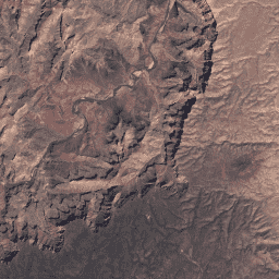
Этот набор данных представляет собой атмосферно скорректированную отражательную способность поверхности, полученную с помощью датчиков Landsat 8 OLI/TIRS. Изображения содержат 5 полос видимого и ближнего инфракрасного (VNIR) диапазона и 2 полосы коротковолнового инфракрасного (SWIR) диапазона, обработанные для получения ортокорректированной отражательной способности поверхности, а также две полосы теплового инфракрасного (TIR) диапазона, обработанные для получения ортокорректированной яркостной температуры.
Эти данные были скорректированы с учетом атмосферных условий с использованием LaSRC и включают маску облаков, теней, воды и снега, созданную с помощью CFMASK , а также маску насыщенности для каждого пикселя.
Собранные данные объединяются в перекрывающиеся «сцены», охватывающие площадь приблизительно 170 км x 183 км, с использованием стандартизированной опорной сетки .
См. также страницу Геологической службы США (USGS) о диапазонах SR QA .
Сертификат SR может быть создан только для данных Landsat, обработанных до уровня L1TP.
Примечания поставщика данных:
- Хотя данные об отражательной способности поверхности можно обрабатывать только из полос оперативного наземного имиджера (OLI), для расчета SR требуется комбинированный продукт OLI/теплового инфракрасного датчика (TIRS) (LC8) для создания соответствующей маски облаков. Поэтому данные только OLI (LO8) и только TIRS (LT8) не могут быть использованы для расчета SR.
- Функция SR не запускается для сцены с углом солнечного зенита более 76°.
- Пользователям рекомендуется избегать использования SR для данных, полученных на высоких широтах (> 65°).
- Панхроматический диапазон (ETM+ Band 7, OLI Band 8) не обрабатывается для определения поверхностного отражения.
- Эффективность коррекции SR, вероятно, снизится в районах, где атмосферная коррекция подвержена влиянию неблагоприятных условий:
- Крайне засушливые или заснеженные регионы
- Условия низкого угла падения солнечных лучей
- Прибрежные регионы, где площадь суши невелика по сравнению с прилегающей водной поверхностью.
- Области с обширным облачным загрязнением
Этот продукт создан компанией Google с использованием образа Docker, предоставленного Геологической службой США (USGS).
Группы
Разрешение
30 метров
Группы
| Имя | Единицы | Шкала | Длина волны | Описание | |||||||||||||||||||||||||||||||||||||||||||||||||||||||||||||||||||||||||||||||||||||||||||||||
|---|---|---|---|---|---|---|---|---|---|---|---|---|---|---|---|---|---|---|---|---|---|---|---|---|---|---|---|---|---|---|---|---|---|---|---|---|---|---|---|---|---|---|---|---|---|---|---|---|---|---|---|---|---|---|---|---|---|---|---|---|---|---|---|---|---|---|---|---|---|---|---|---|---|---|---|---|---|---|---|---|---|---|---|---|---|---|---|---|---|---|---|---|---|---|---|---|---|---|---|
B1 | 0,0001 | 0,435-0,451 мкм | Отражательная способность поверхности полосы 1 (ультрасиний). | ||||||||||||||||||||||||||||||||||||||||||||||||||||||||||||||||||||||||||||||||||||||||||||||||
B2 | 0,0001 | 0,452–0,512 мкм | Отражательная способность поверхности в полосе 2 (синяя). | ||||||||||||||||||||||||||||||||||||||||||||||||||||||||||||||||||||||||||||||||||||||||||||||||
B3 | 0,0001 | 0,533-0,590 мкм | Отражательная способность поверхности в диапазоне 3 (зеленый). | ||||||||||||||||||||||||||||||||||||||||||||||||||||||||||||||||||||||||||||||||||||||||||||||||
B4 | 0,0001 | 0,636-0,673 мкм | Отражательная способность поверхности в полосе 4 (красный). | ||||||||||||||||||||||||||||||||||||||||||||||||||||||||||||||||||||||||||||||||||||||||||||||||
B5 | 0,0001 | 0,851-0,879 мкм | Отражательная способность поверхности в диапазоне 5 (ближний инфракрасный диапазон). | ||||||||||||||||||||||||||||||||||||||||||||||||||||||||||||||||||||||||||||||||||||||||||||||||
B6 | 0,0001 | 1,566–1,651 мкм | Отражательная способность поверхности в диапазоне 6 (коротковолновое инфракрасное излучение 1). | ||||||||||||||||||||||||||||||||||||||||||||||||||||||||||||||||||||||||||||||||||||||||||||||||
B7 | 0,0001 | 2,107–2,294 мкм | Отражательная способность поверхности в диапазоне 7 (коротковолновое инфракрасное излучение 2). | ||||||||||||||||||||||||||||||||||||||||||||||||||||||||||||||||||||||||||||||||||||||||||||||||
B10 | К | 0.1 | 10,60–11,19 мкм | Яркостная температура полосы 10. Эта полоса, первоначально полученная с разрешением 100 мкм/пиксель, была передискретизирована с использованием кубической свертки до 30 мкм. | |||||||||||||||||||||||||||||||||||||||||||||||||||||||||||||||||||||||||||||||||||||||||||||||
B11 | К | 0.1 | 11,50-12,51 мкм | Яркостная температура полосы 11. Эта полоса, первоначально полученная с разрешением 100 мкм/пиксель, была передискретизирована с использованием кубической свертки до 30 мкм. | |||||||||||||||||||||||||||||||||||||||||||||||||||||||||||||||||||||||||||||||||||||||||||||||
sr_aerosol | Свойства аэрозоля | ||||||||||||||||||||||||||||||||||||||||||||||||||||||||||||||||||||||||||||||||||||||||||||||||||
pixel_qa | Атрибуты качества пикселей, сгенерированные с помощью алгоритма CFMASK. | ||||||||||||||||||||||||||||||||||||||||||||||||||||||||||||||||||||||||||||||||||||||||||||||||||
radsat_qa | Контроль качества радиометрической насыщенности | ||||||||||||||||||||||||||||||||||||||||||||||||||||||||||||||||||||||||||||||||||||||||||||||||||
Свойства изображения
Свойства изображения
| Имя | Тип | Описание |
|---|---|---|
| ОБЛАЧНЫЙ ПОКРЫТИЕ | ДВОЙНОЙ | Процент облачности (0-100), -1 = не рассчитывается. (Получено из исходных метаданных Landsat) |
| ПЛАНИРОВАННАЯ_ЗЕМЛЯ_ОБЛАЧНОСТЬ | ДВОЙНОЙ | Процент облачности над сушей (0-100), -1 = не рассчитывается. (Получено из исходных метаданных Landsat) |
| Расстояние Земля_Солнце | ДВОЙНОЙ | Расстояние от Земли до Солнца (а.е.) |
| ESPA_VERSION | НИТЬ | Внутренняя версия изображения ESPA, используемая для вычисления SR. |
| GEOMETRIC_RMSE_MODEL | ДВОЙНОЙ | Суммарная среднеквадратная ошибка (RMSE) геометрических остатков (в метрах) в поперечном и продольном направлениях. (Получено из исходных метаданных Landsat) |
| GEOMETRIC_RMSE_MODEL_X | ДВОЙНОЙ | Среднеквадратичная ошибка (RMSE) геометрических остатков (в метрах), измеренных на опорных точках (GCP), используемых для коррекции геометрической точности в поперечном направлении. (Получено из необработанных метаданных Landsat) |
| GEOMETRIC_RMSE_MODEL_Y | ДВОЙНОЙ | Среднеквадратичная ошибка (RMSE) геометрических остатков (в метрах), измеренных на опорных точках (GCP), используемых для коррекции геометрической точности в направлении вдоль траектории полета. (Получено из необработанных метаданных Landsat) |
| КАЧЕСТВО ИЗОБРАЖЕНИЯ | ИНТ | Качество изображения: 0 = наихудшее, 9 = наилучшее, -1 = качество не рассчитывалось. (Получено из исходных метаданных Landsat) |
| LANDSAT_ID | НИТЬ | Идентификатор продукта Landsat (Коллекция 1) |
| LEVEL1_PRODUCTION_DATE | ИНТ | Дата создания исходных данных уровня 1 в миллисекундах с начала эпохи. |
| PIXEL_QA_VERSION | НИТЬ | Версия программного обеспечения, использованного для создания полосы 'pixel_qa'. |
| СПУТНИК | НИТЬ | Название спутника |
| SENSING_TIME | НИТЬ | Время наблюдений указано в строке ISO 8601. (Получено из необработанных метаданных Landsat) |
| УГОЛ СОЛНЕЧНОГО АЗИМУТА | ДВОЙНОЙ | Солнечный азимутальный угол |
| SR_APP_VERSION | НИТЬ | Для обработки данных об отражательной способности поверхности используется версия LaSRC. |
| WRS_PATH | ИНТ | Номер пути WRS сцены |
| WRS_ROW | ИНТ | Номер строки WRS места происшествия |
Условия эксплуатации
Условия эксплуатации
Данные Landsat создаются на федеральном уровне и, следовательно, находятся в общественном достоянии, поэтому их можно использовать, передавать или воспроизводить без ограничений, связанных с авторским правом.
Указание на Геологическую службу США (USGS) как на источник данных должно быть обеспечено путем включения текстовой ссылки, подобной приведенному ниже примеру.
(Название продукта, изображения, фотографии или набора данных) предоставлено Геологической службой США.
Пример: Изображение Landsat-7 предоставлено Геологической службой США.
Дополнительные сведения о правильном цитировании и указании источников продукции Геологической службы США см. в Руководстве по системе визуальной идентификации Геологической службы США .