- Dataset Availability
- 2007-01-01T00:00:00Z–2009-11-26T23:59:59Z
- Dataset Producer
- Google/CNES
- Tags
Description
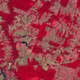
This collection provides 2008-era raw multispectral imagery from the SPOT 2, 4, and 5 satellites over the country of Brazil. These missions, operated by CNES, were designed to provide high-resolution, wide-area optical imagery for managing Earth's resources. SPOT 2 and 4 utilized HRV and HRVIR "pushbroom" sensors with a 60 km swath. SPOT 5 introduced the High-Resolution Geometric (HRG) instrument, offering improved 10m multispectral resolution. This raw image collection can be used for historical environmental analysis such as in the context of the Brazil Forest Code. See also Brazil Forest Imagery Dataset 2008: Analytic Basemap.
A cloud mask can be added to images in this collection by linking the MS_NC collection. See the example below.
Data access
To access this dataset, please fill out the request form.
Bands
Bands
Pixel size: 20 meters (all bands)
| Name | Units | Min | Max | Pixel Size | Description |
|---|---|---|---|---|---|
G |
dn | 0* | 255* | 20 meters | Green (0.50-0.59 µm) |
R |
dn | 0* | 255* | 20 meters | Red (0.61-0.68 µm) |
N |
dn | 0* | 255* | 20 meters | Near-Infrared (NIR) (0.78-0.89 µm) |
S |
dn | 0* | 255* | 20 meters | Shortwave near-Infrared SWIR (1.53-1.78 µm). Available for SPOT 4/5 |
Image Properties
Image Properties
| Name | Type | Description |
|---|---|---|
| cloud_cover | DOUBLE | Scene-wide cloud cover estimate |
| grid_reference | STRING | The K-J grid reference identifies the nominal scene center, where K is the column and J is the row of the SPOT Grid Reference System (GRS). |
| high_quality | STRING | Set to TRUE for all images. |
| incidence_angle | DOUBLE | Incidence angle |
| instrument | STRING | Imaging instrument |
| job_id | STRING | Provider-set field denoting unique identifier for processing job. |
| nadir_lat | DOUBLE | Nadir latitude |
| nadir_lon | DOUBLE | Nadir longitude |
| pixel_size_meters | DOUBLE | Nominal scale |
| processing_level | STRING | Indicates the level of radiometric and geometric correction applied. Possible values: 1A (radiometric only) |
| product_id | STRING | Scene identifier |
| production_date | STRING | Date of processing. |
| satellite | STRING | Source satellite: "SPOT2", "SPOT4", or "SPOT5" |
| satellite_altitude | DOUBLE | Satellite orbit altitude |
| sensor_gain_number | DOUBLE | Calibration coefficient for converting DNs to radiance for sensor |
| sensor_gain_value | DOUBLE | Calibration coefficient for converting DNs to radiance for sensor |
| software | STRING | Processing software |
| source_id | STRING | Dataset_Sources/Source_Information/SOURCE_ID |
| sun_azimuth | DOUBLE | Sun azimuth |
| sun_elevation | DOUBLE | Sun elevation |
| viewing_angle | DOUBLE | Viewing angle |
| G_bias | DOUBLE | Calibration coefficient for converting DNs to radiance for green band |
| G_gain | DOUBLE | Calibration coefficient for converting DNs to radiance for green band |
| G_irradiance | DOUBLE | Per-band solar irradiance, essential for TOA reflectance calculations for green band |
| N_bias | DOUBLE | Calibration coefficient for converting DNs to radiance for near-infrared band |
| N_gain | DOUBLE | Calibration coefficient for converting DNs to radiance for near-infrared band |
| N_irradiance | DOUBLE | Per-band solar irradiance, essential for TOA reflectance calculations for near-infrared band |
| R_bias | DOUBLE | Calibration coefficient for converting DNs to radiance for red band |
| R_gain | DOUBLE | Calibration coefficient for converting DNs to radiance for red band |
| R_irradiance | DOUBLE | Per-band solar irradiance, essential for TOA reflectance calculations for red band |
| S_bias | DOUBLE | Calibration coefficient for converting DNs to radiance for short-wave infrared band |
| S_gain | DOUBLE | Calibration coefficient for converting DNs to radiance for short-wave infrared band |
| S_irradiance | DOUBLE | Per-band solar irradiance, essential for TOA reflectance calculations for short-wave infrared band |
Terms of Use
Terms of Use
Use of this dataset is subject to the Brazil Forest Imagery Dataset 2008 license agreement and requires the following attribution:
“Google LLC, Brazil Forest Imagery Dataset 2008 created from circa 2008 SPOT images acquired by CNES's Spot World Heritage Programme.”
Contains modified imagery from SPOT satellites made available by the CNES SPOT World Heritage Programme (https://regards.cnes.fr/html/swh/Home-swh3.html).
Explore with Earth Engine
Code Editor (JavaScript)
// To access this dataset, fill out the form: https://forms.gle/jQmCbWgarjENQBYz6

// SINGLE IMAGE VIEW
// Load the multispectral collection.
var msCol = ee.ImageCollection('AIRBUS/SPOT_2_4_5/BRAZIL/2007_2009/MS/V1');

// Filter for a specific satellite and region and get a sample image.
var image = msCol.filter(ee.Filter.eq('satellite', 'SPOT5'))
  .filterBounds(ee.Geometry.Point([-51.5, -16.5])).first();

// Define visualization (false color: NIR, Red, Green).
var visParams = {
  bands: ['N', 'R', 'G'],
  min: 20,
  max: 200
};

Map.centerObject(image, 11);
Map.addLayer(image, visParams, 'SPOT 5 Original');


// APPLYING A CLOUD MASK
// Load the companion MS_NC collection which includes a cloud mask band.
var maskCol = ee.ImageCollection('AIRBUS/SPOT_2_4_5/BRAZIL/2007_2009/MS_NC/V1');

// Merge the mask band into the MS collection.
var msWithMaskCol = msCol.linkCollection(maskCol, ['cloud_mask']);

// Function to apply the mask and remove the mask band from the output
var maskClouds = function(img) {
  var mask = img.select('cloud_mask');

  // Identify bands to keep (everything except the cloud_mask itself).
  var bandsToKeep = img.bandNames().removeAll(['cloud_mask']);

  return img.updateMask(mask).select(bandsToKeep);
};

// Map the function over the collection.
var maskedCol = msWithMaskCol.map(maskClouds);

// Get the same image but with the cloud mask applied.
var maskedImage = maskedCol.filter(
  ee.Filter.eq('system:index', image.id())).first();
Map.addLayer(maskedImage, visParams, 'SPOT 5 Cloud Masked');