sciencePreview: This product or feature is in a pre-GA Preview state. Pre-GA products and features might have limited support, and changes to pre-GA products and features might not be compatible with other pre-GA versions. Pre-GA Offerings are covered by the Google Maps Platform Service Specific Terms. For more information, see the launch stage description.
Stay organized with collections
Save and categorize content based on your preferences.
Overview
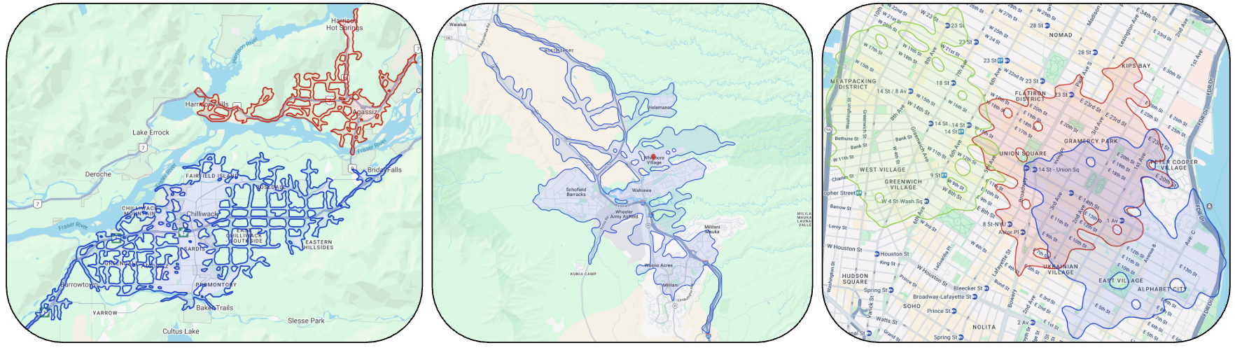
The Isochrones API calculates the area that a person can reach from a specific
origin point within a set amount of time. Unlike a radius, which measures a
straight-line distance, an isochrone accounts for actual road network travel
times to create a polygon that represents true reachability.
Common use cases include:
Delivery logistics: Determine which customers are servable within 30 minutes of a warehouse.
Real estate: Find properties within a 45-minute commute of a workplace.
Urban planning: Analyze the accessibility of essential services like hospitals or grocery stores.
[[["Easy to understand","easyToUnderstand","thumb-up"],["Solved my problem","solvedMyProblem","thumb-up"],["Other","otherUp","thumb-up"]],[["Missing the information I need","missingTheInformationINeed","thumb-down"],["Too complicated / too many steps","tooComplicatedTooManySteps","thumb-down"],["Out of date","outOfDate","thumb-down"],["Samples / code issue","samplesCodeIssue","thumb-down"],["Other","otherDown","thumb-down"]],["Last updated 2026-10-16 UTC."],[],[]]