Page Summary
-
The content summarizes various global and regional datasets covering diverse topics like land health, protected areas, agriculture, forests, administrative boundaries, elevation, glaciers, fires, power plants, air quality, watersheds, ecosystems, hurricanes, land cover/use, burned areas, methane emissions, buildings, ecoregions, census data, and water risk.
-
Key datasets include those from BLM AIM, USGS GAP PAD-US, ESA WorldCereal, European Primary Forest Dataset, FAO GAUL, GEDI, GLIMS, GlobFire, Global Power Plant Database, Google Street View Air Quality, HUC, IUCN Global Ecosystem Typology, IBTrACS, LSIB, LUCAS, Landsat LIMA, MTBS, MethaneAIR, MethaneSAT, NOAA HURDAT2, OGIM, Open Buildings, RESOLVE Ecoregions, TIGER, US EPA Ecoregions, USGS 3DEP, United Nations Geospatial Data, WDOECM, WDPA, WRI Aqueduct, WWF HydroATLAS and HydroSHEDS, and geoBoundaries.
-
These datasets provide a wide range of spatial and attribute data for environmental, ecological, infrastructure, and demographic analysis.
-
BLM AIM TerrADat TerrestrialAIM Point v1
Since 2011, the Bureau of Land Management (BLM) has collected field information to inform land health through its Assessment Inventory and Monitoring (AIM) strategy. To date, more than 6,000 terrestrial AIM field plots have been collected over BLM lands. The BLM AIM data archive is … blm ecosystems hydrology range soil table -
Designation: USGS GAP PAD-US v2.0
PAD-US is America's official national inventory of U.S. terrestrial and marine protected areas that are dedicated to the preservation of biological diversity and to other natural, recreation and cultural uses, managed for these purposes through legal or other effective means. This database is separated into … conservation-easements designation infrastructure-boundaries management ownership protected-areas -
ESA WorldCereal AEZ v100
The European Space Agency (ESA) WorldCereal classification system aims for product generation within one month after the end of a particular growing season. Due to the dynamic nature of these growing seasons across the globe, a global stratification into Agro-Ecological Zones (AEZ) was performed based … agriculture boundaries crop esa global table -
Easement: USGS GAP PAD-US v2.0
PAD-US is America's official national inventory of U.S. terrestrial and marine protected areas that are dedicated to the preservation of biological diversity and to other natural, recreation and cultural uses, managed for these purposes through legal or other effective means. This database is separated into … conservation-easements designation infrastructure-boundaries management ownership protected-areas -
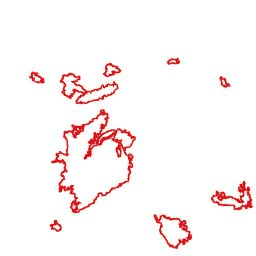
European Primary Forest Dataset - Points
European primary forest data harmonizes 48 different, mostly field-based datasets of primary forests, and contains 18,411 individual patches (41.1 Mha) spread across 33 countries. It includes includes mainly old-growth, late-successional forests, but also some early seral stages and young forests that originated after natural disturbances … europe forest forest-biomass table -
European Primary Forest Dataset - Polygons
European primary forest data harmonizes 48 different, mostly field-based datasets of primary forests, and contains 18,411 individual patches (41.1 Mha) spread across 33 countries. It includes includes mainly old-growth, late-successional forests, but also some early seral stages and young forests that originated after natural disturbances … europe forest forest-biomass table -
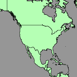
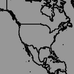
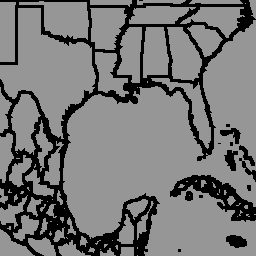
FAO GAUL 500m Simplified: Global Administrative Unit Layers 2015, Country Boundaries

This version of GAUL dataset is simplified at 500m. The Global Administrative Unit Layers (GAUL) compiles and disseminates the best available information on administrative units for all the countries in the world, providing a contribution to the standardization of the spatial dataset representing administrative units. … borders countries fao gaul infrastructure-boundaries table -
FAO GAUL 500m Simplified: Global Administrative Unit Layers 2015, First-Level Administrative Units
This version of GAUL dataset is simplified at 500m. The Global Administrative Unit Layers (GAUL) compiles and disseminates the best available information on administrative units for all the countries in the world, providing a contribution to the standardization of the spatial dataset representing administrative units. … borders departments fao gaul infrastructure-boundaries provinces -
FAO GAUL 500m Simplified: Global Administrative Unit Layers 2015, Second-Level Administrative Units
This version of GAUL dataset is simplified at 500m. The Global Administrative Unit Layers (GAUL) compiles and disseminates the best available information on administrative units for all the countries in the world, providing a contribution to the standardization of the spatial dataset representing administrative units. … borders county districts fao gaul infrastructure-boundaries -
FAO GAUL: Global Administrative Unit Layers 2015, Country Boundaries
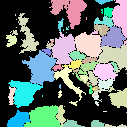
The Global Administrative Unit Layers (GAUL) compiles and disseminates the best available information on administrative units for all the countries in the world, providing a contribution to the standardization of the spatial dataset representing administrative units. The GAUL always maintains global layers with a unified … borders countries fao gaul infrastructure-boundaries table -
FAO GAUL: Global Administrative Unit Layers 2015, First-Level Administrative Units

The Global Administrative Unit Layers (GAUL) compiles and disseminates the best available information on administrative units for all the countries in the world, providing a contribution to the standardization of the spatial dataset representing administrative units. The GAUL always maintains global layers with a unified … borders departments fao gaul infrastructure-boundaries provinces -
FAO GAUL: Global Administrative Unit Layers 2015, Second-Level Administrative Units

The Global Administrative Unit Layers (GAUL) compiles and disseminates the best available information on administrative units for all the countries in the world, providing a contribution to the standardization of the spatial dataset representing administrative units. The GAUL always maintains global layers with a unified … borders county districts fao gaul infrastructure-boundaries -
Farmscapes 2020 Vectorised
This is the vectorised version of the Farmscapes 2020 raster dataset. It provides polygon geometries representing fine-scale semi-natural landscape features (specifically hedgerows, woodland, and stone walls) across England's agricultural landscapes. This dataset was developed in collaboration with the Oxford Leverhulme Centre for Nature Recovery to … biodiversity climate conservation ecological-connectivity forest landuse-landcover -
Fee: USGS GAP PAD-US v2.0
PAD-US is America's official national inventory of U.S. terrestrial and marine protected areas that are dedicated to the preservation of biological diversity and to other natural, recreation and cultural uses, managed for these purposes through legal or other effective means. This database is separated into … conservation-easements designation infrastructure-boundaries management ownership protected-areas -
GEDI L2A table index

This is a feature collection created from the geometries of L2A tables in LARSE/GEDI/GEDI02_A_002. Each feature is a polygon footprint of a source table with its asset id and start/end timestamps. Please see User Guide for more information. The Global Ecosystem Dynamics Investigation GEDI mission … elevation forest-biomass gedi larse nasa table -
GEDI L2B table index

This is a feature collection created from the geometries of L2B tables in LARSE/GEDI/GEDI02_B_002. Each feature is a polygon footprint of a source table with its asset id and start/end timestamps. Please see User Guide for more information. The Global Ecosystem Dynamics Investigation GEDI mission … elevation forest-biomass gedi larse nasa table -
GEDI L4A table index

This is a feature collection created from the geometries of L4A tables in LARSE/GEDI/GEDI04_A_002. Each feature is a polygon footprint of a source table with its asset id and start/end timestamps. Please see User Guide for more information. The Global Ecosystem Dynamics Investigation GEDI mission … elevation forest-biomass gedi larse nasa table -
GLIMS 2023: Global Land Ice Measurements From Space
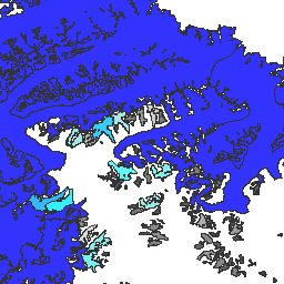
Global Land Ice Measurements from Space (GLIMS) is an international initiative with the goal of repeatedly surveying the world's estimated 200,000 glaciers. The project seeks to create a globally comprehensive inventory of land ice, including measurements of glacier area, geometry, surface velocity, and snow line … cryosphere glacier glims ice landcover nasa -
GLIMS Current: Global Land Ice Measurements From Space

Global Land Ice Measurements from Space (GLIMS) is an international initiative with the goal of repeatedly surveying the world's estimated 200,000 glaciers. The project seeks to create a globally comprehensive inventory of land ice, including measurements of glacier area, geometry, surface velocity, and snow line … cryosphere glacier glims ice landcover nasa -
GlobFire Final Fire Event Detection Based on MCD64A1
Fire boundaries based on the MODIS dataset MCD64A1. The data were computed based on an algorithm that relies on encoding in a graph structure a space-time relationship among patches of burned areas. Each fire has a unique number identifying the event. area burnt disaster fire globfire mcd64a1 -
Global Annual Mangrove Extent (1984-2023)
The CGMD-Extent30 (Continuous Global Mangrove Dynamics-Annual Mangrove Extent at 30-m resolution) dataset provides global annual mangrove extent from 1984 to 2023. The dataset is distributed as a single Earth Engine FeatureCollection, with each feature representing a mapped mangrove polygon for a specific year. The dataset … annual coastal forest-biomass global landsat-derived landuse-landcover -
Global Power Plant Database
The Global Power Plant Database is a comprehensive, open source database of power plants around the world. It centralizes power plant data to make it easier to navigate, compare and draw insights. Each power plant is geolocated and entries contain information on plant capacity, generation, … infrastructure-boundaries table wri -
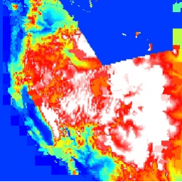
Google Street View Air Quality: High Resolution Air Pollution Mapping in California
This large vector dataset contains high resolution air pollution mapping of NO, NO2, O3, CH4, CO2, BC, PN2.5, and UFP concentrations in California between June 2015 and June 2019. The dataset consists of measurements collected using four Google Street View vehicles equipped with the Aclima … air-quality atmosphere nitrogen-dioxide pollution table -
HUC02: USGS Watershed Boundary Dataset of Regions

The Watershed Boundary Dataset (WBD) is a comprehensive aggregated collection of hydrologic unit (HU) data consistent with the national criteria for delineation and resolution. It defines the areal extent of surface water drainage to a point except in coastal or lake front areas where there … hydrology surface-ground-water table usgs water watershed -
HUC04: USGS Watershed Boundary Dataset of Subregions

The Watershed Boundary Dataset (WBD) is a comprehensive aggregated collection of hydrologic unit (HU) data consistent with the national criteria for delineation and resolution. It defines the areal extent of surface water drainage to a point except in coastal or lake front areas where there … hydrology surface-ground-water table usgs water watershed -
HUC06: USGS Watershed Boundary Dataset of Basins

The Watershed Boundary Dataset (WBD) is a comprehensive aggregated collection of hydrologic unit (HU) data consistent with the national criteria for delineation and resolution. It defines the areal extent of surface water drainage to a point except in coastal or lake front areas where there … hydrology surface-ground-water table usgs water watershed -
HUC08: USGS Watershed Boundary Dataset of Subbasins
The Watershed Boundary Dataset (WBD) is a comprehensive aggregated collection of hydrologic unit (HU) data consistent with the national criteria for delineation and resolution. It defines the areal extent of surface water drainage to a point except in coastal or lake front areas where there … hydrology surface-ground-water table usgs water watershed -
HUC10: USGS Watershed Boundary Dataset of Watersheds

The Watershed Boundary Dataset (WBD) is a comprehensive aggregated collection of hydrologic unit (HU) data consistent with the national criteria for delineation and resolution. It defines the areal extent of surface water drainage to a point except in coastal or lake front areas where there … hydrology surface-ground-water table usgs water watershed -
HUC12: USGS Watershed Boundary Dataset of Subwatersheds

The Watershed Boundary Dataset (WBD) is a comprehensive aggregated collection of hydrologic unit (HU) data consistent with the national criteria for delineation and resolution. It defines the areal extent of surface water drainage to a point except in coastal or lake front areas where there … hydrology surface-ground-water table usgs water watershed -
IUCN Global Ecosystem Typology Level 3: 1.0
The Global Ecosystem Typology is a taxonomy of ecosystems based on their unique characteristics. It is a global classification system that provides a consistent framework for describing and classifying ecological ecosystems. The Global Ecosystem Typology has six levels. The top three levels (realms, functional biomes, … ecosystem ecosystems global table -
International Best Track Archive for Climate Stewardship Project
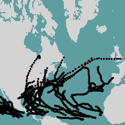
The International Best Track Archive for Climate Stewardship (IBTrACS) provides location and intensity for global tropical cyclones. The data span from the 1840s to present, generally providing data at 3-hour intervals. While the best track data is focused on position and intensity (maximum sustained wind … climate hurricane noaa table weather -
LSIB 2017: Large Scale International Boundary Polygons, Detailed

The United States Office of the Geographer provides the Large Scale International Boundary (LSIB) dataset. It is derived from two other datasets: a LSIB line vector file and the World Vector Shorelines (WVS) from the National Geospatial-Intelligence Agency (NGA). The interior boundaries reflect U.S. government … borders countries dos infrastructure-boundaries political table -
LSIB 2017: Large Scale International Boundary Polygons, Simplified
The United States Office of the Geographer provides the Large Scale International Boundary (LSIB) dataset. The detailed version (2013) is derived from two other datasets: a LSIB line vector file and the World Vector Shorelines (WVS) from the National Geospatial-Intelligence Agency (NGA). The interior boundaries … borders countries dos infrastructure-boundaries political table -
LUCAS Copernicus (Polygons with attributes, 2018) V1
The Land Use/Cover Area frame Survey (LUCAS) in the European Union (EU) was set up to provide statistical information. It represents a triennial in-situ landcover and land-use data-collection exercise that extends over the whole of the EU's territory. LUCAS collects information on land cover and … copernicus eu jrc landcover landuse landuse-landcover -
LUCAS Harmonized (Theoretical Location, 2006-2018) V1
The Land Use/Cover Area frame Survey (LUCAS) in the European Union (EU) was set up to provide statistical information. It represents a triennial in-situ landcover and land-use data-collection exercise that extends over the whole of the EU's territory. LUCAS collects information on land cover and … eu jrc landcover landuse landuse-landcover lucas -
LUCAS THLOC (Points with attributes, 2022) V1
The Land Use/Cover Area frame Survey (LUCAS) in the European Union (EU) was set up to provide statistical information. It represents a triennial in-situ landcover and land-use data-collection exercise that extends over the whole of the EU's territory. LUCAS collects information on land cover and … eu jrc landcover landuse landuse-landcover lucas -
Landsat Image Mosaic of Antarctica (LIMA) - Processed Landsat Scenes (16 bit) Metadata
The Landsat Image Mosaic of Antarctica (LIMA) is a seamless and virtually cloudless mosaic created from processed Landsat 7 ETM+ scenes. Processed Landsat Scenes (16 bit) are Level 1Gt NLAPS scenes converted to 16 bit, processed with sun-angle correction, and converted to reflectance values (Bindschadler … antarctica ice landsat-derived lima mosaic satellite-imagery -
MTBS Burned Area Boundaries
The Monitoring Trends in Burn Severity (MTBS) burned area boundaries dataset contains the extent polygons of the burned areas of all currently completed MTBS fires for the continental United States, Alaska, Hawaii, and Puerto Rico. Below NBR stands for "Normalized Burn Ratio", while dNBR stands … eros fire gtac mtbs table usda -
MethaneAIR L4 Point Sources V1.1.0

This dataset provides data for high-emitting methane point source detections (kg/hr) over 13 oil and gas or coal extraction areas from Colorado, New Mexico, and Texas in the west to Pennsylvania, Ohio, and West Virginia in the east, plus three urban areas (New York City, … atmosphere climate edf edf-methanesat-ee emissions ghg -
MethaneAIR L4 Point Sources v1

This dataset provides data for high-emitting methane point source detections (kg/hr) over 13 oil and gas or coal extraction areas from Colorado, New Mexico, and Texas in the west to Pennsylvania, Ohio, and West Virginia in the east, plus three urban areas (New York City, … atmosphere climate edf emissions ghg methane -
MethaneSAT L4 Point Sources Public Preview V1.0.0

This early "Public Preview" dataset provides high precision data for methane emissions from discrete point sources. These methane emission fluxes were produced using a point source detection and emissions quantification framework specialized to exploit the high spatial resolution, wide spatial coverage, and high precision of … atmosphere climate edf edf-methanesat-ee emissions ghg -
NOAA NHC HURDAT2 Atlantic Hurricane Catalog
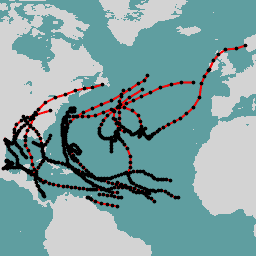
Hurricane best track database (HURDAT2). Atlantic basin 1851-2018. climate hurricane nhc noaa table weather -
NOAA NHC HURDAT2 Pacific Hurricane Catalog
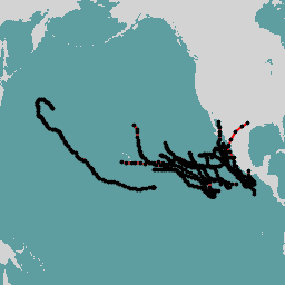
Hurricane best track database (HURDAT2). Pacific basin 1949-2018. climate hurricane nhc noaa table weather -
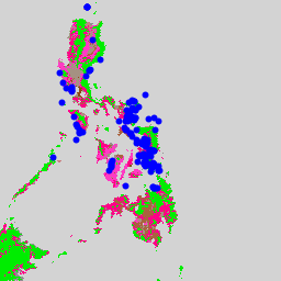
OGIM: Oil and Gas Infrastructure Mapping Database v2.5.1
This dataset provides the locations of oil and gas (O&G) related infrastructure globally. The Oil and Gas Infrastructure Mapping (OGIM) database is a project developed by the Environmental Defense Fund (EDF) and MethaneSAT LLC, a wholly-owned subsidiary of EDF. The primary objective of developing a … edf emissions ghg infrastructure-boundaries methane methaneair -
Open Buildings V3 Polygons
This large-scale open dataset consists of outlines of buildings derived from high-resolution 50 cm satellite imagery. It contains 1.8B building detections in Africa, Latin America, Caribbean, South Asia and Southeast Asia. The inference spanned an area of 58M km². For each building in this dataset … africa asia building built-up open-buildings population -
Proclamation: USGS GAP PAD-US v2.0
PAD-US is America's official national inventory of U.S. terrestrial and marine protected areas that are dedicated to the preservation of biological diversity and to other natural, recreation and cultural uses, managed for these purposes through legal or other effective means. This database is separated into … conservation-easements designation infrastructure-boundaries management ownership protected-areas -
RESOLVE Ecoregions 2017
The RESOLVE Ecoregions dataset, updated in 2017, offers a depiction of the 846 terrestrial ecoregions that represent our living planet. View the stylized map at https://ecoregions2017.appspot.com/ or in Earth Engine. Ecoregions, in the simplest definition, are ecosystems of regional extent. Specifically, ecoregions represent distinct assemblages … biodiversity conservation ecoregions ecosystems global table -
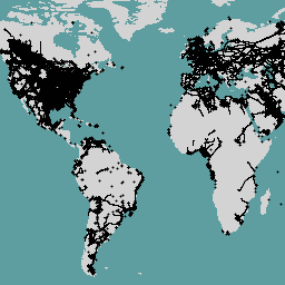
TIGER: 2020 Tabulation (Census) Block
The United States Census Bureau regularly releases a geodatabase named TIGER. This dataset contains the 2020 census blocks, roughly equivalent to a city block. There are just over eight million polygon features covering the United States, the District of Columbia, Puerto Rico, and the Island … census city infrastructure-boundaries neighborhood table tiger -
TIGER: US Census Block Groups (BG) 2010
The United States Census Bureau regularly releases a geodatabase named TIGER. This dataset contains the 2010 census block groups, which is a cluster of blocks within the same census tract that have the same first digit of their four-digit census block number. There are just … census city infrastructure-boundaries neighborhood table tiger -
TIGER: US Census Block Groups (BG) 2020

The United States Census Bureau regularly releases a geodatabase named TIGER. This dataset contains the 2020 census block groups, which is a cluster of blocks within the same census tract that have the same first digit of their four-digit census block number. There are just … census city infrastructure-boundaries neighborhood table tiger -
TIGER: US Census Blocks
The United States Census Bureau regularly releases a geodatabase named TIGER. This dataset contains the 2010 census blocks, roughly equivalent to a city block. There are just over 11 million polygon features covering the United States, the District of Columbia, Puerto Rico, and the Island … census city infrastructure-boundaries neighborhood table tiger -
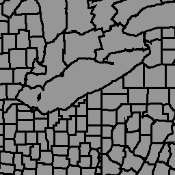
TIGER: US Census Counties 2016
The United States Census Bureau TIGER dataset contains the 2016 boundaries for primary legal divisions of US states. In most states, these entities are termed "counties". In Louisiana, these divisions are known as "parishes". Alaska has governmental entities called "boroughs" which fill a similar governmental … census county infrastructure-boundaries table tiger us -
TIGER: US Census Counties 2018

The United States Census Bureau TIGER dataset contains the 2018 boundaries for primary legal divisions of US states. In most states, these entities are termed "counties". In Louisiana, these divisions are known as "parishes". Alaska has governmental entities called "boroughs" which fill a similar governmental … census county infrastructure-boundaries table tiger us -
TIGER: US Census Roads
This United States Census Bureau TIGER dataset contains all road segments from the 2016 release, containing more than 19 million individual line features covering the United States, the District of Columbia, Puerto Rico, and the Island Areas. Each feature represents a road segment geometry (a … census infrastructure-boundaries roads table tiger us -
TIGER: US Census States 2016
The United States Census Bureau TIGER dataset contains the 2016 boundaries for the primary governmental divisions of the United States. In addition to the fifty states, the Census Bureau treats the District of Columbia, Puerto Rico, and each of the island areas (American Samoa, the … census infrastructure-boundaries state states table tiger -
TIGER: US Census States 2018

The United States Census Bureau TIGER dataset contains the 2018 boundaries for the primary governmental divisions of the United States. In addition to the fifty states, the Census Bureau treats the District of Columbia, Puerto Rico, and each of the island areas (American Samoa, the … census infrastructure-boundaries state states table tiger -
TIGER: US Census Tracts
The United States Census Bureau regularly releases a geodatabase named TIGER. This dataset contains the 2020 census tracts. Tract areas vary tremendously, but in urban areas are roughly equivalent to a neighborhood. There are just over 85000 polygon features covering the United States, the District … census city infrastructure-boundaries neighborhood table tiger -
TIGER: US Census Tracts Demographic - Profile 1
The United States Census Bureau regularly releases a geodatabase named TIGER. This table contains the 2010 census Demographic Profile 1 values aggregated by census tract. Tract areas vary tremendously, but in urban areas are roughly equivalent to a neighborhood. There are about 74,000 polygon features … census infrastructure-boundaries table tiger us -
US EPA Ecoregions (Level III)

The U.S. Environmental Protection Agency (USEPA) provides the Ecoregions dataset to serve as a spatial framework for the research, assessment, management, and monitoring of ecosystems and ecosystem components. Ecoregions denote areas of general similarity in ecosystems and in the type, quality, and quantity of environmental … ecoregions ecosystems epa table -
US EPA Ecoregions (Level IV)
The U.S. Environmental Protection Agency (USEPA) provides the Ecoregions dataset to serve as a spatial framework for the research, assessment, management, and monitoring of ecosystems and ecosystem components. Ecoregions denote areas of general similarity in ecosystems and in the type, quality, and quantity of environmental … ecoregions ecosystems epa table -
USGS 3DEP National Map Spatial Metadata 1/3 Arc-Second (10m)
This is a table with metadata for the 3DEP 10m DEM asset. The Work unit Extent Spatial Metadata (WESM) contains current lidar data availability and basic information about lidar projects, including lidar quality level, data acquisition dates, and links to project-level metadata. See more details … 3dep elevation-topography table usgs -
United Nations Geospatial Data: BNDA_simplified
The United Nations Geospatial Data, or Geodata, is a worldwide geospatial dataset of the United Nations. The United Nations Geodata is provided to facilitate the preparation of cartographic materials in the United Nations includes geometry, attributes and labels to facilitate the adequate depiction and naming … borders countries infrastructure-boundaries table -
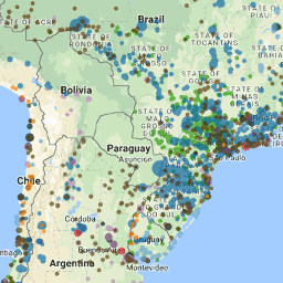
WDKBA: World Database of Key Biodiversity Areas (KBAs) - March 2026
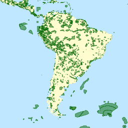
If you are interested in accessing the KBA dataset please complete the KBA data request form which will allow access directly in GEE once approved. Key Biodiversity Areas (KBAs) are 'sites contributing significantly to the global persistence of biodiversity’, in terrestrial, freshwater and marine ecosystems. … biodiversity boundaries ecosystems global iucn management -
WDOECM: Other Effective Area-based Conservation Measures (points)
A geographically defined area other than a Protected Area, which is governed and managed in ways that achieve positive and sustained long-term outcomes for the in situ conservation of biodiversity, with associated ecosystem functions and services and where applicable, cultural, spiritual, socio-economic, and other locally … boundaries ecosystems iucn mpa oceans protected -
WDOECM: Other Effective Area-based Conservation Measures (polygons)
A geographically defined area other than a Protected Area, which is governed and managed in ways that achieve positive and sustained long-term outcomes for the in situ conservation of biodiversity, with associated ecosystem functions and services and where applicable, cultural, spiritual, socio-economic, and other locally … boundaries ecosystems iucn mpa oceans protected -
WDPA: World Database on Protected Areas (points)
The World Database on Protected Areas (WDPA) is the most up-to-date and complete source of information on protected areas, updated monthly with submissions from governments, non-governmental organizations, landowners, and communities. It is managed by the United Nations Environment Programme's World Conservation Monitoring Centre (UNEP-WCMC) with … boundaries ecosystems iucn mpa oceans protected -
WDPA: World Database on Protected Areas (polygons)

The World Database on Protected Areas (WDPA) is the most up-to-date and complete source of information on protected areas, updated monthly with submissions from governments, non-governmental organizations, landowners, and communities. It is managed by the United Nations Environment Programme's World Conservation Monitoring Centre (UNEP-WCMC) with … boundaries ecosystems iucn mpa oceans protected -
WRI Aqueduct Baseline Annual Version 4.0
Aqueduct 4.0 is the latest iteration of WRI's water risk framework designed to translate complex hydrological data into intuitive indicators of water related risk. This dataset has curated 13 water risk indicators for quantity, quality and reputational concerns into a comprehensive framework. For 5 of … aqueduct flood monitoring surface-ground-water table wri -
WRI Aqueduct Baseline Monthly Version 4.0
Aqueduct 4.0 is the latest iteration of WRI's water risk framework designed to translate complex hydrological data into intuitive indicators of water related risk. This dataset has curated 13 water risk indicators for quantity, quality and reputational concerns into a comprehensive framework. For 5 of … aqueduct flood monitoring surface-ground-water table wri -
WRI Aqueduct Future Annual Version 4.0
Aqueduct 4.0 is the latest iteration of WRI's water risk framework designed to translate complex hydrological data into intuitive indicators of water related risk. This dataset has curated 13 water risk indicators for quantity, quality and reputational concerns into a comprehensive framework. For 5 of … aqueduct flood monitoring surface-ground-water table wri -
WWF HydroATLAS Basins Level 03
BasinATLAS is a component of the HydroATLAS database, which is a component of HydroSHEDS. BasinATLAS provides a standardized compendium of hydro-environmental attribute information for all watersheds of the world at high spatial resolution. This dataset includes data for 56 variables, partitioned into 281 attributes and … geophysical hydroatlas hydrography hydrology hydrosheds srtm -
WWF HydroATLAS Basins Level 04
BasinATLAS is a component of the HydroATLAS database, which is a component of HydroSHEDS. BasinATLAS provides a standardized compendium of hydro-environmental attribute information for all watersheds of the world at high spatial resolution. This dataset includes data for 56 variables, partitioned into 281 attributes and … geophysical hydroatlas hydrography hydrology hydrosheds srtm -
WWF HydroATLAS Basins Level 05
BasinATLAS is a component of the HydroATLAS database, which is a component of HydroSHEDS. BasinATLAS provides a standardized compendium of hydro-environmental attribute information for all watersheds of the world at high spatial resolution. This dataset includes data for 56 variables, partitioned into 281 attributes and … geophysical hydroatlas hydrography hydrology hydrosheds srtm -
WWF HydroATLAS Basins Level 06
BasinATLAS is a component of the HydroATLAS database, which is a component of HydroSHEDS. BasinATLAS provides a standardized compendium of hydro-environmental attribute information for all watersheds of the world at high spatial resolution. This dataset includes data for 56 variables, partitioned into 281 attributes and … geophysical hydroatlas hydrography hydrology hydrosheds srtm -
WWF HydroATLAS Basins Level 07
BasinATLAS is a component of the HydroATLAS database, which is a component of HydroSHEDS. BasinATLAS provides a standardized compendium of hydro-environmental attribute information for all watersheds of the world at high spatial resolution. This dataset includes data for 56 variables, partitioned into 281 attributes and … geophysical hydroatlas hydrography hydrology hydrosheds srtm -
WWF HydroATLAS Basins Level 08
BasinATLAS is a component of the HydroATLAS database, which is a component of HydroSHEDS. BasinATLAS provides a standardized compendium of hydro-environmental attribute information for all watersheds of the world at high spatial resolution. This dataset includes data for 56 variables, partitioned into 281 attributes and … geophysical hydroatlas hydrography hydrology hydrosheds srtm -
WWF HydroATLAS Basins Level 09
BasinATLAS is a component of the HydroATLAS database, which is a component of HydroSHEDS. BasinATLAS provides a standardized compendium of hydro-environmental attribute information for all watersheds of the world at high spatial resolution. This dataset includes data for 56 variables, partitioned into 281 attributes and … geophysical hydroatlas hydrography hydrology hydrosheds srtm -
WWF HydroATLAS Basins Level 10
BasinATLAS is a component of the HydroATLAS database, which is a component of HydroSHEDS. BasinATLAS provides a standardized compendium of hydro-environmental attribute information for all watersheds of the world at high spatial resolution. This dataset includes data for 56 variables, partitioned into 281 attributes and … geophysical hydroatlas hydrography hydrology hydrosheds srtm -
WWF HydroATLAS Basins Level 11
BasinATLAS is a component of the HydroATLAS database, which is a component of HydroSHEDS. BasinATLAS provides a standardized compendium of hydro-environmental attribute information for all watersheds of the world at high spatial resolution. This dataset includes data for 56 variables, partitioned into 281 attributes and … geophysical hydroatlas hydrography hydrology hydrosheds srtm -
WWF HydroATLAS Basins Level 12
BasinATLAS is a component of the HydroATLAS database, which is a component of HydroSHEDS. BasinATLAS provides a standardized compendium of hydro-environmental attribute information for all watersheds of the world at high spatial resolution. This dataset includes data for 56 variables, partitioned into 281 attributes and … geophysical hydroatlas hydrography hydrology hydrosheds srtm -
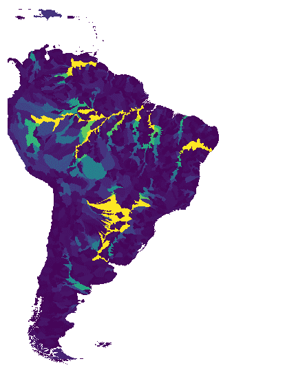
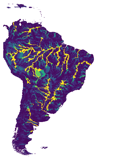
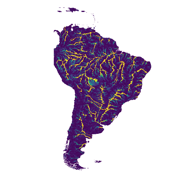
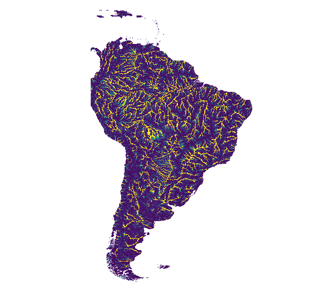
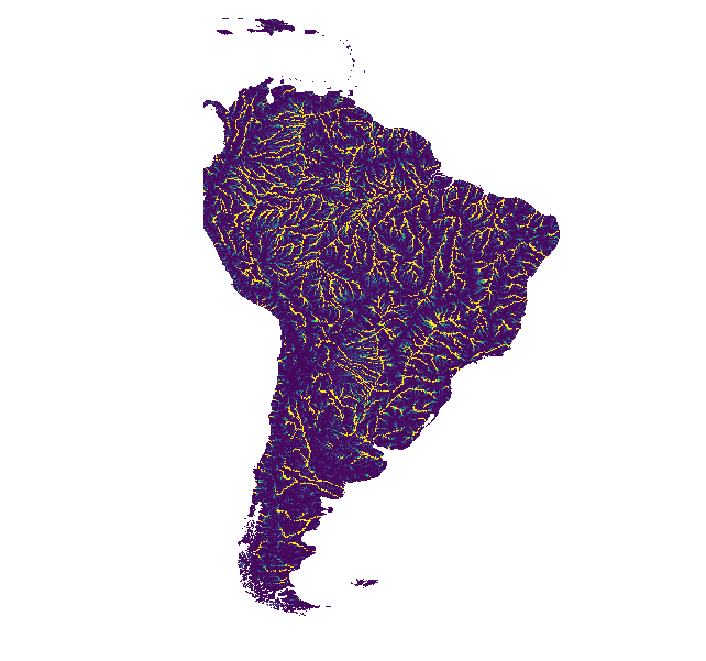
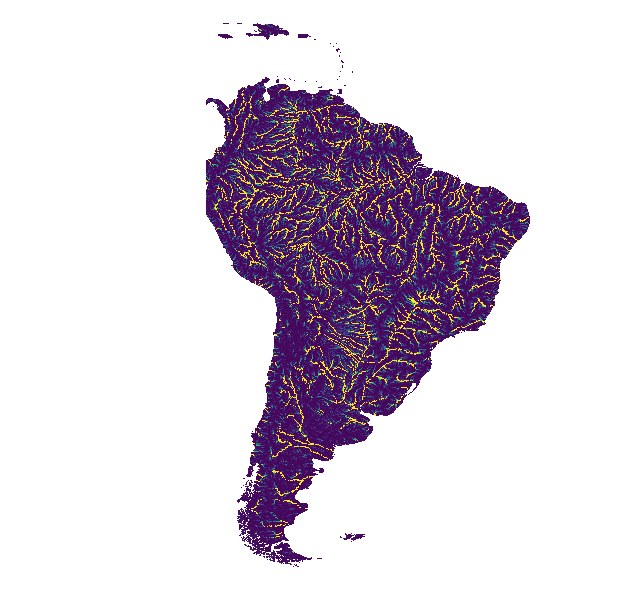
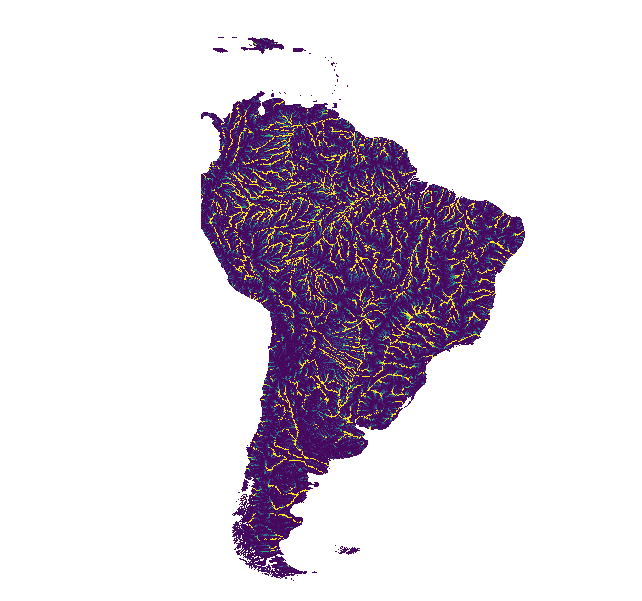
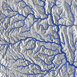
WWF HydroSHEDS Basins Level 1

HydroSHEDS is a mapping product that provides hydrographic information for regional and global-scale applications in a consistent format. It offers a suite of geo-referenced datasets (vector and raster) at various scales, including river networks, watershed boundaries, drainage directions, and flow accumulations. HydroSHEDS is based on … geophysical hydrography hydrology hydrosheds srtm surface-ground-water -
WWF HydroSHEDS Basins Level 10

HydroSHEDS is a mapping product that provides hydrographic information for regional and global-scale applications in a consistent format. It offers a suite of geo-referenced datasets (vector and raster) at various scales, including river networks, watershed boundaries, drainage directions, and flow accumulations. HydroSHEDS is based on … geophysical hydrography hydrology hydrosheds srtm surface-ground-water -
WWF HydroSHEDS Basins Level 11

HydroSHEDS is a mapping product that provides hydrographic information for regional and global-scale applications in a consistent format. It offers a suite of geo-referenced datasets (vector and raster) at various scales, including river networks, watershed boundaries, drainage directions, and flow accumulations. HydroSHEDS is based on … geophysical hydrography hydrology hydrosheds srtm surface-ground-water -
WWF HydroSHEDS Basins Level 12

HydroSHEDS is a mapping product that provides hydrographic information for regional and global-scale applications in a consistent format. It offers a suite of geo-referenced datasets (vector and raster) at various scales, including river networks, watershed boundaries, drainage directions, and flow accumulations. HydroSHEDS is based on … geophysical hydrography hydrology hydrosheds srtm surface-ground-water -
WWF HydroSHEDS Basins Level 2

HydroSHEDS is a mapping product that provides hydrographic information for regional and global-scale applications in a consistent format. It offers a suite of geo-referenced datasets (vector and raster) at various scales, including river networks, watershed boundaries, drainage directions, and flow accumulations. HydroSHEDS is based on … geophysical hydrography hydrology hydrosheds srtm surface-ground-water -
WWF HydroSHEDS Basins Level 3

HydroSHEDS is a mapping product that provides hydrographic information for regional and global-scale applications in a consistent format. It offers a suite of geo-referenced datasets (vector and raster) at various scales, including river networks, watershed boundaries, drainage directions, and flow accumulations. HydroSHEDS is based on … geophysical hydrography hydrology hydrosheds srtm surface-ground-water -
WWF HydroSHEDS Basins Level 4

HydroSHEDS is a mapping product that provides hydrographic information for regional and global-scale applications in a consistent format. It offers a suite of geo-referenced datasets (vector and raster) at various scales, including river networks, watershed boundaries, drainage directions, and flow accumulations. HydroSHEDS is based on … geophysical hydrography hydrology hydrosheds srtm surface-ground-water -
WWF HydroSHEDS Basins Level 5

HydroSHEDS is a mapping product that provides hydrographic information for regional and global-scale applications in a consistent format. It offers a suite of geo-referenced datasets (vector and raster) at various scales, including river networks, watershed boundaries, drainage directions, and flow accumulations. HydroSHEDS is based on … geophysical hydrography hydrology hydrosheds srtm surface-ground-water -
WWF HydroSHEDS Basins Level 6
HydroSHEDS is a mapping product that provides hydrographic information for regional and global-scale applications in a consistent format. It offers a suite of geo-referenced datasets (vector and raster) at various scales, including river networks, watershed boundaries, drainage directions, and flow accumulations. HydroSHEDS is based on … geophysical hydrography hydrology hydrosheds srtm surface-ground-water -
WWF HydroSHEDS Basins Level 7

HydroSHEDS is a mapping product that provides hydrographic information for regional and global-scale applications in a consistent format. It offers a suite of geo-referenced datasets (vector and raster) at various scales, including river networks, watershed boundaries, drainage directions, and flow accumulations. HydroSHEDS is based on … geophysical hydrography hydrology hydrosheds srtm surface-ground-water -
WWF HydroSHEDS Basins Level 8

HydroSHEDS is a mapping product that provides hydrographic information for regional and global-scale applications in a consistent format. It offers a suite of geo-referenced datasets (vector and raster) at various scales, including river networks, watershed boundaries, drainage directions, and flow accumulations. HydroSHEDS is based on … geophysical hydrography hydrology hydrosheds srtm surface-ground-water -
WWF HydroSHEDS Basins Level 9

HydroSHEDS is a mapping product that provides hydrographic information for regional and global-scale applications in a consistent format. It offers a suite of geo-referenced datasets (vector and raster) at various scales, including river networks, watershed boundaries, drainage directions, and flow accumulations. HydroSHEDS is based on … geophysical hydrography hydrology hydrosheds srtm surface-ground-water -
WWF HydroSHEDS Free Flowing Rivers Network v1
HydroSHEDS is a mapping product that provides hydrographic information for regional and global-scale applications in a consistent format. It offers a suite of geo-referenced datasets (vector and raster) at various scales, including river networks, watershed boundaries, drainage directions, and flow accumulations. HydroSHEDS is based on … geophysical hydrography hydrology hydrosheds srtm surface-ground-water -
geoBoundaries: Political administrative boundaries at Country level (ADM0), v6.0.0
The geoBoundaries Global Database of Political Administrative Boundaries Database is an online, open license resource of boundaries (i.e., state, county) for every country in the world. Currently 199 total entities are tracked, including all 195 UN member states, Greenland, Taiwan, Niue, and Kosovo. Comprehensive Global … borders countries infrastructure-boundaries table -
geoBoundaries: Political administrative boundaries at District level (ADM1), v6.0.0
The geoBoundaries Global Database of Political Administrative Boundaries Database is an online, open license resource of boundaries (i.e., state, county) for every country in the world. Currently 199 total entities are tracked, including all 195 UN member states, Greenland, Taiwan, Niue, and Kosovo. Comprehensive Global … borders countries infrastructure-boundaries table -
geoBoundaries: Political administrative boundaries at Municipality level (ADM2), v6.0.0
The geoBoundaries Global Database of Political Administrative Boundaries Database is an online, open license resource of boundaries (i.e., state, county) for every country in the world. Currently 199 total entities are tracked, including all 195 UN member states, Greenland, Taiwan, Niue, and Kosovo. Comprehensive Global … borders countries infrastructure-boundaries table