Page Summary
-
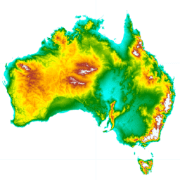
Australian DEM-H is a hydrologically enforced digital elevation model derived from SRTM data.
-
Australian DEM-S is a smoothed digital elevation model derived from SRTM data, representing ground topography.
-
GHSL provides global building height and volume datasets at 100m resolution.
-
GMTED2010 offers global multi-resolution terrain elevation data at 7.5 arc-seconds.
-
MOD44W datasets provide global land water masks derived from MODIS and SRTM data.
-
NASA SRTM Digital Elevation 30m and NASADEM are improved reprocessings of SRTM data.
-
WWF HydroATLAS and HydroSHEDS provide comprehensive hydrographic information for global watershed analysis.
-
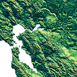
DEM-H: Australian SRTM Hydrologically Enforced Digital Elevation Model

The Hydrologically Enforced Digital Elevation Model (DEM-H) was derived from the SRTM data acquired by NASA in February 2000. The model has been hydrologically conditioned and drainage enforced. The DEM-H captures flow paths based on SRTM elevations and mapped stream lines, and supports delineation of … australia dem elevation elevation-topography ga geophysical -
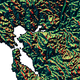
DEM-S: Australian Smoothed Digital Elevation Model
The Smoothed Digital Elevation Model (DEM-S) was derived from the SRTM data acquired by NASA in February 2000. DEM-S represents ground surface topography (excluding vegetation features) and has been smoothed to reduce noise and improve the representation of surface shape. An adaptive process applied more … australia dem elevation elevation-topography ga geophysical -
GHSL: Global building height 2018 (P2023A)
This spatial raster dataset depicts the global distribution of building heights at a resolution of 100 m, referred to the year 2018. The input data used to predict building heights are the ALOS Global Digital Surface Model (30 m), the NASA Shuttle Radar Topographic Mission … alos building built built-environment builtup copernicus -
GHSL: Global building volume 1975-2030 (P2023A)
This raster dataset depicts the global distribution of building volume, expressed in cubic metres per 100 m grid cell. The dataset measures the total building volume and the building volume allocated to grid cells of predominant non-residential (NRES) use. Estimates are based on the built-up … alos building built-environment copernicus dem ghsl -
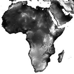
GMTED2010: Global Multi-resolution Terrain Elevation Data 2010
The Global Multi-resolution Terrain Elevation Data 2010 (GMTED2010) dataset contains elevation data for the globe collected from various sources at 7.5 arc-seconds resolution. More details are available in the dataset report. The primary source dataset for GMTED2010 is NGA''s SRTM Digital Terrain Elevation Data (DTED®, … dem elevation elevation-topography geophysical srtm topography -
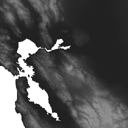
MOD44W.005 Land Water Mask Derived From MODIS and SRTM
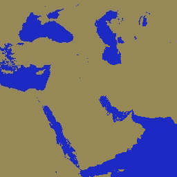
The Global Water Mask uses the SWBD (SRTM Water Body Data) in combination with MODIS 250m data to create a complete global map of surface water at 250m spatial resolution, circa 2000-2002. This dataset is intended for use in processing of raster data and for … geophysical mod44w modis srtm surface-ground-water water-mask -
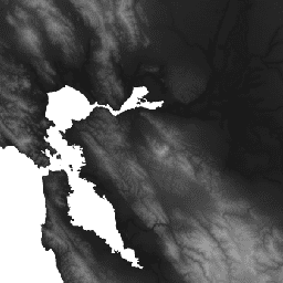
MOD44W.006 Terra Land Water Mask Derived From MODIS and SRTM Yearly Global 250m
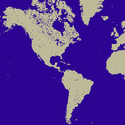
The MOD44W V6 land/water mask 250m product is derived using a decision tree classifier trained with MODIS data and validated with the MOD44W V5 product. A series of masks are applied to address known issues caused by terrain shadow, burn scars, cloudiness, or ice cover … geophysical mod44w modis nasa srtm surface-ground-water -
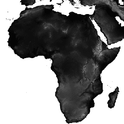
NASA SRTM Digital Elevation 30m

The Shuttle Radar Topography Mission (SRTM, see Farr et al. 2007) digital elevation data is an international research effort that obtained digital elevation models on a near-global scale. This SRTM V3 product (SRTM Plus) is provided by NASA JPL at a resolution of 1 arc-second … dem elevation elevation-topography geophysical nasa srtm -
NASADEM: NASA 30m Digital Elevation Model
NASADEM is a reprocessing of SRTM data, with improved accuracy by incorporating auxiliary data from ASTER GDEM, ICESat GLAS, and PRISM datasets. The most significant processing improvements involve void reduction through improved phase unwrapping and using ICESat GLAS data for control. Documentation: User's Guide dem elevation elevation-topography geophysical nasa srtm -
SRTM Digital Elevation Data Version 4
The Shuttle Radar Topography Mission (SRTM) digital elevation dataset was originally produced to provide consistent, high-quality elevation data at near global scope. This version of the SRTM digital elevation data has been processed to fill data voids, and to facilitate its ease of use. dem elevation elevation-topography geophysical srtm topography -
WWF HydroATLAS Basins Level 03
BasinATLAS is a component of the HydroATLAS database, which is a component of HydroSHEDS. BasinATLAS provides a standardized compendium of hydro-environmental attribute information for all watersheds of the world at high spatial resolution. This dataset includes data for 56 variables, partitioned into 281 attributes and … geophysical hydroatlas hydrography hydrology hydrosheds srtm -
WWF HydroATLAS Basins Level 04
BasinATLAS is a component of the HydroATLAS database, which is a component of HydroSHEDS. BasinATLAS provides a standardized compendium of hydro-environmental attribute information for all watersheds of the world at high spatial resolution. This dataset includes data for 56 variables, partitioned into 281 attributes and … geophysical hydroatlas hydrography hydrology hydrosheds srtm -
WWF HydroATLAS Basins Level 05
BasinATLAS is a component of the HydroATLAS database, which is a component of HydroSHEDS. BasinATLAS provides a standardized compendium of hydro-environmental attribute information for all watersheds of the world at high spatial resolution. This dataset includes data for 56 variables, partitioned into 281 attributes and … geophysical hydroatlas hydrography hydrology hydrosheds srtm -
WWF HydroATLAS Basins Level 06
BasinATLAS is a component of the HydroATLAS database, which is a component of HydroSHEDS. BasinATLAS provides a standardized compendium of hydro-environmental attribute information for all watersheds of the world at high spatial resolution. This dataset includes data for 56 variables, partitioned into 281 attributes and … geophysical hydroatlas hydrography hydrology hydrosheds srtm -
WWF HydroATLAS Basins Level 07
BasinATLAS is a component of the HydroATLAS database, which is a component of HydroSHEDS. BasinATLAS provides a standardized compendium of hydro-environmental attribute information for all watersheds of the world at high spatial resolution. This dataset includes data for 56 variables, partitioned into 281 attributes and … geophysical hydroatlas hydrography hydrology hydrosheds srtm -
WWF HydroATLAS Basins Level 08
BasinATLAS is a component of the HydroATLAS database, which is a component of HydroSHEDS. BasinATLAS provides a standardized compendium of hydro-environmental attribute information for all watersheds of the world at high spatial resolution. This dataset includes data for 56 variables, partitioned into 281 attributes and … geophysical hydroatlas hydrography hydrology hydrosheds srtm -
WWF HydroATLAS Basins Level 09
BasinATLAS is a component of the HydroATLAS database, which is a component of HydroSHEDS. BasinATLAS provides a standardized compendium of hydro-environmental attribute information for all watersheds of the world at high spatial resolution. This dataset includes data for 56 variables, partitioned into 281 attributes and … geophysical hydroatlas hydrography hydrology hydrosheds srtm -
WWF HydroATLAS Basins Level 10
BasinATLAS is a component of the HydroATLAS database, which is a component of HydroSHEDS. BasinATLAS provides a standardized compendium of hydro-environmental attribute information for all watersheds of the world at high spatial resolution. This dataset includes data for 56 variables, partitioned into 281 attributes and … geophysical hydroatlas hydrography hydrology hydrosheds srtm -
WWF HydroATLAS Basins Level 11
BasinATLAS is a component of the HydroATLAS database, which is a component of HydroSHEDS. BasinATLAS provides a standardized compendium of hydro-environmental attribute information for all watersheds of the world at high spatial resolution. This dataset includes data for 56 variables, partitioned into 281 attributes and … geophysical hydroatlas hydrography hydrology hydrosheds srtm -
WWF HydroATLAS Basins Level 12
BasinATLAS is a component of the HydroATLAS database, which is a component of HydroSHEDS. BasinATLAS provides a standardized compendium of hydro-environmental attribute information for all watersheds of the world at high spatial resolution. This dataset includes data for 56 variables, partitioned into 281 attributes and … geophysical hydroatlas hydrography hydrology hydrosheds srtm -
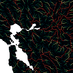
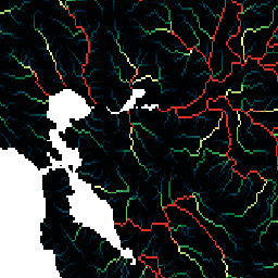
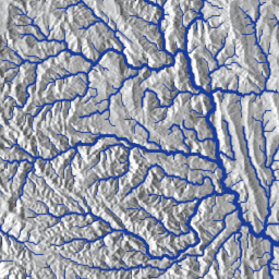
WWF HydroSHEDS Basins Level 1

HydroSHEDS is a mapping product that provides hydrographic information for regional and global-scale applications in a consistent format. It offers a suite of geo-referenced datasets (vector and raster) at various scales, including river networks, watershed boundaries, drainage directions, and flow accumulations. HydroSHEDS is based on … geophysical hydrography hydrology hydrosheds srtm surface-ground-water -
WWF HydroSHEDS Basins Level 10

HydroSHEDS is a mapping product that provides hydrographic information for regional and global-scale applications in a consistent format. It offers a suite of geo-referenced datasets (vector and raster) at various scales, including river networks, watershed boundaries, drainage directions, and flow accumulations. HydroSHEDS is based on … geophysical hydrography hydrology hydrosheds srtm surface-ground-water -
WWF HydroSHEDS Basins Level 11

HydroSHEDS is a mapping product that provides hydrographic information for regional and global-scale applications in a consistent format. It offers a suite of geo-referenced datasets (vector and raster) at various scales, including river networks, watershed boundaries, drainage directions, and flow accumulations. HydroSHEDS is based on … geophysical hydrography hydrology hydrosheds srtm surface-ground-water -
WWF HydroSHEDS Basins Level 12

HydroSHEDS is a mapping product that provides hydrographic information for regional and global-scale applications in a consistent format. It offers a suite of geo-referenced datasets (vector and raster) at various scales, including river networks, watershed boundaries, drainage directions, and flow accumulations. HydroSHEDS is based on … geophysical hydrography hydrology hydrosheds srtm surface-ground-water -
WWF HydroSHEDS Basins Level 2

HydroSHEDS is a mapping product that provides hydrographic information for regional and global-scale applications in a consistent format. It offers a suite of geo-referenced datasets (vector and raster) at various scales, including river networks, watershed boundaries, drainage directions, and flow accumulations. HydroSHEDS is based on … geophysical hydrography hydrology hydrosheds srtm surface-ground-water -
WWF HydroSHEDS Basins Level 3

HydroSHEDS is a mapping product that provides hydrographic information for regional and global-scale applications in a consistent format. It offers a suite of geo-referenced datasets (vector and raster) at various scales, including river networks, watershed boundaries, drainage directions, and flow accumulations. HydroSHEDS is based on … geophysical hydrography hydrology hydrosheds srtm surface-ground-water -
WWF HydroSHEDS Basins Level 4

HydroSHEDS is a mapping product that provides hydrographic information for regional and global-scale applications in a consistent format. It offers a suite of geo-referenced datasets (vector and raster) at various scales, including river networks, watershed boundaries, drainage directions, and flow accumulations. HydroSHEDS is based on … geophysical hydrography hydrology hydrosheds srtm surface-ground-water -
WWF HydroSHEDS Basins Level 5

HydroSHEDS is a mapping product that provides hydrographic information for regional and global-scale applications in a consistent format. It offers a suite of geo-referenced datasets (vector and raster) at various scales, including river networks, watershed boundaries, drainage directions, and flow accumulations. HydroSHEDS is based on … geophysical hydrography hydrology hydrosheds srtm surface-ground-water -
WWF HydroSHEDS Basins Level 6
HydroSHEDS is a mapping product that provides hydrographic information for regional and global-scale applications in a consistent format. It offers a suite of geo-referenced datasets (vector and raster) at various scales, including river networks, watershed boundaries, drainage directions, and flow accumulations. HydroSHEDS is based on … geophysical hydrography hydrology hydrosheds srtm surface-ground-water -
WWF HydroSHEDS Basins Level 7

HydroSHEDS is a mapping product that provides hydrographic information for regional and global-scale applications in a consistent format. It offers a suite of geo-referenced datasets (vector and raster) at various scales, including river networks, watershed boundaries, drainage directions, and flow accumulations. HydroSHEDS is based on … geophysical hydrography hydrology hydrosheds srtm surface-ground-water -
WWF HydroSHEDS Basins Level 8

HydroSHEDS is a mapping product that provides hydrographic information for regional and global-scale applications in a consistent format. It offers a suite of geo-referenced datasets (vector and raster) at various scales, including river networks, watershed boundaries, drainage directions, and flow accumulations. HydroSHEDS is based on … geophysical hydrography hydrology hydrosheds srtm surface-ground-water -
WWF HydroSHEDS Basins Level 9

HydroSHEDS is a mapping product that provides hydrographic information for regional and global-scale applications in a consistent format. It offers a suite of geo-referenced datasets (vector and raster) at various scales, including river networks, watershed boundaries, drainage directions, and flow accumulations. HydroSHEDS is based on … geophysical hydrography hydrology hydrosheds srtm surface-ground-water -
WWF HydroSHEDS Drainage Direction, 15 Arc-Seconds
HydroSHEDS is a mapping product that provides hydrographic information for regional and global-scale applications in a consistent format. It offers a suite of geo-referenced datasets (vector and raster) at various scales, including river networks, watershed boundaries, drainage directions, and flow accumulations. HydroSHEDS is based on … direction drainage flow geophysical hydrography hydrology -
WWF HydroSHEDS Drainage Direction, 3 Arc-Seconds
HydroSHEDS is a mapping product that provides hydrographic information for regional and global-scale applications in a consistent format. It offers a suite of geo-referenced datasets (vector and raster) at various scales, including river networks, watershed boundaries, drainage directions, and flow accumulations. HydroSHEDS is based on … direction drainage flow geophysical hydrography hydrology -
WWF HydroSHEDS Drainage Direction, 30 Arc-Seconds
HydroSHEDS is a mapping product that provides hydrographic information for regional and global-scale applications in a consistent format. It offers a suite of geo-referenced datasets (vector and raster) at various scales, including river networks, watershed boundaries, drainage directions, and flow accumulations. HydroSHEDS is based on … direction drainage flow geophysical hydrography hydrology -
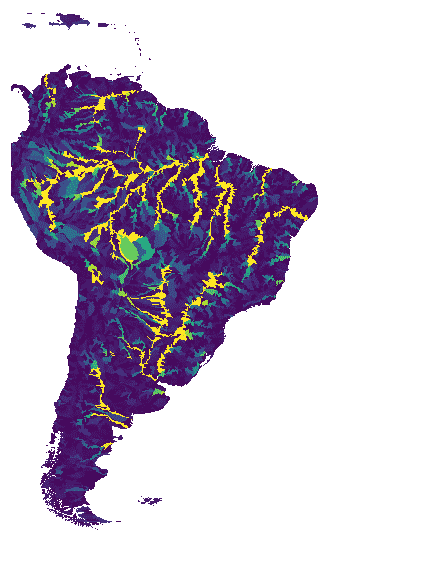
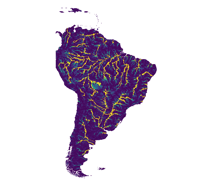
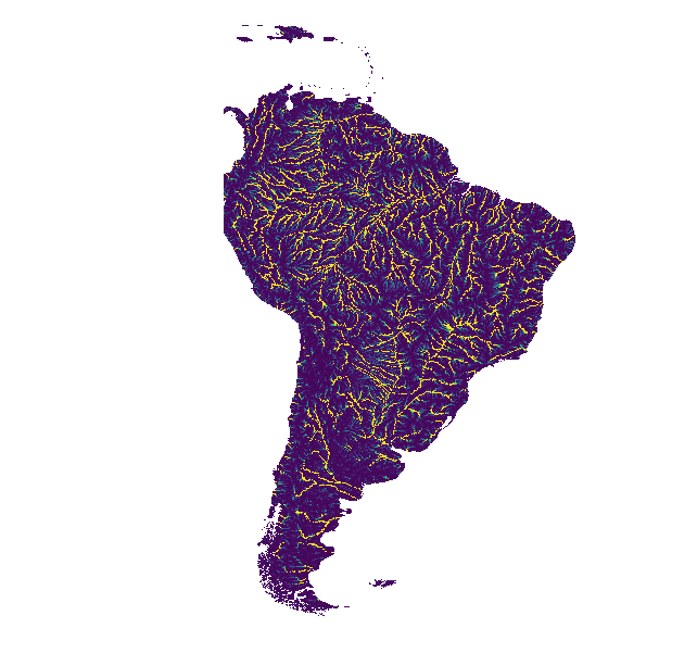
WWF HydroSHEDS Flow Accumulation, 15 Arc-Seconds
HydroSHEDS is a mapping product that provides hydrographic information for regional and global-scale applications in a consistent format. It offers a suite of geo-referenced datasets (vector and raster) at various scales, including river networks, watershed boundaries, drainage directions, and flow accumulations. HydroSHEDS is based on … accumulation drainage flow geophysical hydrography hydrology -
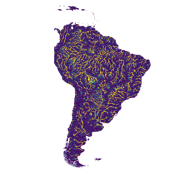
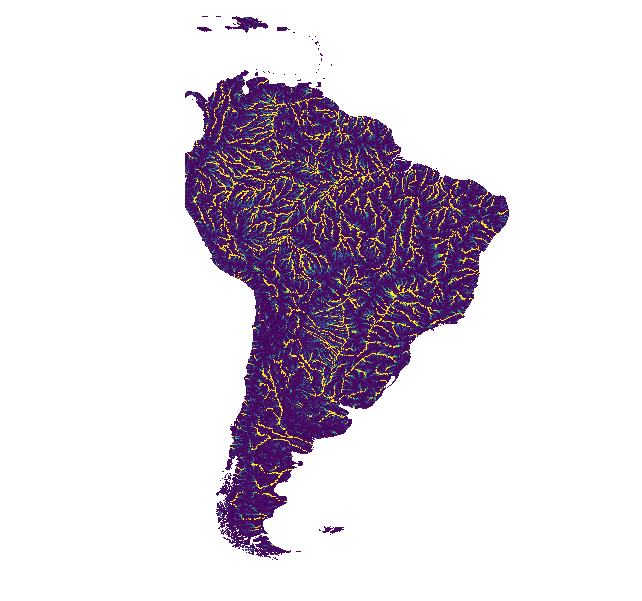
WWF HydroSHEDS Flow Accumulation, 30 Arc-Seconds
HydroSHEDS is a mapping product that provides hydrographic information for regional and global-scale applications in a consistent format. It offers a suite of geo-referenced datasets (vector and raster) at various scales, including river networks, watershed boundaries, drainage directions, and flow accumulations. HydroSHEDS is based on … accumulation drainage flow geophysical hydrography hydrology -
WWF HydroSHEDS Free Flowing Rivers Network v1
HydroSHEDS is a mapping product that provides hydrographic information for regional and global-scale applications in a consistent format. It offers a suite of geo-referenced datasets (vector and raster) at various scales, including river networks, watershed boundaries, drainage directions, and flow accumulations. HydroSHEDS is based on … geophysical hydrography hydrology hydrosheds srtm surface-ground-water -
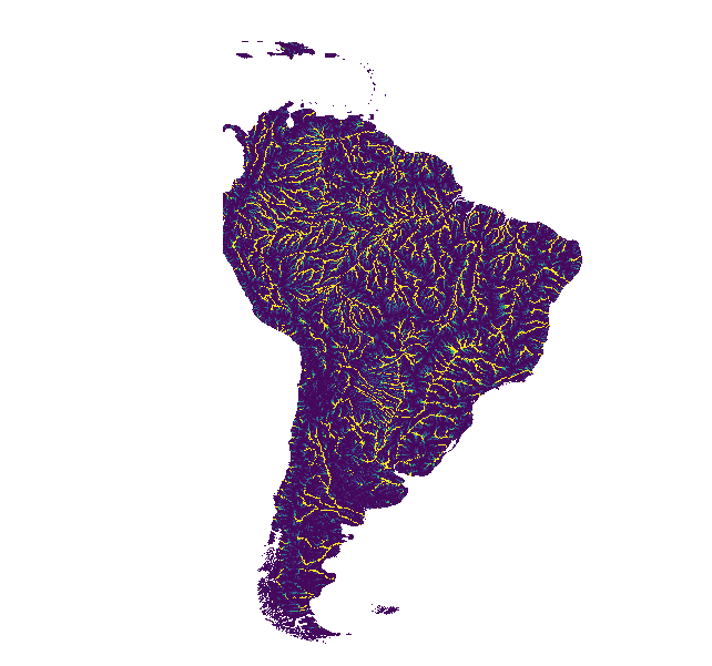
WWF HydroSHEDS Hydrologically Conditioned DEM, 15 Arc-Seconds
HydroSHEDS is a mapping product that provides hydrographic information for regional and global-scale applications in a consistent format. It offers a suite of geo-referenced datasets (vector and raster) at various scales, including river networks, watershed boundaries, drainage directions, and flow accumulations. HydroSHEDS is based on … conditioned dem elevation geophysical hydrography hydrology -
WWF HydroSHEDS Hydrologically Conditioned DEM, 3 Arc-Seconds
HydroSHEDS is a mapping product that provides hydrographic information for regional and global-scale applications in a consistent format. It offers a suite of geo-referenced datasets (vector and raster) at various scales, including river networks, watershed boundaries, drainage directions, and flow accumulations. HydroSHEDS is based on … conditioned dem elevation geophysical hydrography hydrology -
WWF HydroSHEDS Hydrologically Conditioned DEM, 30 Arc-Seconds
HydroSHEDS is a mapping product that provides hydrographic information for regional and global-scale applications in a consistent format. It offers a suite of geo-referenced datasets (vector and raster) at various scales, including river networks, watershed boundaries, drainage directions, and flow accumulations. HydroSHEDS is based on … conditioned dem elevation geophysical hydrography hydrology -
WWF HydroSHEDS Void-Filled DEM, 3 Arc-Seconds
HydroSHEDS is a mapping product that provides hydrographic information for regional and global-scale applications in a consistent format. It offers a suite of geo-referenced datasets (vector and raster) at various scales, including river networks, watershed boundaries, drainage directions, and flow accumulations. HydroSHEDS is based on … dem elevation geophysical hydrography hydrology hydrosheds