Page Summary
-
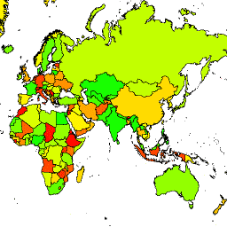
The LSIB 2017 dataset, provided by the United States Office of the Geographer, details large scale international boundary polygons.
-
There is also a simplified version of the LSIB 2017 dataset available.
-
Both datasets are derived from the LSIB line vector file and the World Vector Shorelines from the NGA.
-
LSIB 2017: Large Scale International Boundary Polygons, Detailed

The United States Office of the Geographer provides the Large Scale International Boundary (LSIB) dataset. It is derived from two other datasets: a LSIB line vector file and the World Vector Shorelines (WVS) from the National Geospatial-Intelligence Agency (NGA). The interior boundaries reflect U.S. government … borders countries dos infrastructure-boundaries political table -
LSIB 2017: Large Scale International Boundary Polygons, Simplified
The United States Office of the Geographer provides the Large Scale International Boundary (LSIB) dataset. The detailed version (2013) is derived from two other datasets: a LSIB line vector file and the World Vector Shorelines (WVS) from the National Geospatial-Intelligence Agency (NGA). The interior boundaries … borders countries dos infrastructure-boundaries political table