-
Mô hình chiều cao tán cây (CHM) của NEON

Chiều cao của đỉnh tán lá so với mặt đất (Mô hình chiều cao tán lá; CHM). CHM được lấy từ đám mây điểm LiDAR của NEON và được tạo bằng cách tạo một bề mặt liên tục của các số liệu ước tính về chiều cao tán cây trên toàn bộ miền không gian của khảo sát LiDAR. … trên không tán cây rừng sinh khối rừng độ phân giải cao lidar -
Nội dung về nitơ trong tán lá (CNC) của NEON
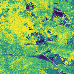
Nồng độ nitơ trong tán cây được mô hình hoá, hiệu chỉnh bằng các quan sát về thành phần hoá học của lá cây NEON và dự đoán bằng hệ số phản xạ định hướng bề mặt L1, lấy từ Máy quang phổ hình ảnh NEON (NIS). Các dải bao gồm 1) tỷ lệ phần trăm nitơ trong tán lá, 2) độ không chắc chắn của mô hình nitơ trong tán lá, 3) kết quả phân loại cho mô hình kim so với mô hình không kim và … airborne canopy forest highres hyperspectral neon -
Mô hình độ cao kỹ thuật số (DEM) của NEON

Mô hình kỹ thuật số của bề mặt (DSM) và địa hình (DTM) được lấy từ dữ liệu LiDAR của NEON. DSM: Các đặc điểm bề mặt (thông tin địa hình có thảm thực vật và các cấu trúc nhân tạo). DTM: Độ cao của bề mặt đất (thông tin địa hình đã loại bỏ thảm thực vật và các công trình nhân tạo). Hình ảnh được cung cấp theo mét so với mực nước biển trung bình … airborne dem elevation-topography forest highres lidar -
Hình ảnh từ camera RGB của NEON

Hình ảnh camera có độ phân giải cao, được chỉnh sửa hình học theo màu Đỏ-Xanh lục-Xanh dương (RGB), được ghép và xuất ra một lưới không gian cố định, đồng nhất bằng cách sử dụng phương pháp lấy mẫu lại lân cận gần nhất; độ phân giải không gian là 0,1 m. Camera kỹ thuật số là một phần của bộ công cụ trên Nền tảng quan sát trên không (AOP) của NEON, bao gồm cả… airborne forest highres neon neon-prod-earthengine orthophoto -
Độ phản xạ hai chiều của bề mặt NEON

Suất phản chiếu hai chiều của bề mặt AOP NEON là một sản phẩm dữ liệu siêu phổ VSWIR (từ ánh sáng nhìn thấy đến hồng ngoại sóng ngắn), chứa 426 dải tần trải dài từ bước sóng ~380 nm đến 2510 nm. Hệ số phản xạ được điều chỉnh theo tỷ lệ 10.000. Bước sóng từ 1340 đến 1445 nm và từ 1790 đến 1955 nm được đặt thành … airborne forest highres hyperspectral neon neon-prod-earthengine -
Độ phản xạ có hướng của bề mặt NEON

Suất phản chiếu có hướng của bề mặt AOP NEON là một sản phẩm dữ liệu siêu phổ VSWIR (từ ánh sáng nhìn thấy đến tia hồng ngoại sóng ngắn), chứa 426 dải tần trải dài từ bước sóng ~380 nm đến 2510 nm. Hệ số phản xạ được điều chỉnh theo tỷ lệ 10.000. Bước sóng từ 1340 đến 1445 nm và từ 1790 đến 1955 nm được đặt thành … airborne forest hyperspectral neon neon-prod-earthengine publisher-dataset