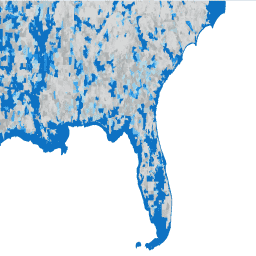
The United States Census Bureau regularly releases a geodatabase named TIGER. This dataset contains the 2020 census blocks, roughly equivalent to a city block. There are just over eight million polygon features covering the United States, the District of Columbia, Puerto Rico, and the Island …
The United States Census Bureau regularly releases a geodatabase named TIGER. This dataset contains the 2010 census block groups, which is a cluster of blocks within the same census tract that have the same first digit of their four-digit census block number. There are just …
The United States Census Bureau regularly releases a geodatabase named TIGER. This dataset contains the 2020 census block groups, which is a cluster of blocks within the same census tract that have the same first digit of their four-digit census block number. There are just …
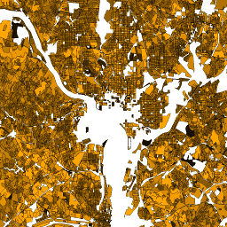
The United States Census Bureau regularly releases a geodatabase named TIGER. This dataset contains the 2010 census blocks, roughly equivalent to a city block. There are just over 11 million polygon features covering the United States, the District of Columbia, Puerto Rico, and the Island …
The United States Census Bureau regularly releases a geodatabase named TIGER. This dataset contains the 2020 census tracts. Tract areas vary tremendously, but in urban areas are roughly equivalent to a neighborhood. There are just over 85000 polygon features covering the United States, the District …
[[["Easy to understand","easyToUnderstand","thumb-up"],["Solved my problem","solvedMyProblem","thumb-up"],["Other","otherUp","thumb-up"]],[["Missing the information I need","missingTheInformationINeed","thumb-down"],["Too complicated / too many steps","tooComplicatedTooManySteps","thumb-down"],["Out of date","outOfDate","thumb-down"],["Samples / code issue","samplesCodeIssue","thumb-down"],["Other","otherDown","thumb-down"]],[],[[["\u003cp\u003eThe United States Census Bureau provides TIGER geodatabases with various levels of geographic detail for the 2010 and 2020 censuses, including block groups, blocks, and tracts.\u003c/p\u003e\n"],["\u003cp\u003eThese datasets offer polygon features encompassing the United States, the District of Columbia, Puerto Rico, and the Island Areas.\u003c/p\u003e\n"],["\u003cp\u003eTIGER data can be used to analyze census data at different granularities, ranging from city blocks to neighborhoods and larger regions.\u003c/p\u003e\n"],["\u003cp\u003eThe datasets are tagged with relevant keywords, such as census, city, neighborhood, table, tiger, and urban, to facilitate searching and filtering.\u003c/p\u003e\n"],["\u003cp\u003eCensus blocks roughly correspond to city blocks, while block groups represent clusters of blocks within a census tract, and census tracts can be comparable to neighborhoods in urban areas.\u003c/p\u003e\n"]]],[],null,["# Datasets tagged neighborhood in Earth Engine\n\n-\n\n |-------------------------------------------------------------------------------------------------------------------------------------------------------------------------------------------------------------------------------------------------------------------------------------------------------------------------|\n | [### TIGER: 2020 Tabulation (Census) Block](/earth-engine/datasets/catalog/TIGER_2020_TABBLOCK20) |\n | The United States Census Bureau regularly releases a geodatabase named TIGER. This dataset contains the 2020 census blocks, roughly equivalent to a city block. There are just over eight million polygon features covering the United States, the District of Columbia, Puerto Rico, and the Island ... |\n | [census](/earth-engine/datasets/tags/census) [city](/earth-engine/datasets/tags/city) [infrastructure-boundaries](/earth-engine/datasets/tags/infrastructure-boundaries) [neighborhood](/earth-engine/datasets/tags/neighborhood) [table](/earth-engine/datasets/tags/table) [tiger](/earth-engine/datasets/tags/tiger) |\n\n-\n\n |-------------------------------------------------------------------------------------------------------------------------------------------------------------------------------------------------------------------------------------------------------------------------------------------------------------------------|\n | [### TIGER: US Census Block Groups (BG) 2010](/earth-engine/datasets/catalog/TIGER_2010_BG) |\n | The United States Census Bureau regularly releases a geodatabase named TIGER. This dataset contains the 2010 census block groups, which is a cluster of blocks within the same census tract that have the same first digit of their four-digit census block number. There are just ... |\n | [census](/earth-engine/datasets/tags/census) [city](/earth-engine/datasets/tags/city) [infrastructure-boundaries](/earth-engine/datasets/tags/infrastructure-boundaries) [neighborhood](/earth-engine/datasets/tags/neighborhood) [table](/earth-engine/datasets/tags/table) [tiger](/earth-engine/datasets/tags/tiger) |\n\n-\n\n |-------------------------------------------------------------------------------------------------------------------------------------------------------------------------------------------------------------------------------------------------------------------------------------------------------------------------|\n | [### TIGER: US Census Block Groups (BG) 2020](/earth-engine/datasets/catalog/TIGER_2020_BG) |\n | The United States Census Bureau regularly releases a geodatabase named TIGER. This dataset contains the 2020 census block groups, which is a cluster of blocks within the same census tract that have the same first digit of their four-digit census block number. There are just ... |\n | [census](/earth-engine/datasets/tags/census) [city](/earth-engine/datasets/tags/city) [infrastructure-boundaries](/earth-engine/datasets/tags/infrastructure-boundaries) [neighborhood](/earth-engine/datasets/tags/neighborhood) [table](/earth-engine/datasets/tags/table) [tiger](/earth-engine/datasets/tags/tiger) |\n\n-\n\n |-------------------------------------------------------------------------------------------------------------------------------------------------------------------------------------------------------------------------------------------------------------------------------------------------------------------------|\n | [### TIGER: US Census Blocks](/earth-engine/datasets/catalog/TIGER_2010_Blocks) |\n | The United States Census Bureau regularly releases a geodatabase named TIGER. This dataset contains the 2010 census blocks, roughly equivalent to a city block. There are just over 11 million polygon features covering the United States, the District of Columbia, Puerto Rico, and the Island ... |\n | [census](/earth-engine/datasets/tags/census) [city](/earth-engine/datasets/tags/city) [infrastructure-boundaries](/earth-engine/datasets/tags/infrastructure-boundaries) [neighborhood](/earth-engine/datasets/tags/neighborhood) [table](/earth-engine/datasets/tags/table) [tiger](/earth-engine/datasets/tags/tiger) |\n\n-\n\n |-------------------------------------------------------------------------------------------------------------------------------------------------------------------------------------------------------------------------------------------------------------------------------------------------------------------------|\n | [### TIGER: US Census Tracts](/earth-engine/datasets/catalog/TIGER_2020_TRACT) |\n | The United States Census Bureau regularly releases a geodatabase named TIGER. This dataset contains the 2020 census tracts. Tract areas vary tremendously, but in urban areas are roughly equivalent to a neighborhood. There are just over 85000 polygon features covering the United States, the District ... |\n | [census](/earth-engine/datasets/tags/census) [city](/earth-engine/datasets/tags/city) [infrastructure-boundaries](/earth-engine/datasets/tags/infrastructure-boundaries) [neighborhood](/earth-engine/datasets/tags/neighborhood) [table](/earth-engine/datasets/tags/table) [tiger](/earth-engine/datasets/tags/tiger) |"]]