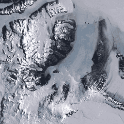
這份資料集是 NASA 的 Making Earth System Data Records for Use in Research Environments (MEaSUREs) 計畫的一部分,包含選定冰川出口區域的月平均速度地圖。這些地圖是透過追蹤 Landsat 取得的光學影像組合之間的可見特徵產生。
[[["容易理解","easyToUnderstand","thumb-up"],["確實解決了我的問題","solvedMyProblem","thumb-up"],["其他","otherUp","thumb-up"]],[["缺少我需要的資訊","missingTheInformationINeed","thumb-down"],["過於複雜/步驟過多","tooComplicatedTooManySteps","thumb-down"],["過時","outOfDate","thumb-down"],["翻譯問題","translationIssue","thumb-down"],["示例/程式碼問題","samplesCodeIssue","thumb-down"],["其他","otherDown","thumb-down"]],[],[[["\u003cp\u003eThis collection of datasets provides various measurements and diagnostics related to ice, land, and ocean surfaces.\u003c/p\u003e\n"],["\u003cp\u003eIt includes data on glacier characteristics, sea surface temperature, land surface properties, and ice velocity.\u003c/p\u003e\n"],["\u003cp\u003eDatasets are derived from sources like Landsat, MERRA-2, and OISST, offering diverse perspectives on Earth's systems.\u003c/p\u003e\n"],["\u003cp\u003eThe data covers various geographical regions, including Greenland, Antarctica, and global extents.\u003c/p\u003e\n"],["\u003cp\u003eThese datasets are valuable for studying climate change, glacier dynamics, and Earth's cryosphere.\u003c/p\u003e\n"]]],["Several datasets focus on monitoring ice and related land/ocean features. GLIMS surveys global glaciers, measuring area, geometry, and velocity. MERRA-2 provides hourly land surface diagnostics like soil wetness and runoff. NOAA's OISST offers daily sea surface temperatures. ETOPO1 is a global elevation model with ice and bedrock bands. Greenland Ice & Ocean Mask classifies Greenland's ice cover. MEaSUREs tracks glacier velocity in Greenland, and LIMA offers cloudless Landsat mosaics of Antarctica.\n"],null,[]]