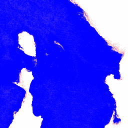
Digital Earth Australia (DEA) Water Observations uses an algorithm to classify each pixel from Landsat satellite imagery as 'wet', 'dry', or 'invalid'. Water Observations Statistics provides information on how many times each year the Landsat satellites were able to clearly see an area, how many times those observations were wet, and what that means for the percentage of time that water was observed in the landscape.
Combining the classified pixels into summaries covering each year gives the information on where water is usually, and where it is rarely. As no confidence filtering is applied to this product, it is affected by noise where misclassifications have occurred in the input water classifications, and can be difficult to interpret on its own.
Mueller, N., Lewis, A., Roberts, D., Ring, S., Melrose, R., Sixsmith, J., Lymburner, L., McIntyre, A., Tan, P., Curnow, S., & Ip, A. (2016). Water observations from space: Mapping surface water from 25 years of Landsat imagery across Australia. Remote Sensing of Environment, 174, 341-352
doi:10.1016/j.rse.2015.11.003
Digital Earth Australia (DEA) Water Observations uses an algorithm to classify each pixel from Landsat satellite imagery as 'wet', 'dry', or 'invalid'. Water Observations Statistics provides information on how many times each year the Landsat satellites were able to clearly see an area, how many times those observations were wet, …
[[["Easy to understand","easyToUnderstand","thumb-up"],["Solved my problem","solvedMyProblem","thumb-up"],["Other","otherUp","thumb-up"]],[["Missing the information I need","missingTheInformationINeed","thumb-down"],["Too complicated / too many steps","tooComplicatedTooManySteps","thumb-down"],["Out of date","outOfDate","thumb-down"],["Samples / code issue","samplesCodeIssue","thumb-down"],["Other","otherDown","thumb-down"]],[],[[["\u003cp\u003eThis dataset from Geoscience Australia and NGIS uses Landsat imagery to classify water observations across Australia from 1987 to 2022.\u003c/p\u003e\n"],["\u003cp\u003eIt provides statistics on water frequency, clear observations, and wet observations at a 25-meter resolution.\u003c/p\u003e\n"],["\u003cp\u003eThe dataset includes three bands: \u003ccode\u003ecount_clear\u003c/code\u003e, \u003ccode\u003ecount_wet\u003c/code\u003e, and \u003ccode\u003efrequency\u003c/code\u003e, indicating the number of clear observations, wet observations, and the percentage of clear observations identified as wet, respectively.\u003c/p\u003e\n"],["\u003cp\u003eDEA Water Observations Statistics is affected by noise due to potential misclassifications in the input water classifications and is best interpreted in conjunction with other datasets.\u003c/p\u003e\n"],["\u003cp\u003eThe dataset is available under a CC-BY-4.0 license and is part of the Digital Earth Australia Program.\u003c/p\u003e\n"]]],[],null,["# DEA Water Observations Statistics 3.1.6 [deprecated]\n\n**Caution:** This dataset was removed on March 01, 2025. [Learn more.](https://developers.google.com/earth-engine/datasets/reference/removed_datasets#geoscience_australia_publisher_catalog) \ninfo\n\n\nThis dataset is part of a Publisher Catalog, and not managed by Google Earth Engine.\n\nContact [Geoscience Australia](https://www.ga.gov.au/contact-us)\n\nfor bugs or [view more datasets](https://developers.google.com/earth-engine/datasets/publisher/geoscience-aus-cat)\nfrom the Geoscience Australia Catalog. [Learn more about Publisher datasets](/earth-engine/datasets/publisher). \n[](https://www.ga.gov.au/) \n\nCatalog Owner\n: Geoscience Australia\n\nDataset Availability\n: 1987-01-01T00:00:00Z--2022-01-01T00:00:00Z\n\nDataset Provider\n:\n\n\n [Geoscience Australia](https://cmi.ga.gov.au/data-products/dea/686/dea-water-observations-statistics-landsat)\n\n\n [NGIS](https://ngis.com.au/)\n\nContact\n: [Geoscience Australia](https://www.ga.gov.au/contact-us)\n\nTags\n:\n[australia](/earth-engine/datasets/tags/australia) [ga](/earth-engine/datasets/tags/ga) [geoscience-aus-cat](/earth-engine/datasets/tags/geoscience-aus-cat) [landsat-derived](/earth-engine/datasets/tags/landsat-derived) [publisher-dataset](/earth-engine/datasets/tags/publisher-dataset) [water](/earth-engine/datasets/tags/water) \n\n#### Description\n\nDigital Earth Australia (DEA) Water Observations uses an algorithm to classify each pixel from Landsat satellite imagery as 'wet', 'dry', or 'invalid'. Water Observations Statistics provides information on how many times each year the Landsat satellites were able to clearly see an area, how many times those observations were wet, and what that means for the percentage of time that water was observed in the landscape.\n\nCombining the classified pixels into summaries covering each year gives the information on where water is usually, and where it is rarely. As no confidence filtering is applied to this product, it is affected by noise where misclassifications have occurred in the input water classifications, and can be difficult to interpret on its own.\n\nFor more information, please see the [DEA Water Observations Statistics Landsat](https://cmi.ga.gov.au/data-products/dea/686/dea-water-observations-statistics-landsat)\n\nThis product is part of the [Digital Earth Australia Program](https://www.dea.ga.gov.au/)\n\n### Bands\n\n\n**Pixel Size**\n\n25 meters\n\n**Bands**\n\n| Name | Units | Min | Max | Description |\n|---------------|-------|----------|---------|-------------------------------------------------------------------------------|\n| `count_clear` | count | -32768\\* | 32767\\* | Clear count: how many times an area could be clearly seen. |\n| `count_wet` | count | -32768\\* | 32767\\* | Wet count: how many times water was detected in observations that were clear. |\n| `frequency` | % | 0 | 1 | Water frequency: what percentage of clear observations were detected as wet. |\n\n\\* estimated min or max value\n\n### Terms of Use\n\n**Terms of Use**\n\n[CC-BY-4.0](https://spdx.org/licenses/CC-BY-4.0.html)\n\n### Citations\n\nCitations:\n\n- Mueller, N., Lewis, A., Roberts, D., Ring, S., Melrose, R., Sixsmith, J., Lymburner, L., McIntyre, A., Tan, P., Curnow, S., \\& Ip, A. (2016). Water observations from space: Mapping surface water from 25 years of Landsat imagery across Australia. Remote Sensing of Environment, 174, 341-352\n [doi:10.1016/j.rse.2015.11.003](https://doi.org/10.1016/j.rse.2015.11.003)\n\n### DOIs\n\n- \u003chttps://doi.org/10.1016/j.rse.2015.11.003\u003e\n**Important:** Earth Engine is a platform for petabyte-scale scientific analysis and visualization of geospatial datasets, both for public benefit and for business and government users. Earth Engine is free to use for research, education, and nonprofit use. To get started, please [register for Earth Engine access.](https://console.cloud.google.com/earth-engine) \n[DEA Water Observations Statistics 3.1.6 \\[deprecated\\]](/earth-engine/datasets/catalog/projects_geoscience-aus-cat_assets_ga_ls_wo_fq_cyear_3) \nDigital Earth Australia (DEA) Water Observations uses an algorithm to classify each pixel from Landsat satellite imagery as 'wet', 'dry', or 'invalid'. Water Observations Statistics provides information on how many times each year the Landsat satellites were able to clearly see an area, how many times those observations were wet, ... \nprojects/geoscience-aus-cat/assets/ga_ls_wo_fq_cyear_3, australia,ga,geoscience-aus-cat,landsat-derived,publisher-dataset,water \n1987-01-01T00:00:00Z/2022-01-01T00:00:00Z \n-44.41 108.81 -9.13 157.82 \nGoogle Earth Engine \nhttps://developers.google.com/earth-engine/datasets\n\n- [https://doi.org/10.1016/j.rse.2015.11.003](https://doi.org/https://cmi.ga.gov.au/data-products/dea/686/dea-water-observations-statistics-landsat)\n- [https://doi.org/10.1016/j.rse.2015.11.003](https://doi.org/https://ngis.com.au/)\n- [https://doi.org/10.1016/j.rse.2015.11.003](https://doi.org/https://developers.google.com/earth-engine/datasets/catalog/projects_geoscience-aus-cat_assets_ga_ls_wo_fq_cyear_3)"]]