

- Catalog Owner
- WeatherNext
- Dataset Availability
- 1999-01-01T00:00:00Z–2023-12-31T23:45:00Z
- Dataset Producer
- Cadence
- 15 Minutes
- Tags
Description
PARDIG (Precipitation AI Reanalysis - Densely Inferred GPM) is an experimental dataset of global AI-driven precipitation estimates by Google DeepMind and Google Research, produced by the model described in: Global Precipitation Estimates Learned from Sparse Satellite Observations.
PARDIG is produced by an AI model that is trained to predict precipitation estimates from the Combined Radar-Radiometer Algorithm (CORRA), part of the NASA/JAXA Global Precipitation Measurement (GPM) Core Observatory. PARDIG-LR relies on ECMWF's ERA5, NOAA's GridSat-B1, and a global mosaic of polar-orbiting (LEO) microwave sounder observations as its inputs. PARDIG precipitation estimates are provided at a 15 minute cadence and 0.1° spatial resolution.
This image collection provides the full historical archive of PARDIG-LR
(Long-Record) from 1999 through 2023. The dataset is also available in Zarr
format in our Google Cloud Storage bucket (gs://pardig_1/LR/). The
companion dataset, PARDIG-NRT (Near-Real-Time), is also available on
Earth Engine
and on Google Cloud Storage (gs://pardig_1/NRT/).
Both datasets are publicly available in the Earth Engine Data Catalog and on Google Cloud Storage. Users can access them via their Google Cloud account immediately, without needing to explicitly apply for access.
For more details about PARDIG and related products, visit the Developer Guide.
Acknowledgements
This experimental dataset was generated by a model using data and products of the European Centre for Medium-Range Weather Forecasts (ECMWF), as well as additional third-party providers. For a full list of attribution and acknowledgements, please see our acknowledgements page.
Bands
Bands
Pixel size: 11132 meters (all bands)
| Name | Units | Pixel Size | Description |
|---|---|---|---|
precipitation |
m/h | 11132 meters | Instantaneous precipitation rate at the valid timestamp (start_time). |
Image Properties
Image Properties
| Name | Type | Description |
|---|---|---|
| start_time | STRING | The valid time of the precipitation estimate. |
| end_time | STRING | The valid time of the precipitation estimate. |
| ingestion_time_utc | DOUBLE | The time when this data was ingested into Earth Engine. |
| B0 | STRING | The band name: precipitation. |
Terms of Use
Terms of Use
PARDIG is licensed under the Creative Commons Attribution International License, Version 4.0 (CC BY 4.0).
Third-party materials
Use of the third-party materials referred to in the Acknowledgements section may be governed by separate terms and conditions or license provisions. Your use of the third-party materials is subject to any such terms and you should check that you can comply with any applicable restrictions or terms and conditions before use.
Citations
If you disclose findings arising from PARDIG, you must cite "© 2026 Google LLC's machine learning models used to create the experimental data made available at https://developers.google.com/earth-engine/datasets/catalog/projects_gcp-public-data-weathernext_assets_PARDIG_1_LR under CC BY 4.0 licence terms. This data is intended for experimental modelling only and is not intended, validated, or approved for real world use."
Explore with Earth Engine
Code Editor (JavaScript)
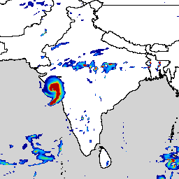
// PARDIG-LR 15-minute global precipitation rate for a single timestamp.
var dataset =
    ee.ImageCollection(
          'projects/gcp-public-data-weathernext/assets/PARDIG_1_LR')
        .filterDate('2021-05-17T12:15:00Z');

// Convert m/hr to mm/hr and mask low precipitation.
var precipitation = dataset.first()
    .select('precipitation')
    .multiply(1000);
precipitation = precipitation.updateMask(precipitation.gt(0.5));

var palette = [
  '000096', '0064ff', '00b4ff', '33db80', '9beb4a',
  'ffeb00', 'ffb300', 'ff6400', 'eb1e00', 'af0000'
];
var precipitationVis = {min: 1, max: 15, palette: palette};

Map.setCenter(78, 20, 4);
Map.addLayer(precipitation, precipitationVis, 'Precipitation (mm/hr)');