Page Summary
-
The iNaturalist Multispecies Range Dataset offers modeled geographic ranges for thousands of species, derived from iNaturalist observations.
-
This dataset, available through BigQuery, includes species polygons with attributes like taxon_id, name, scientific_name, and geomodel_version.
-
Ranges are updated monthly and support large-scale biodiversity analyses and ecological modeling.
-
The dataset has a defined availability window and is licensed under CC-BY-4.0.
- Dataset Availability
- 2025-02-25T00:00:00Z–2025-03-25T00:00:00Z
- Dataset Producer
- iNaturalist
- Tags
Description
The iNaturalist Multispecies Range Dataset provides modeled geographic ranges for thousands of species. Dataset contains species polygons, with attributes such as taxon_id, name, scientific_name, and geomodel_version. Ranges are estimated from iNaturalist community observations and updated on a monthly basis. These datasets enable large-scale biodiversity analyses, ecological modeling, and integration with other spatial data. This dataset contains the latest available range maps for multiple species from iNaturalist. The dataset is available through BigQuery.
BigQuery Table Schema
Table Schema
| Name | Type | Description |
|---|---|---|
| taxon_id | STRING | Unique identifier for a species in iNaturalist |
| parent_taxon_id | STRING | Identifier for the immediate higher-level taxon (e.g., genus or family), giving taxonomic context. |
| name | STRING | The scientific name of the species. |
| rank | STRING | Taxonomic rank of the taxon (e.g., species, genus, family, order). Useful for filtering or grouping taxa by level. |
| iconic_taxon_id | STRING | Internal identifier for one of iNaturalist's "iconic taxa" - broad, recognizable groups such as Mammalia, Aves, Reptilia, Plantae. |
| iconic_taxon_name | STRING | The iconic taxon name of the species (e.g., Mammalia, Aves). |
| geomodel_version | STRING | The version of the geomodel used. |
| geometry | GEOMETRY | Polygon or multipolygon in WGS84 (EPSG:4326) representing the modeled distribution. |
Terms of Use
Terms of Use
Terms of Use
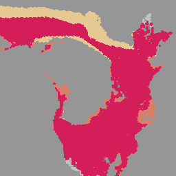
Explore with Earth Engine
Code Editor (JavaScript)
// Load the collection using the BigQuery connector.
var inaturalist = ee.FeatureCollection.loadBigQueryTable(
  'earth-engine-public-data.inaturalist_open_range_map.multispecies_latest'
)

Map.setCenter(25, 0, 3);

// Create a dictionary to map each species name to a specific color.
var palette = {
  'Panthera leo': '#E4004B',           // Lion
  'Loxodonta africana': '#ED775A',     // African bush elephant
  'Giraffa camelopardalis': '#FAD691', // Giraffe
  'Acinonyx jubatus': '#C9CDCF'        // Cheetah
};

for (var name in palette) {
  var species = inaturalist.filter(ee.Filter.eq('name', name));
  Map.addLayer(species, {color: palette[name]}, name);
}