- Ketersediaan Set Data
- 2018-01-01T00:00:00Z–2019-01-01T00:00:00Z
- Produsen Set Data
- Department of Earth System Science, Tsinghua University (DESS, THU)
- Tag
Deskripsi
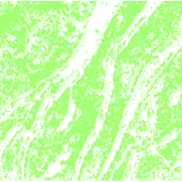
Set data ini adalah peta teras China pada resolusi 30 m pada tahun 2018. Lapisan ini dikembangkan melalui klasifikasi berbasis piksel yang diawasi menggunakan data multi-sumber dan multi-temporal berdasarkan platform Google Earth Engine. Akurasi keseluruhan dan koefisien kappa yang dicapai masing-masing adalah 94% dan 0, 72. Peta teras China 30 m pertama ini dapat digunakan untuk studi tentang erosi tanah, ketahanan pangan, siklus biogeokimia, keanekaragaman hayati, dan penilaian layanan ekosistem.
Band
Band
Ukuran piksel: 30 meter (semua band)
| Nama | Ukuran Piksel | Deskripsi |
|---|---|---|
terrace |
30 meter | 1 jika ada teras, 0 jika tidak ada. |
terrace Class Table
| Nilai | Warna | Deskripsi |
|---|---|---|
| 0 | #ffffff | Tidak ada teras |
| 1 | #a3ff74 | Teras yang ada |
Persyaratan Penggunaan
Persyaratan Penggunaan
Kutipan
Cao, B., Yu, L., Naipal, V., Ciais, P., Li, W., Zhao, Y., Wei, W., Chen, D., Liu, Z., dan Gong, P.: Pemetaan teras 30 m di China menggunakan citra Landsat 8 dan model elevasi digital berdasarkan Google Earth Engine, Earth Syst. Sci. Data, 13, 2437-2456, doi:10.5194/essd-13-2437-2021, 2021.
DOI
Mengeksplorasi dengan Earth Engine
Editor Kode (JavaScript)
var image = ee.Image('Tsinghua/DESS/ChinaTerraceMap/v1');

var image = image.updateMask(image);
Map.addLayer(image, {min: 0, max: 1, palette: ['a3ff74']}, 'Terraces');

Map.setCenter(106.6, 30.4, 10);
Map.setOptions('SATELLITE');