
- Доступность набора данных
- 2014-01-01T00:00:00Z–2026-07-01T00:00:00Z
- Производитель наборов данных
- Группа наблюдения за Землей, Институт государственной политики Пейна, Горная школа Колорадо
- Каденция
- 1 месяц
- Теги
- stray-light
Описание
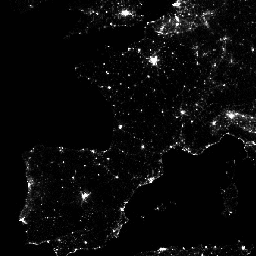
Среднемесячные составные изображения яркости, полученные с использованием ночных данных с помощью прибора Visible Infrared Imaging Radiometer Suite (VIIRS) в дневном/ночном диапазоне (DNB).
As these data are composited monthly, there are many areas of the globe where it is impossible to get good quality data coverage for that month. This can be due to cloud cover, especially in the tropical regions, or due to solar illumination, as happens toward the poles in their respective summer months. Therefore it is recommended that users of these data utilize the 'cf_cvg' band and not assume a value of zero in the average radiance image means that no lights were observed.
Cloud cover is determined using the VIIRS Cloud Mask product (VCM). In addition, data near the edges of the swath are not included in the composites (aggregation zones 29-32). Version 1 has NOT been filtered to screen out lights from aurora, fires, boats, and other temporal lights. This separation is under development and will be included in a later version of this time series. Also in development is a method to separate lights from background (non-light) values.
This product is an alternative configuration of the VIIRS DNB using a procedure to correct for stray light. The correction procedure extends visible areas closer to the poles and improves dynamic range. It should be noted some artifacts are introduced due to the procedure used in twilight regions; see reference paper for more details. This product excludes data impacted by cloud cover.
Группы
Группы
Размер пикселя: 463,83 метра (все диапазоны)
| Имя | Единицы | Мин | Макс | Размер пикселя | Описание |
|---|---|---|---|---|---|
avg_rad | нановатты/ср/см² | -1.5* | 193565* | 463,83 метра | Средние значения яркости DNB. |
cf_cvg | 0* | 84* | 463,83 метра | Покрытие без облаков; общее количество наблюдений, попавших в каждый пиксель. Этот диапазон можно использовать для выявления областей с малым количеством наблюдений, где качество изображения снижено. |
Условия эксплуатации
Условия эксплуатации
Данные, информация и продукты Колорадской горной школы, независимо от способа их предоставления, не защищены авторским правом и не накладывают никаких ограничений на их последующее использование общественностью. После получения они могут быть использованы в любых законных целях. Приведенные выше данные находятся в общественном достоянии и предоставляются без ограничений на использование и распространение.
Исследуйте мир с помощью Earth Engine.
Редактор кода (JavaScript)
var dataset = ee.ImageCollection('NOAA/VIIRS/DNB/MONTHLY_V1/VCMSLCFG')
                  .filter(ee.Filter.date('2017-05-01', '2017-05-31'));
var nighttime = dataset.select('avg_rad');
var nighttimeVis = {min: 0.0, max: 60.0};
Map.setCenter(-77.1056, 38.8904, 8);
Map.addLayer(nighttime, nighttimeVis, 'Nighttime');
import ee
import geemap.core as geemap
Colab (Python)
dataset = ee.ImageCollection('NOAA/VIIRS/DNB/MONTHLY_V1/VCMSLCFG').filter(
    ee.Filter.date('2017-05-01', '2017-05-31')
)

nighttime = dataset.select('avg_rad')

nighttime_vis = {'min': 0.0, 'max': 60.0}

m = geemap.Map()
m.set_center(-77.1056, 38.8904, 8)
m.add_layer(nighttime, nighttime_vis, 'Nighttime')
m