Page Summary
-
This dataset, containing Landsat 8 composites from 2013 to 2017, is deprecated and has been superseded by a newer version due to USGS no longer producing Pre-Collection Landsat as of May 1, 2017.
-
The composites are created from Level L1T orthorectified scenes using computed top-of-atmosphere (TOA) reflectance.
-
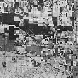
Annual greenest pixel composites are generated by selecting the pixel with the highest Normalized Difference Vegetation Index (NDVI) value from all scenes within a year.
-
Landsat datasets are public domain and can be used without copyright restriction, with acknowledgement of the USGS as the data source recommended.
-
The dataset can be explored using the Earth Engine platform, which requires registration for access.
- Dataset Availability
- 2013-04-11T00:00:00Z–2017-01-01T00:00:00Z
- Dataset Producer
- USGS
- Tags
Description
These Landsat 8 composites are made from Level L1T orthorectified scenes, using the computed top-of-atmosphere (TOA) reflectance. See Chander et al. (2009) for details on the TOA computation.
As of May 1, 2017, the USGS is no longer producing Pre-Collection Landsat, and therefore this collection is complete. Please switch to a Collection 1-based dataset. See this documentation page for more information.
These composites are created from all the scenes in each annual period beginning from the first day of the year and continuing to the last day of the year. All the images from each year are included in the composite, with the greenest pixel as the composite value, where the greenest pixel means the pixel with the highest value of the Normalized Difference Vegetation Index (NDVI).
Terms of Use
Terms of Use
Landsat datasets are federally created data and therefore reside in the public domain and may be used, transferred, or reproduced without copyright restriction.
Acknowledgement or credit of the USGS as data source should be provided by including a line of text citation such as the example shown below.
(Product, Image, Photograph, or Dataset Name) courtesy of the U.S. Geological Survey
Example: Landsat-7 image courtesy of the U.S. Geological Survey
See the USGS Visual Identity System Guidance for further details on proper citation and acknowledgement of USGS products.