- Доступность набора данных
- 2003-07-29T00:00:00Z–2008-07-29T00:00:00Z
- Производитель наборов данных
- Геологическая служба США
- Теги
Описание
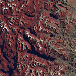
Набор данных GLS2005 представляет собой коллекцию из 9500 ортокорректированных спутниковых снимков среднего разрешения, полученных в период с 2004 по 2007 год и охватывающих земную поверхность. В GLS2005 используются в основном данные Landsat 5 и данные Landsat 7 с заполненными пробелами, а также данные EO-1 ALI и Terra ASTER для заполнения любых пробелов в данных.
Этот набор данных содержит изображения только с датчиков L5 TM и L7 ETM+, и только из 6 диапазонов, общих для этих двух датчиков: 10, 20, 30, 40, 50 и 70.
Группы
Группы
Размер пикселя: 30 метров (все диапазоны)
| Имя | Размер пикселя | Длина волны | Описание |
|---|---|---|---|
10 | 30 метров | 0,45 - 0,52 мкм | Синий |
20 | 30 метров | 0,52 - 0,60 мкм | Зеленый |
30 | 30 метров | 0,63 - 0,69 мкм | Красный |
40 | 30 метров | 0,76 - 0,90 мкм | Ближний инфракрасный диапазон |
50 | 30 метров | 1,55 - 1,75 мкм | Коротковолновое инфракрасное излучение 1 |
70 | 30 метров | 2,08 - 2,35 мкм | Коротковолновое инфракрасное излучение 2 |
Условия эксплуатации
Условия эксплуатации
Данные Landsat создаются на федеральном уровне и, следовательно, находятся в общественном достоянии, поэтому их можно использовать, передавать или воспроизводить без ограничений, связанных с авторским правом.
Указание на Геологическую службу США (USGS) как на источник данных должно быть обеспечено путем включения текстовой ссылки, подобной приведенному ниже примеру.
(Название продукта, изображения, фотографии или набора данных) предоставлено Геологической службой США.
Пример: Изображение Landsat-7 предоставлено Геологической службой США.
Дополнительные сведения о правильном цитировании и указании источников продукции Геологической службы США см. в Руководстве по системе визуальной идентификации Геологической службы США .
Исследуйте мир с помощью Earth Engine.
Редактор кода (JavaScript)
var dataset = ee.ImageCollection('LANDSAT/GLS2005');
var trueColor321 = dataset.select(['30', '20', '10']);
Map.setCenter(6.746, 46.529, 6);
Map.addLayer(trueColor321, {}, 'True Color (321)');