Page Summary
-
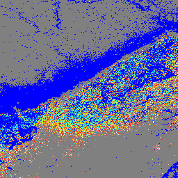
These Landsat Collection 2 Tier 1 Level 2 composites provide the Normalized Difference Water Index (NDWI), which is sensitive to changes in vegetation water content.
-
The dataset is available from 1984 to 2025 with a 32-day cadence.
-
The NDWI values range from -1.0 to 1.0 and are derived from Near-IR and a second IR band.
-
Composites are created using all scenes within each 32-day period, with the most recent pixel value used.
-
Landsat datasets are in the public domain and require acknowledgement of the U.S. Geological Survey as the data source.
- Dataset Availability
- 1984-01-01T00:00:00Z–2026-07-12T00:00:00Z
- Dataset Producer
- Cadence
- 32 Days
- Tags
Description
These Landsat Collection 2 Tier 1 Level 2 composites are made from Tier 1 Level 2 orthorectified scenes.
The Normalized Difference Water Index (NDWI) is designed to delineate open water features and enhance their presence in imagery while eliminating soil and terrestrial vegetation features. It is derived from the Green band and the Near-Infrared (NIR) band. It ranges in value from -1.0 to 1.0. See McFeeters (1996) for details.
These composites are created from all the scenes in each 32-day period beginning from the first day of the year and continuing to the 352nd day of the year. The last composite of the year, beginning on day 353, will overlap the first composite of the following year by 20 days. All the images from each 32-day period are included in the composite, with the most recent pixel as the composite value.
Notes:
The code used to create the composites can be seen here.
Only daytime images with WRS_ROW < 122 are included.
For Landsat 7 , images after 2017-01-01 are excluded due to orbital drift.
For Landsat 8, images before 2013-05-01 are excluded due to pointing issues.
Caution: These composites are computed on the fly and count towards the requesting project's EECU usage.
Bands
Bands
Pixel size: 30 meters (all bands)
| Name | Pixel Size | Description |
|---|---|---|
NDWI |
30 meters | Normalized Difference Water Index |
Terms of Use
Terms of Use
Landsat datasets are federally created data and therefore reside in the public domain and may be used, transferred, or reproduced without copyright restriction.
Acknowledgement or credit of the USGS as data source should be provided by including a line of text citation such as the example shown below.
(Product, Image, Photograph, or Dataset Name) courtesy of the U.S. Geological Survey
Example: Landsat-7 image courtesy of the U.S. Geological Survey
See the USGS Visual Identity System Guidance for further details on proper citation and acknowledgement of USGS products.
Explore with Earth Engine
Code Editor (JavaScript)
var dataset = ee.ImageCollection('LANDSAT/COMPOSITES/C02/T1_L2_32DAY_NDWI')
                  .filterDate('2017-01-01', '2017-12-31');
var colorized = dataset.select('NDWI');
var colorizedVis = {
  min: 0.0,
  max: 1.0,
  palette: ['0000ff', '00ffff', 'ffff00', 'ff0000', 'ffffff'],
};
Map.setCenter(6.746, 46.529, 6);
Map.addLayer(colorized, colorizedVis, 'Colorized');