Page Summary
-
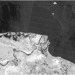
The JAXA/ALOS/PALSAR-2/Level2_2/ScanSAR dataset contains 25m normalized backscatter SAR imagery with an observation width of 350 km, ortho-rectified and slope corrected using the ALOS World 3D - 30m Digital Surface Model.
-
The dataset is available from 2014-08-04 to 2025-09-30 and is provided by JAXA EORC.
-
Polarization data is stored as 16-bit digital numbers (DN) and can be converted to gamma naught values in decibels using a specified equation.
-
Level 2.2 data is ortho-rectified, radiometrically terrain-corrected, and compatible with the CEOS Analysis Ready Data for LAND (CARD4L) standard.
-
The dataset includes bands for HH and HV polarization, local incidence angle, and a data quality bitmask.
- Dataset Availability
- 2014-08-04T00:00:00Z–2026-06-30T16:50:11.993000Z
- Dataset Producer
- JAXA EORC
- Tags
Description
The 25 m PALSAR-2 ScanSAR is normalized backscatter data of PALSAR-2 broad area observation mode with observation width of 350 km. The SAR imagery was ortho-rectificatied and slope corrected using the ALOS World 3D - 30 m (AW3D30) Digital Surface Model. Polarization data are stored as 16-bit digital numbers (DN). The DN values can be converted to gamma naught values in decibel unit (dB) using the following equation:
- γ0 = 10*log10(DN2) - 83.0 dB
Level 2.2 data are ortho-rectified and radiometrically terrain-corrected.
This dataset is compatible with the Committee on Earth Observation (CEOS) Analysis Ready Data for LAND (CARD4L) standard.
Note that this collection is heterogeneous and contains a mixture of
single-polarization (HH) and dual-polarization (HH+HV, and rarely VV+VH)
images. Users should filter the collection by the Polarizations property
before selecting polarization bands (e.g.,
collection.filter(ee.Filter.listContains('Polarizations', 'HV'))).
Bands
Bands
Pixel size: 25 meters (all bands)
| Name | Units | Scale | Pixel Size | Description | |||||||||||||||||||||||||||||||||||||||||||||||||||||||||||||||||||||||||||||||||||||||||||||||
|---|---|---|---|---|---|---|---|---|---|---|---|---|---|---|---|---|---|---|---|---|---|---|---|---|---|---|---|---|---|---|---|---|---|---|---|---|---|---|---|---|---|---|---|---|---|---|---|---|---|---|---|---|---|---|---|---|---|---|---|---|---|---|---|---|---|---|---|---|---|---|---|---|---|---|---|---|---|---|---|---|---|---|---|---|---|---|---|---|---|---|---|---|---|---|---|---|---|---|---|
HH |
25 meters | HH polarization Terrain-flattened Gamma-Nought backscatter coefficient. |
|||||||||||||||||||||||||||||||||||||||||||||||||||||||||||||||||||||||||||||||||||||||||||||||||
HV |
25 meters | HV polarization Terrain-flattened Gamma-Nought backscatter coefficient. |
|||||||||||||||||||||||||||||||||||||||||||||||||||||||||||||||||||||||||||||||||||||||||||||||||
VV |
25 meters | VV polarization Terrain-flattened Gamma-Nought backscatter coefficient. |
|||||||||||||||||||||||||||||||||||||||||||||||||||||||||||||||||||||||||||||||||||||||||||||||||
VH |
25 meters | VH polarization Terrain-flattened Gamma-Nought backscatter coefficient. |
|||||||||||||||||||||||||||||||||||||||||||||||||||||||||||||||||||||||||||||||||||||||||||||||||
LIN |
deg | 0.01 | 25 meters | Local incidence angle. The angle formed by the radar irradiation direction and the normal of the slope. |
|||||||||||||||||||||||||||||||||||||||||||||||||||||||||||||||||||||||||||||||||||||||||||||||
MSK |
25 meters | Data quality bitmask. |
|||||||||||||||||||||||||||||||||||||||||||||||||||||||||||||||||||||||||||||||||||||||||||||||||
Image Properties
Image Properties
| Name | Type | Description |
|---|---|---|
| AntennaPointing | STRING | Antenna pointing direction ("Right" or "Left"). |
| AzimuthPixelSpacing | DOUBLE | Azimuth pixel spacing. |
| AzimuthResolution | DOUBLE | Azimuth resolution. |
| BeamID | STRING | Beam ID. |
| DataAccess_ProcessingTime | STRING | Processing time of this product (ISO8601 string). |
| DataAccess_SoftwareVersion | STRING | Software version of this product. |
| DigitalElevationModel | STRING | Type of DEM used ("Elevation" or "Surface"). |
| EasternBias | DOUBLE | Bias of easting error. |
| EasternSTDev | DOUBLE | Standard deviation of easting error. |
| Easting_LR | DOUBLE | Easting of Lower Right of Product. |
| Easting_UL | DOUBLE | Easting of upper left of product. |
| Estimates_HH | DOUBLE | Estimated HH value in Noise Equivalent Intensity (NESZ). |
| Estimates_HV | DOUBLE | Estimated HV value in Noise Equivalent Intensity (NESZ). |
| FilterApplied | STRING | Whether a filter was applied ("TRUE" or "FALSE"). |
| FilterType | STRING | Filter type (N/A if no filtering was applied). |
| FirstAcquisitionDate | STRING | Observation date of the first acquisition (ISO8601 string). |
| IDCMethod | STRING | Ionospheric delay correction ("TEC model" or "Coregistration"). |
| IncAngleFarRange | DOUBLE | Incident angle in far range. |
| IncAngleNearRange | DOUBLE | Incident angle in near range. |
| IonosphericDelayCorrectionApplied | DOUBLE | Whether ionospheric delay correction was applied ("TRUE" or "FALSE"). |
| LastAcquisitionDate | STRING | Observation date of the last acquisition (ISO 8601 string). |
| NRAlgorithm | STRING | Noise removal algorithm. |
| NoiseRemovalApplied | STRING | Whether noise removal algorithm was applied ("TRUE" or "FALSE"). |
| NorthernBias | DOUBLE | Bias of northing error. |
| NorthernSTDev | DOUBLE | Standard deviation of northing error. |
| Northing_LR | DOUBLE | Northing of lower right of product. |
| Northing_UL | DOUBLE | Northing of upper left of product. |
| ObservationMode | STRING | Observation mode. |
| OrbitDataSource | STRING | Orbit data source (e.g., predicted, definite, precise, downlinked). |
| PassDirection | STRING | Pass direction ("Ascending" or "Descending"). |
| Polarizations | STRING_LIST | Transmit/Receive polarisation for the data. There is one element for each Tx/Rx combination: ['VV'], ['HH'], ['VV', 'VH'], or ['HH', 'HV']. |
| ProductColumnSpacing | DOUBLE | Product column spacing. |
| ProductRowSpacing | DOUBLE | Product row spacing. |
| Product_Version | DOUBLE | Product version. |
| RSP_Frame_Number | INT | Scene frame number. |
| RSP_Path_Number | INT | Scene path number. |
| RadarCenterFrequency | DOUBLE | Center frequency. |
| RangePixelSpacing | DOUBLE | Range pixel spacing. |
| RangeResolution | INT | Range resolution. |
| SlantRangeCorrection | INT_LIST | The correction for each scan described from the first scan. |
| SourceProcParam_ProcessingDate | STRING | Processing date of the source product (ISO8601 string). |
| SourceProcParam_ProcessingFacility | STRING | Processing facility of the source product. |
| SourceProcParam_ProductID | STRING | Product ID of the source product. |
| SourceProcParam_SoftwareVersion | DOUBLE | Software version of the source product. |
Terms of Use
Terms of Use
Anyone can use this data free of charge subject to the to the attribution requirements. For detailed terms of use see JAXA G-Portal Terms of service (Section 7. Condition concerning of G-Portal data).
Citations
The data used for this paper have been provided by Earth Observation Research Center (EORC) of Japan Aerospace Exploration Agency (JAXA).
Explore with Earth Engine
Code Editor (JavaScript)
var collection = ee.ImageCollection('JAXA/ALOS/PALSAR-2/Level2_2/ScanSAR')
  .filterBounds(ee.Geometry.Point(143, -5));
var image = collection.first();

Map.addLayer(image.select(['HH']), {min: 0, max: 8000}, 'HH polarization');
Map.centerObject(image);
import ee
import geemap.core as geemap
Colab (Python)
collection = ee.ImageCollection(
    'JAXA/ALOS/PALSAR-2/Level2_2/ScanSAR'
).filterBounds(ee.Geometry.Point(143, -5))

image = collection.first()

m = geemap.Map()
m.add_layer(image.select(['HH']), {'min': 0, 'max': 8000}, 'HH polarization')
m.center_object(image)
m