Page Summary
-
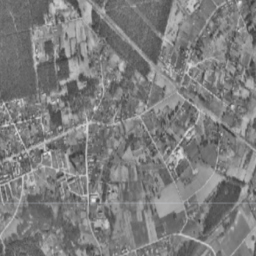
The Estonia/Maamet/orthos/mono dataset contains grayscale orthophotos covering Estonia.
-
This dataset is available from 1993 to 2021 and is provided by Estonia orthophotos.
-
Orthophotos are processed aerial photos with removed distortions, having a pixel size of 10-40 cm depending on the area.
-
The data is free to use for commercial and non-commercial purposes with proper attribution.
-
The dataset has a single 'mono' band representing grayscale values.
- Dataset Availability
- 1993-01-01T00:00:00Z–2021-06-16T00:00:00Z
- Dataset Producer
- Estonia orthophotos
- Tags
Description
Orthophotos are an aerial photo dataset covering Estonia.
An orthophoto is a processed aerial photo from which distortions caused by terrain relief, camera tilt relative to the ground at the moment of exposure and camera central projection are removed. A digital orthophoto has a certain pixel size or resolution which shows the smallest indivisible exposed area on the ground (Ground Sampling Distance, GSD).
Orthophotos have a nationwide coverage and correspond to the scale of 1:5000-1:10000 (pixel size 20-40 cm). Orthophotos for densely-populated areas are produced with the pixel size of 10-16 cm.
The mono dataset has a single grayscale band with nationwide coverage.
For more information, please see the Estonia orthophotos documentation
Bands
Bands
Pixel size: 0.4 meters (all bands)
| Name | Min | Max | Pixel Size | Description |
|---|---|---|---|---|
mono |
0 | 255 | 0.4 meters | Grayscale |
Terms of Use
Terms of Use
The data is free to use for commercial and non-commercial purposes for a non-specified term, provided that proper attribution is given to the licensor (e.g. Estonian Land Board) along with the title and age of the data.
For more details please see the Terms of use
Citations
Map data: Estonian Land Board
Explore with Earth Engine
Code Editor (JavaScript)
var dataset = ee.ImageCollection('Estonia/Maamet/orthos/mono');
Map.setCenter(26.61312, 58.5879, 15);
Map.addLayer(dataset, null, 'Estonia Maamet mono');