- Dataset Availability
- 2019-12-01T00:00:00Z–2020-12-01T00:00:00Z
- Dataset Producer
- Earth Big Data LLC Alaska Satellite Facility
- Tags
Description
This data set is the first-of-its-kind spatial representation of multi-seasonal, global C-band Synthetic Aperture Radar (SAR) interferometric repeat-pass coherence and backscatter signatures. Coverage comprises land masses and ice sheets from 82 degrees Northern to 79 degrees Southern latitudes. The data set is derived from multi-temporal repeat-pass interferometric processing of about 205,000 Sentinel-1 C-band SAR images acquired in Interferometric Wide-Swath Mode from 1-Dec-2019 to 30-Nov-2020.
This dataset contains ancillary data to aid in the interpretation and processing of the backscatter and coherence products.
Other datasets derived from Sentinel-1 observations over the same time period include:
Bands
Bands
Pixel size: 92.7 meters (all bands)
| Name | Units | Pixel Size | Description |
|---|---|---|---|
inc |
deg | 92.7 meters | The angle between the incoming radar signal path and the normal vector to the local ground surface at each pixel. |
lsmap |
92.7 meters | Layover/Shadow mask:
|
Image Properties
Image Properties
| Name | Type | Description |
|---|---|---|
| tile_id | STRING | Tile ID |
| relative_orbit_number | INT | Relative orbit number. |
| flight_direction | STRING | Flight direction: "A" for ascending or "D" for descending. |
Terms of Use
Terms of Use
Citations
Kellndorfer, J., Cartus, O., Lavalle, M. et al. Global seasonal Sentinel-1 interferometric coherence and backscatter data set. Sci Data 9, 73 (2022). doi:10.1038/s41597-022-01189-6.
DOIs
Explore with Earth Engine
Code Editor (JavaScript)
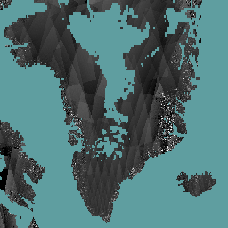
var dataset = ee.ImageCollection(
    'Earth_Big_Data/GLOBAL_SEASONAL_S1/V2019/INCIDENCE_LAYOVER_SHADOW');
var visParams = {
  bands: ['inc'],
  min: 30,
  max: 70,
};
Map.setCenter(-45.2, 64.177, 5);
Map.addLayer(dataset, visParams, 'Incidence Angle');