- Доступность набора данных
- 2017-03-28T00:00:00Z–2026-07-18T01:41:20.152000Z
- Производитель наборов данных
- Европейский Союз/ЕКА/Коперник
- Интервал повторного посещения
- 5 дней
- Теги
- Коперник
Описание
См. также коллекцию COPERNICUS/S2_SR_HARMONIZED, в которой данные с PROCESSING_BASELINE '04.00' или выше (после 25.01.2022) перемещаются в тот же диапазон, что и в более старых сценах.
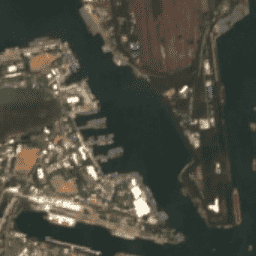
Sentinel-2 — это широкополосная миссия по многоспектральной съемке с высоким разрешением, поддерживающая исследования в рамках программы Copernicus Land Monitoring, включая мониторинг растительности, почвы и водного покрова, а также наблюдение за внутренними водными путями и прибрежными районами.
Данные Sentinel-2 L2 загружены с CDSE. Они были рассчитаны с помощью программы sen2cor. ВНИМАНИЕ: охват данных L2 за 2017-2018 годы в коллекции EE еще не является глобальным.
Данные содержат 12 спектральных полос UINT16, представляющих SR, масштабированный в 10000 раз (в отличие от данных L1, полоса B10 отсутствует). Также имеется несколько дополнительных полос, специфичных для L2 (подробности см. в списке полос). Подробности см. в Руководстве пользователя Sentinel-2 .
QA60 — это битовая маска, содержащая растровые полигоны облачных масок до 25.01.2022, после чего их создание прекратилось. Начиная с 28.02.2024, из классификационных полос облаков MSK_CLASSI строятся соответствующие устаревшим стандартам полосы QA60. Более подробное описание процесса вычисления облачных масок см. в соответствующем разделе.
Идентификаторы активов EE для активов Sentinel-2 L2 имеют следующий формат: COPERNICUS/S2_SR/20151128T002653_20151128T102149_T56MNN. Здесь первая цифровая часть представляет дату и время измерения, вторая цифровая часть — дату и время создания продукта, а последняя 6-символьная строка — уникальный идентификатор гранулы, указывающий на ее привязку к сетке UTM (см. MGRS ).
Для получения наборов данных, помогающих в обнаружении облаков и/или облачных теней, см. COPERNICUS/S2_CLOUD_PROBABILITY и GOOGLE/CLOUD_SCORE_PLUS/V1/S2_HARMONIZED .
Более подробную информацию о радиометрическом разрешении спутника Sentinel-2 можно найти на этой странице .
Группы
Группы
Размер пикселя: варьируется
| Имя | Единицы | Мин | Макс | Шкала | Размер пикселя | Длина волны | Описание | ||||||||||||||||||||||||||||||||||||||||||||||||||||||||||||||||||||||||||||||||||||||||||||
|---|---|---|---|---|---|---|---|---|---|---|---|---|---|---|---|---|---|---|---|---|---|---|---|---|---|---|---|---|---|---|---|---|---|---|---|---|---|---|---|---|---|---|---|---|---|---|---|---|---|---|---|---|---|---|---|---|---|---|---|---|---|---|---|---|---|---|---|---|---|---|---|---|---|---|---|---|---|---|---|---|---|---|---|---|---|---|---|---|---|---|---|---|---|---|---|---|---|---|---|
B1 | 0,0001 | 60 метров | 443,9 нм (S2A) / 442,3 нм (S2B) | Аэрозоли | |||||||||||||||||||||||||||||||||||||||||||||||||||||||||||||||||||||||||||||||||||||||||||||||
B2 | 0,0001 | 10 метров | 496,6 нм (S2A) / 492,1 нм (S2B) | Синий | |||||||||||||||||||||||||||||||||||||||||||||||||||||||||||||||||||||||||||||||||||||||||||||||
B3 | 0,0001 | 10 метров | 560 нм (S2A) / 559 нм (S2B) | Зеленый | |||||||||||||||||||||||||||||||||||||||||||||||||||||||||||||||||||||||||||||||||||||||||||||||
B4 | 0,0001 | 10 метров | 664,5 нм (S2A) / 665 нм (S2B) | Красный | |||||||||||||||||||||||||||||||||||||||||||||||||||||||||||||||||||||||||||||||||||||||||||||||
B5 | 0,0001 | 20 метров | 703,9 нм (S2A) / 703,8 нм (S2B) | Красный край 1 | |||||||||||||||||||||||||||||||||||||||||||||||||||||||||||||||||||||||||||||||||||||||||||||||
B6 | 0,0001 | 20 метров | 740,2 нм (S2A) / 739,1 нм (S2B) | Красный край 2 | |||||||||||||||||||||||||||||||||||||||||||||||||||||||||||||||||||||||||||||||||||||||||||||||
B7 | 0,0001 | 20 метров | 782,5 нм (S2A) / 779,7 нм (S2B) | Красный край 3 | |||||||||||||||||||||||||||||||||||||||||||||||||||||||||||||||||||||||||||||||||||||||||||||||
B8 | 0,0001 | 10 метров | 835,1 нм (S2A) / 833 нм (S2B) | ИК-спектр | |||||||||||||||||||||||||||||||||||||||||||||||||||||||||||||||||||||||||||||||||||||||||||||||
B8A | 0,0001 | 20 метров | 864,8 нм (S2A) / 864 нм (S2B) | Красный край 4 | |||||||||||||||||||||||||||||||||||||||||||||||||||||||||||||||||||||||||||||||||||||||||||||||
B9 | 0,0001 | 60 метров | 945 нм (S2A) / 943,2 нм (S2B) | Водяной пар | |||||||||||||||||||||||||||||||||||||||||||||||||||||||||||||||||||||||||||||||||||||||||||||||
B11 | 0,0001 | 20 метров | 1613,7 нм (S2A) / 1610,4 нм (S2B) | SWIR 1 | |||||||||||||||||||||||||||||||||||||||||||||||||||||||||||||||||||||||||||||||||||||||||||||||
B12 | 0,0001 | 20 метров | 2202,4 нм (S2A) / 2185,7 нм (S2B) | SWIR 2 | |||||||||||||||||||||||||||||||||||||||||||||||||||||||||||||||||||||||||||||||||||||||||||||||
AOT | 0,001 | 10 метров | Никто | Оптическая толщина аэрозоля | |||||||||||||||||||||||||||||||||||||||||||||||||||||||||||||||||||||||||||||||||||||||||||||||
WVP | см | 0,001 | 10 метров | Никто | Давление водяного пара. Высота, которую занимала бы вода, если бы пар сконденсировался в жидкость и равномерно распределился по столбу пара. | ||||||||||||||||||||||||||||||||||||||||||||||||||||||||||||||||||||||||||||||||||||||||||||||
SCL | 1 | 11 | 20 метров | Никто | Карта классификации сцен (значение «Нет данных» равное 0 замаскировано) | ||||||||||||||||||||||||||||||||||||||||||||||||||||||||||||||||||||||||||||||||||||||||||||||
TCI_R | 10 метров | Никто | Изображение в истинных цветах, красный канал | ||||||||||||||||||||||||||||||||||||||||||||||||||||||||||||||||||||||||||||||||||||||||||||||||
TCI_G | 10 метров | Никто | Изображение в истинных цветах, зеленый канал | ||||||||||||||||||||||||||||||||||||||||||||||||||||||||||||||||||||||||||||||||||||||||||||||||
TCI_B | 10 метров | Никто | Изображение в истинных цветах, синий канал | ||||||||||||||||||||||||||||||||||||||||||||||||||||||||||||||||||||||||||||||||||||||||||||||||
MSK_CLDPRB | 0 | 100 | 20 метров | Никто | Карта вероятности образования облаков (отсутствует в некоторых продуктах) | ||||||||||||||||||||||||||||||||||||||||||||||||||||||||||||||||||||||||||||||||||||||||||||||
MSK_SNWPRB | 0 | 100 | 10 метров | Никто | Карта вероятности выпадения снега (отсутствует в некоторых товарах) | ||||||||||||||||||||||||||||||||||||||||||||||||||||||||||||||||||||||||||||||||||||||||||||||
QA10 | 10 метров | Никто | Всегда пусто | ||||||||||||||||||||||||||||||||||||||||||||||||||||||||||||||||||||||||||||||||||||||||||||||||
QA20 | 20 метров | Никто | Всегда пусто | ||||||||||||||||||||||||||||||||||||||||||||||||||||||||||||||||||||||||||||||||||||||||||||||||
QA60 | 60 метров | Никто | Маска в виде облака. Использовалась в период с 25.01.2022 по 28.02.2024 включительно. | ||||||||||||||||||||||||||||||||||||||||||||||||||||||||||||||||||||||||||||||||||||||||||||||||
MSK_CLASSI_OPAQUE | 60 метров | Никто | Классификационный диапазон непрозрачных облаков (0 = нет облаков, 1 = есть облака). Исключено из данных до февраля 2024 года. | ||||||||||||||||||||||||||||||||||||||||||||||||||||||||||||||||||||||||||||||||||||||||||||||||
MSK_CLASSI_CIRRUS | 60 метров | Никто | Классификационная полоса перистых облаков (0 = нет облаков, 1 = есть облака). Исключено до февраля 2024 года. | ||||||||||||||||||||||||||||||||||||||||||||||||||||||||||||||||||||||||||||||||||||||||||||||||
MSK_CLASSI_SNOW_ICE | 60 метров | Никто | Классификация «снег/лед» (0 = нет снега/льда, 1 = снег/лед). Исключено до февраля 2024 года. | ||||||||||||||||||||||||||||||||||||||||||||||||||||||||||||||||||||||||||||||||||||||||||||||||
Таблица классов SCL
| Ценить | Цвет | Описание |
|---|---|---|
| 1 | #ff0004 | Насыщенный или дефектный |
| 2 | #868686 | Пиксели темной области |
| 3 | #774b0a | Тени облаков |
| 4 | #10d22c | Растительность |
| 5 | #ffff52 | Голые почвы |
| 6 | #0000ff | Вода |
| 7 | #818181 | Облачность: низкая вероятность / не классифицировано |
| 8 | #c0c0c0 | Облака Средняя вероятность |
| 9 | #f1f1f1 | Облака Высокая вероятность |
| 10 | #bac5eb | Перистые |
| 11 | #52fff9 | Снег / Лед |
Свойства изображения
Свойства изображения
| Имя | Тип | Описание |
|---|---|---|
| AOT_RETRIEVAL_ACCURACY | ДВОЙНОЙ | Точность модели оптической толщины аэрозоля |
| ПРОЦЕНТ ЗАГРЯЗНЕННЫХ_ПИКСЕЛЕЙ | ДВОЙНОЙ | Процент облачных пикселей для каждой гранулы, взятый из исходных метаданных. |
| ОЦЕНКА_ПОКРЫТИЯ_ОБЛАКОВ | ДВОЙНОЙ | Процент облачных пикселей для всего архива, содержащего этот фрагмент. Взято из исходных метаданных. |
| ПРОЦЕНТ ОБЛАЧНОЙ_ТЕНИ | ДВОЙНОЙ | Процент пикселей, классифицированных как тени от облаков. |
| DARK_FEATURES_PERCENTAGE | ДВОЙНОЙ | Процент пикселей, классифицированных как темные участки или тени. |
| DATASTRIP_ID | НИТЬ | Уникальный идентификатор элемента данных продукта (PDI) на табло. |
| DATAKE_IDENTIFIER | НИТЬ | Идентификатор однозначно определяет каждый полученный набор данных. Он содержит информацию о спутнике Sentinel-2, дате и времени начала обработки, абсолютном номере орбиты и базовой линии обработки. |
| ДАТАТЕКТИП | НИТЬ | режим работы MSI |
| DEGRADED_MSI_DATA_PERCENTAGE | ДВОЙНОЙ | Процент поврежденных данных MSI и вспомогательных данных. |
| ПРАВИЛЬНОСТЬ ФОРМАТА | НИТЬ | Синтез результатов проверок онлайн-контроля качества (OLQC), выполненных на уровне гранул (Product_Syntax) и на уровне полос данных (Product Syntax и DS_Consistency). |
| ОБЩЕЕ КАЧЕСТВО | НИТЬ | Синтез результатов проверок OLQC, выполненных на уровне полосы данных (относительное число орбит). |
| ВРЕМЯ_ПОКОЛЕНИЯ | ДВОЙНОЙ | время генерации продукта |
| ГЕОМЕТРИЧЕСКОЕ КАЧЕСТВО | НИТЬ | Синтез результатов проверок OLQC, выполненных на уровне ленты данных (индикатор качества отношения). |
| GRANULE_ID | НИТЬ | Уникальный идентификатор гранулы PDI (PDI_ID) |
| ВЫСОКИЙ ПРОЦЕНТ ОБЛАКОВ_ВОЗМОЖНОСТИ | ДВОЙНОЙ | Процент пикселей, классифицированных как облака с высокой вероятностью |
| СРЕДНИЙ_УГОЛ_АЗИМУТА_B1 | ДВОЙНОЙ | Среднее значение, включающее среднее значение угла азимута падения для полосы B1 и для всех детекторов. |
| СРЕДНИЙ_УГОЛ_АЗИМУТА_B2 | ДВОЙНОЙ | Среднее значение, включающее средний угол азимута падения для диапазона B2 и для всех детекторов. |
| СРЕДНИЙ_УГОЛ_АЗИМУТА_B3 | ДВОЙНОЙ | Среднее значение, включающее средний угол азимута падения для диапазона B3 и для всех детекторов. |
| СРЕДНИЙ_УГОЛ_АЗИМУТА_B4 | ДВОЙНОЙ | Среднее значение, включающее среднее значение угла азимута падения для диапазона B4 и для всех детекторов. |
| СРЕДНИЙ_УГОЛ_АЗИМУТА_B5 | ДВОЙНОЙ | Среднее значение, включающее средний угол азимута падения для диапазона B5 и для всех детекторов. |
| СРЕДНИЙ_УГОЛ_АЗИМУТА_B6 | ДВОЙНОЙ | Среднее значение, включающее средний угол азимута падения для диапазона B6 и для всех детекторов. |
| СРЕДНИЙ_УГОЛ_АЗИМУТА_B7 | ДВОЙНОЙ | Среднее значение, включающее средний угол азимута падения для диапазона B7 и для всех детекторов. |
| СРЕДНИЙ_УГОЛ_АЗИМУТА_B8 | ДВОЙНОЙ | Среднее значение, включающее средний угол азимута падения для диапазона B8 и для всех детекторов. |
| СРЕДНИЙ_УГОЛ_АЗИМУЛЯЦИИ_B8A | ДВОЙНОЙ | Среднее значение, включающее средний угол азимута падения для диапазона B8a и для всех детекторов. |
| СРЕДНИЙ_УГОЛ_АЗИМУТА_B9 | ДВОЙНОЙ | Среднее значение, включающее средний угол азимута падения для полосы B9 и для всех детекторов. |
| СРЕДНИЙ_УГОЛ_АЗИМУЛЯЦИИ_B10 | ДВОЙНОЙ | Среднее значение, включающее среднее значение угла азимута падения для диапазона B10 и для всех детекторов. |
| СРЕДНИЙ_УГОЛ_АЗИМУТА_B11 | ДВОЙНОЙ | Среднее значение, включающее средний угол азимута падения для диапазона B11 и для всех детекторов. |
| СРЕДНИЙ_УГОЛ_АЗИМУТА_B12 | ДВОЙНОЙ | Среднее значение, включающее средний угол азимута падения для диапазона B12 и для всех детекторов. |
| СРЕДНИЙ_УГОЛ_ЗЕНИТНОСТИ_B1 | ДВОЙНОЙ | Среднее значение, включающее среднее значение угла зенита при наблюдении для полосы B1 и для всех детекторов. |
| СРЕДНИЙ_УГОЛ_ЗЕНИТНОСТИ_B2 | ДВОЙНОЙ | Среднее значение, включающее среднее значение зенитного угла падения для полосы B2 и для всех детекторов. |
| СРЕДНИЙ_УГОЛ_ЗЕНИТНОСТИ_B3 | ДВОЙНОЙ | Среднее значение, включающее среднее значение угла зенита при наблюдении для полосы B3 и для всех детекторов. |
| СРЕДНИЙ_УГОЛ_ЗЕНИТНОГО_ПАДЕНИЯ_B4 | ДВОЙНОЙ | Среднее значение, включающее среднее значение угла зенита при наблюдении для полосы B4 и для всех детекторов. |
| СРЕДНИЙ_УГОЛ_ЗЕНИТНОСТИ_B5 | ДВОЙНОЙ | Среднее значение, включающее среднее значение угла зенита при наблюдении для полосы B5 и для всех детекторов. |
| СРЕДНИЙ_УГОЛ_ЗЕНИТНОСТИ_B6 | ДВОЙНОЙ | Среднее значение, включающее среднее значение угла зенита при наблюдении для полосы B6 и для всех детекторов. |
| СРЕДНИЙ_УГОЛ_ЗЕНИТНОГО_ПАДЕНИЯ_B7 | ДВОЙНОЙ | Среднее значение, включающее среднее значение зенитного угла падения для полосы B7 и для всех детекторов. |
| СРЕДНИЙ_УГОЛ_ЗЕНИТНОСТИ_B8 | ДВОЙНОЙ | Среднее значение, включающее среднее значение угла зенита при наблюдении для полосы B8 и для всех детекторов. |
| СРЕДНИЙ_УГОЛ_ЗЕНИТНОСТИ_B8A | ДВОЙНОЙ | Среднее значение, включающее среднее значение зенитного угла падения для полосы B8a и для всех детекторов. |
| СРЕДНИЙ_УГОЛ_ЗЕНИТНОСТИ_B9 | ДВОЙНОЙ | Среднее значение, включающее среднее значение угла зенита при наблюдении для полосы B9 и для всех детекторов. |
| СРЕДНИЙ_УГОЛ_ЗЕНИТНОСТИ_B10 | ДВОЙНОЙ | Среднее значение, включающее среднее значение угла зенита при наблюдении для диапазона B10 и для всех детекторов. |
| СРЕДНИЙ_УГОЛ_ЗЕНИТНОСТИ_B11 | ДВОЙНОЙ | Среднее значение, включающее среднее значение угла зенита при наблюдении для полосы B11 и для всех детекторов. |
| СРЕДНИЙ УГОЛ ЗОНИТА B12 | ДВОЙНОЙ | Среднее значение, включающее среднее значение угла зенита при наблюдении для диапазона B12 и для всех детекторов. |
| СРЕДНИЙ УГОЛ АЗИМУТА СОЛНЕЧНОЙ СВЯЗИ | ДВОЙНОЙ | Среднее значение, включающее среднее значение угла азимута Солнца для всех диапазонов и детекторов. |
| СРЕДНИЙ УГОЛ ЗЕНИТА СОЛНЕЧНОЙ ФОНЕ | ДВОЙНОЙ | Среднее значение, включающее среднее значение угла зенита Солнца для всех диапазонов и детекторов. |
| MEDIUM_PROBA_CLOUDS_PERCENTAGE | ДВОЙНОЙ | Процент пикселей, классифицированных как облака средней вероятности |
| MGRS_TILE | НИТЬ | Плитка американской системы координатной сетки (MGRS) |
| NODATA_PIXEL_PERCENTAGE | ДВОЙНОЙ | Процент пикселей с отсутствием данных |
| ПРОЦЕНТ НЕРАСТИТЕЛЬНЫХ | ДВОЙНОЙ | Процент пикселей, классифицированных как не покрытые растительностью. |
| БАЗОВАЯ ОБРАБОТКА | НИТЬ | Базовая конфигурация, использованная на момент создания продукта, включает в себя версию программного обеспечения процессора и основную версию параметров обработки наземных изображений (GIPP). |
| PRODUCT_ID | НИТЬ | Полный идентификатор оригинального продукта Sentinel-2. |
| ТОЧНОСТЬ ПЕРЕНОСА ИЗЛУЧЕНИЯ | ДВОЙНОЙ | Точность модели переноса излучения |
| РАДИОМЕТРИЧЕСКОЕ КАЧЕСТВО | НИТЬ | На основании отчетов OLQC, содержащихся в Datastrips/QI_DATA с названием контрольного списка RADIOMETRIC_QUALITY. |
| КОРРЕКЦИЯ ПРЕОБРАЗОВАНИЯ ОТРАЖАЕМОСТИ | ДВОЙНОЙ | Поправочный коэффициент расстояния Земля-Солнце |
| ПРОЦЕНТ НАСЫЩЕННЫХ ДЕФЕКТОВ | ДВОЙНОЙ | Процент насыщенных или дефектных пикселей |
| НАПРАВЛЕНИЕ ОРБИТЫ ДЛЯ ИЗМЕРЕНИЯ | НИТЬ | Направление орбиты при съемке |
| НОМЕР_ОРБИТЫ_ДАТЧИКА | ДВОЙНОЙ | Номер орбиты изображения |
| КАЧЕСТВО ДАТЧИКА | НИТЬ | Синтез результатов проверок OLQC, выполненных на уровне гранул (Missing_Lines, Corrupted_ISP и Sensing_Time) и полос данных (Degraded_SAD и Datation_Model). |
| СОЛНЕЧНОЕ_ИЗЛУЧЕНИЕ_B1 | ДВОЙНОЙ | Средняя внеатмосферная солнечная радиация для полосы B1 |
| Солнечное излучение_B2 | ДВОЙНОЙ | Средняя внеатмосферная солнечная радиация для полосы B2 |
| СОЛНЕЧНОЕ_ИЗЛУЧЕНИЕ_B3 | ДВОЙНОЙ | Средняя внеатмосферная солнечная радиация для полосы B3 |
| СОЛНЕЧНОЕ_ИЗЛУЧЕНИЕ_B4 | ДВОЙНОЙ | Средняя внеатмосферная солнечная радиация для полосы B4 |
| СОЛНЕЧНОЕ_ИЗЛУЧЕНИЕ_B5 | ДВОЙНОЙ | Средняя внеатмосферная солнечная радиация для диапазона B5 |
| СОЛНЕЧНОЕ_ИЗЛУЧЕНИЕ_B6 | ДВОЙНОЙ | Средняя внеатмосферная солнечная радиация для полосы B6 |
| СОЛНЕЧНОЕ_ИЗЛУЧЕНИЕ_B7 | ДВОЙНОЙ | Средняя внеатмосферная солнечная радиация для полосы B7 |
| СОЛНЕЧНОЕ_ИЗЛУЧЕНИЕ_B8 | ДВОЙНОЙ | Средняя внеатмосферная солнечная радиация для полосы B8 |
| СОЛНЕЧНОЕ_ИЗЛУЧЕНИЕ_B8A | ДВОЙНОЙ | Средняя внеатмосферная солнечная радиация для полосы B8a |
| СОЛНЕЧНОЕ_ИЗЛУЧЕНИЕ_B9 | ДВОЙНОЙ | Средняя внеатмосферная солнечная радиация для полосы B9 |
| Солнечное излучение B10 | ДВОЙНОЙ | Средняя внеатмосферная солнечная радиация для полосы B10 |
| СОЛНЕЧНОЕ_ИЗЛУЧЕНИЕ_B11 | ДВОЙНОЙ | Средняя внеатмосферная солнечная радиация для полосы B11 |
| Солнечное излучение B12 | ДВОЙНОЙ | Средняя внеатмосферная солнечная радиация для полосы B12 |
| ПРОЦЕНТ_СНЕГОВОГО_ЛЕДА | ДВОЙНОЙ | Процент пикселей, классифицированных как снег или лед. |
| НАЗВАНИЕ КОСМИЧЕСКОГО САМОЛЕТА | НИТЬ | Названия космических аппаратов Sentinel-2: Sentinel-2A, Sentinel-2B |
| THIN_CIRRUS_PERCENTAGE | ДВОЙНОЙ | Процент пикселей, классифицированных как тонкие перистые облака. |
| НЕЗАСЕКРЕЧЕНО_ПРОЦЕНТ | ДВОЙНОЙ | Процент неклассифицированных пикселей |
| ПРОЦЕНТ РАСТИТЕЛЬНОСТИ | ДВОЙНОЙ | Процент пикселей, классифицированных как растительность. |
| ПРОЦЕНТ ВОДЫ | ДВОЙНОЙ | Процент пикселей, классифицированных как вода. |
| ТОЧНОСТЬ ИЗВЛЕЧЕНИЯ ВОДЯНОГО ПАРА | ДВОЙНОЙ | Заявленная точность модели водяного пара |
Условия эксплуатации
Условия эксплуатации
Использование данных Sentinel регулируется Условиями использования данных Copernicus Sentinel.
Исследуйте мир с помощью Earth Engine.
Редактор кода (JavaScript)
/**
 * Function to mask clouds using the Sentinel-2 QA band
 * @param {ee.Image} image Sentinel-2 image
 * @return {ee.Image} cloud masked Sentinel-2 image
 */
function maskS2clouds(image) {
  var qa = image.select('QA60');

  // Bits 10 and 11 are clouds and cirrus, respectively.
  var cloudBitMask = 1 << 10;
  var cirrusBitMask = 1 << 11;

  // Both flags should be set to zero, indicating clear conditions.
  var mask = qa.bitwiseAnd(cloudBitMask).eq(0)
      .and(qa.bitwiseAnd(cirrusBitMask).eq(0));

  return image.updateMask(mask).divide(10000);
}

var dataset = ee.ImageCollection('COPERNICUS/S2_SR')
                  .filterDate('2020-01-01', '2020-01-30')
                  // Pre-filter to get less cloudy granules.
                  .filter(ee.Filter.lt('CLOUDY_PIXEL_PERCENTAGE',20))
                  .map(maskS2clouds);

var visualization = {
  min: 0.0,
  max: 0.3,
  bands: ['B4', 'B3', 'B2'],
};

Map.setCenter(83.277, 17.7009, 12);

Map.addLayer(dataset.mean(), visualization, 'RGB');
import ee
import geemap.core as geemap
Colab (Python)
def mask_s2_clouds(image):
  """Masks clouds in a Sentinel-2 image using the QA band.

  Args:
      image (ee.Image): A Sentinel-2 image.

  Returns:
      ee.Image: A cloud-masked Sentinel-2 image.
  """
  qa = image.select('QA60')

  # Bits 10 and 11 are clouds and cirrus, respectively.
  cloud_bit_mask = 1 << 10
  cirrus_bit_mask = 1 << 11

  # Both flags should be set to zero, indicating clear conditions.
  mask = (
      qa.bitwiseAnd(cloud_bit_mask)
      .eq(0)
      .And(qa.bitwiseAnd(cirrus_bit_mask).eq(0))
  )

  return image.updateMask(mask).divide(10000)


dataset = (
    ee.ImageCollection('COPERNICUS/S2_SR')
    .filterDate('2020-01-01', '2020-01-30')
    # Pre-filter to get less cloudy granules.
    .filter(ee.Filter.lt('CLOUDY_PIXEL_PERCENTAGE', 20))
    .map(mask_s2_clouds)
)

visualization = {
    'min': 0.0,
    'max': 0.3,
    'bands': ['B4', 'B3', 'B2'],
}

m = geemap.Map()
m.set_center(83.277, 17.7009, 12)
m.add_layer(dataset.mean(), visualization, 'RGB')
m