
Page Summary
-
The Maps Static API returns errors as HTTP status codes or warning messages for invalid requests, usage limits, or issues with API keys and billing.
-
Errors that prevent map display can result in error images or text messages instead of the map, with details provided in the response.
-
Warnings about potential issues, like geocoding problems or marker limits, are indicated by a yellow error bar on the map and HTTP header warnings.
-
For invalid requests, refer to the HTTP status code (e.g., 400, 403) and message for details about the specific issue.
-
Always check for HTTP header warnings and the yellow error bar to ensure your map is displayed correctly and address potential issues.
The Maps Static API may issue an error or warning when something goes wrong. This guide explains each error message, and provides further instructions for resolving errors.
Invalid requests
In the case of an invalid request, the Maps Static API returns
an HTTP 4xx status code and a message describing the
problem. Below are examples of such error conditions. Note: This is not
a complete list of the possible errors. Please check the actual error code
and message returned by the API for details of specific problems.
| Example of error condition | Status code |
|---|---|
The request includes an invalid parameter, or a required parameter is
missing. For example, the size parameter is not within the
expected range of numeric values, or is missing from the request. |
400 BAD REQUEST |
| The API key included in the request is invalid. | 403 FORBIDDEN |
Errors that prevent a map from being displayed
If the request is valid, but another error occurs that prevents the map from
being displayed, the Maps Static API returns either text or an error
image instead of the map, depending on the error. An example of such an error
condition is when the application exceeds its
usage limits.

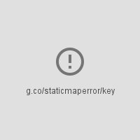
Errors related to API keys and billing
If you use the Maps Static API without an API key, or if billing is not enabled on your account, the page displays an error image instead of a map, with a link indicating the type of error. For example "g.co/staticmaperror/key".
| Keyless errors and solutions | |
|---|---|
 |
You are using the Maps Static API without an API key. To resolve, you must: |
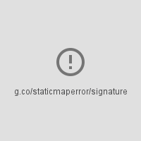 |
Your request is missing a digital signature (required). To resolve, Sign your URL |
Warnings
For some error conditions, the API returns a map but some information may be missing from the map. When this happens, two conditions occur to inform you of the warning.
- One, the map displays, but with a yellow error bar superimposed over top of the map with the text "Map error: g.co/staticmaperror".
- Two, the API returns a warning in
the form of an HTTP header named
X-Staticmap-API-Warning.
For example, the following URL contains an unexpected value in the
markers parameter:
https://maps.googleapis.com/maps/api/staticmap?center=Williamsburg,Brooklyn,NY&zoom=13&scale=1&size=400x400&markers=sdgaags&key=YOUR_API_KEY
The API returns a map, but displays a yellow error bar superimposed over the image with "Map error: g.co/staticmaperror":

The API also returns the following HTTP header:
X-Staticmap-API-Warning:Error geocoding: marker 1
The following table describes the warnings that the API may issue as HTTP headers:
Warnings in X-Staticmap-API-Warning headers
|
|
|---|---|
Error geocoding:
[center, ][marker #number, ][visible #num, ][path #num, ]* |
An error occurred while attempting to geocode the request. There are
many variants of this message, depending on the element where geocoding
failed (center, marker, visible, or path) and the number of elements
that failed. One example of this warning is
X-Staticmap-API-Warning:Error geocoding: marker 1, as
shown in the above example. |
Too many geocoded markers requested (max is 15). |
The request specifies more than the allowed maximum number of markers with a human readable address. The maximum is 15. Note that this limit applies only to markers specified as a human-readable address that requires geocoding. It does not apply to markers specified with latitude/longitude coordinates. |
Too many geocoded polyline vertices requested (max is 15). |
The request specifies more than the allowed maximum number of polylines with a human readable address. The maximum is 15. Note that this limit applies only to polylines with vertices specified as human-readable addresses that require geocoding. It does not apply to polylines specified with latitude/longitude coordinates. |
You can see the HTTP header warnings in the Chrome DevTools Console, the Firefox Web Console, or other equivalent tools in your browser.