Google आपकी पसंदीदा भाषा में कॉन्टेंट का अनुवाद करने के लिए, एआई टेक्नोलॉजी का इस्तेमाल करता है. एआई से मिले अनुवादों में गलतियां हो सकती हैं.
सुझाव भेजें
मैप में 3D मॉडल जोड़ना
संग्रह की मदद से व्यवस्थित रहें
अपनी प्राथमिकताओं के आधार पर, कॉन्टेंट को सेव करें और कैटगरी में बांटें.
यह प्रॉडक्ट या सुविधा, एक्सपेरिमेंट के तौर पर उपलब्ध है (pre-GA).
हो सकता है कि Pre-GA के तहत आने वाले प्रॉडक्ट और सुविधाओं के लिए, आपको पूरी सहायता न मिले. साथ ही, ऐसा हो सकता है कि Pre-GA के तहत आने वाले प्रॉडक्ट और सुविधाओं में किए गए बदलाव, Pre-GA के अन्य वर्शन के साथ काम न करें. Pre-GA ऑफ़र पर, Google Maps Platform की सेवा से जुड़ी खास शर्तें लागू होती हैं. ज़्यादा जानकारी के लिए, लॉन्च के चरणों की जानकारी देखें.
प्लैटफ़ॉर्म चुनें:
Android
iOS
JavaScript
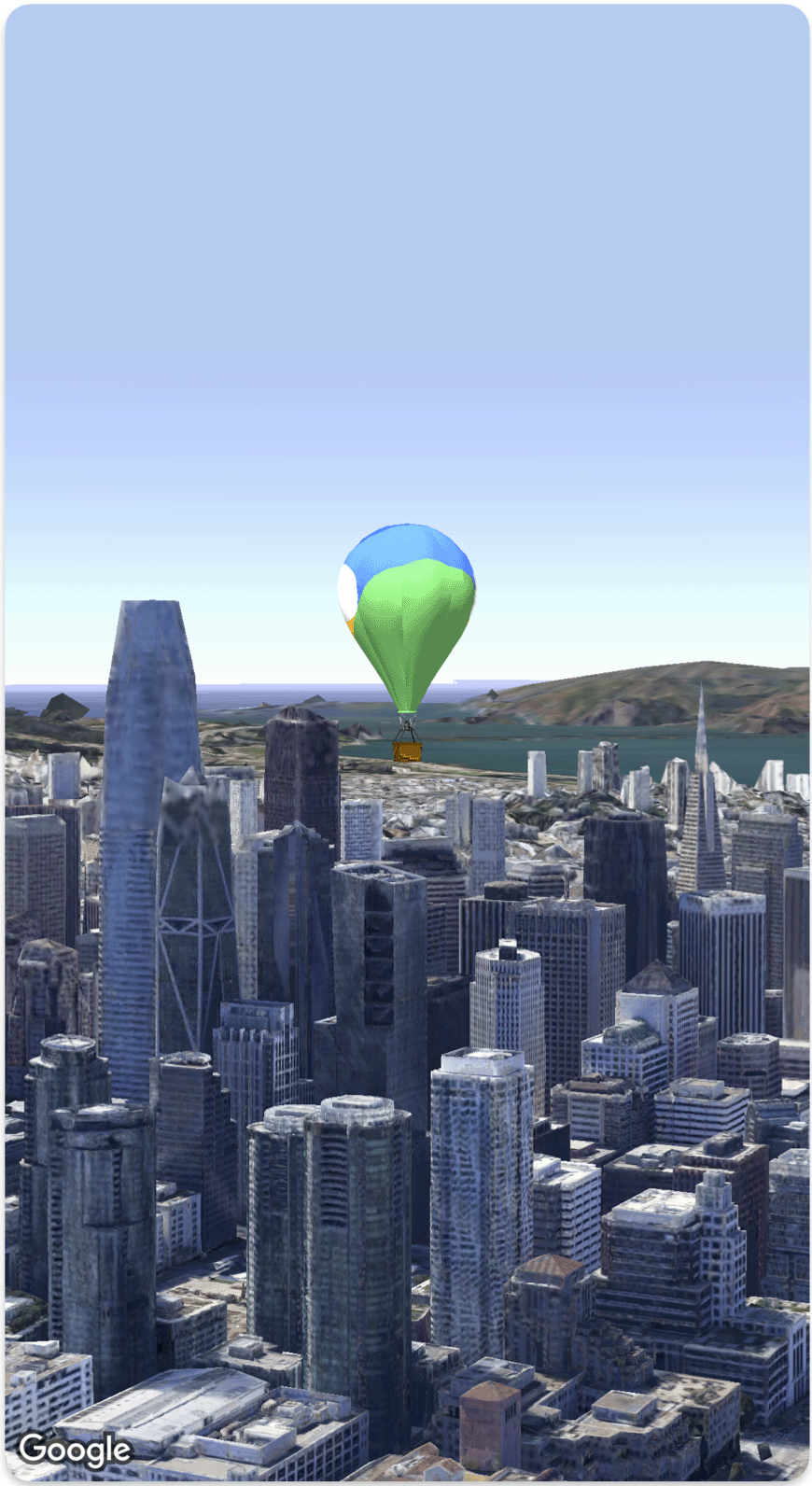
3D मैप में, इंपोर्ट किया गया अपना 3D मॉडल जोड़ा जा सकता है.
यहां दिए गए कोड सैंपल में, Model
struct SimpleModelDemo : View {
@ State var camera : Camera = . init (
center : . init ( latitude : 37.791376 , longitude : - 122.397571 , altitude : 240 ),
heading : 288.0 ,
tilt : 88.0 ,
roll : 0.0 ,
range : 1500 )
@ State var balloonModel : Model = . init (
position : . init (
LatLngAltitude (
latitude : 37.7845812 ,
longitude : - 122.3660241 ,
altitude : 585 ),
url : URL ( string : "" ) ?? URL ( fileURLWithPath : fileUrl ),
altitudeMode : . relativeToMesh ,
scale : . init ( x : 5 , y : 5 , z : 5 ),
orientation : . init ( heading : 0 , tilt : 0 , roll : 0 )
)
var body : some View {
Map ( camera : $ camera , mode : . satellite ) {
balloonModel
}
}
}
private let fileUrl = Bundle . main . url ( forResource : "balloon" , withExtension : "glb" ) ! . path
सुझाव भेजें
जब तक कुछ अलग से न बताया जाए, तब तक इस पेज की सामग्री को Creative Commons Attribution 4.0 License के तहत और कोड के नमूनों को Apache 2.0 License के तहत लाइसेंस मिला है. ज़्यादा जानकारी के लिए, Google Developers साइट नीतियां देखें. Oracle और/या इससे जुड़ी हुई कंपनियों का, Java एक रजिस्टर किया हुआ ट्रेडमार्क है.
आखिरी बार 2026-09-19 (UTC) को अपडेट किया गया.
क्या आपको हमें और कुछ बताना है?
[[["समझने में आसान है","easyToUnderstand","thumb-up"],["मेरी समस्या हल हो गई","solvedMyProblem","thumb-up"],["अन्य","otherUp","thumb-up"]],[["वह जानकारी मौजूद नहीं है जो मुझे चाहिए","missingTheInformationINeed","thumb-down"],["बहुत मुश्किल है / बहुत सारे चरण हैं","tooComplicatedTooManySteps","thumb-down"],["पुराना","outOfDate","thumb-down"],["अनुवाद से जुड़ी समस्या","translationIssue","thumb-down"],["सैंपल / कोड से जुड़ी समस्या","samplesCodeIssue","thumb-down"],["अन्य","otherDown","thumb-down"]],["आखिरी बार 2026-09-19 (UTC) को अपडेट किया गया."],[],[]]