-
ASTER L1T 복사휘도

참고: ASTER 기기의 기술적 문제로 인해 2024년 11월 28일과 2025년 1월 16일 사이에 데이터 수집에 차이가 있습니다. 자세한 내용은 USGS 공지사항을 참고하세요. 첨단 우주 탑재 열 방출 및 반사 방사계 (ASTER)는 … aster 이미지 nasa nir 복사량 위성 이미지 -
MCD19A1.061: 일일 육지 표면 BRF L2G 전 세계 500m 및 1km

MCD19A1 버전 6.1 데이터 제품은 500미터 및 1킬로미터 해상도로 매일 생성되는 Moderate Resolution Imaging Spectroradiometer (MODIS) Terra 및 Aqua 결합 지표면 양방향 반사율 (BRF) 그리드 Level 2 제품입니다. 자세한 내용은 MAIAC 사용자 가이드를 참고하세요. aerosol aod aqua daily global maiac -
MCD19A2.061: Terra 및 Aqua MAIAC 육지 에어로졸 광학 두께 일일 1km

MCD19A2 V6.1 데이터 제품은 MODIS Terra 및 Aqua 결합 다각도 대기 보정 (MAIAC) 육지 에어로졸 광학 깊이 (AOD) 그리드 레벨 2 제품으로, 1km 해상도로 매일 생성됩니다. 자세한 내용은 MAIAC 사용자 가이드를 참고하세요. 참고: 이 제품에는 … 에어로졸 aod aqua 대기 일일 전역 -
MOD08_M3.061 Terra Atmosphere Monthly Global Product

MOD08_M3 V6.1은 대기 매개변수의 월별 1x1도 그리드 평균값을 포함하는 대기 전역 제품입니다. 이러한 파라미터는 대기 에어로졸 입자 속성, 총 오존 부하, 대기 수증기, 구름 광학 및 물리적 속성, 대기 안정성 지수와 관련이 있습니다. … 대기 기후 지구물리학 전역 modis 월별 -
MOD09A1.061 Terra 표면 반사율 8일 전 세계 500m

MOD09A1 V6.1 제품은 500m 해상도에서 Terra MODIS 밴드 1~7의 지표면 스펙트럼 반사율을 추정하고 가스, 에어로졸, 레일리 산란과 같은 대기 조건에 대해 보정합니다. 7개의 반사율 밴드와 함께 품질 레이어와 4개의 관측… 8일 전역 modis nasa 위성 이미지 sr -
MOD09CMG.061 Terra 표면 반사율 일일 L3 전 세계 0.05도 CMG

MOD09CMG 버전 6.1 제품은 5, 600미터 픽셀 해상도로 리샘플링되고 가스, 에어로졸, 레일리 산란과 같은 대기 조건에 대해 보정된 Terra Moderate Resolution Imaging Spectroradiometer (MODIS) 1~7번 대역의 표면 스펙트럼 반사율 추정치를 제공합니다. MOD09CMG 데이터는 … brightness-temperature ozone satellite-imagery surface-reflectance terra -
MOD09GA.061 일일 전 세계 Terra 표면 반사율 1km 및 500m
MODIS 표면 반사율 제품은 대기 산란이나 흡수가 없는 지상에서 측정되는 표면 스펙트럼 반사율의 추정치를 제공합니다. 하위 수준 데이터는 대기 가스 및 에어로졸에 대해 수정됩니다. MOD09GA 버전 6.1은 … daily global modis nasa satellite-imagery sr -
MOD09GQ.061 Terra 일일 전 세계 물 표면 반사율 250m

MODIS 표면 반사율 제품은 대기 산란이나 흡수가 없는 지상에서 측정되는 표면 스펙트럼 반사율의 추정치를 제공합니다. 하위 수준 데이터는 대기 가스 및 에어로졸에 대해 수정됩니다. MOD09GQ 버전 6.1은 1번 밴드와 … daily global modis nasa satellite-imagery sr -
MOD09Q1.061 Terra Surface Reflectance 8-Day Global 250m
MOD09Q1 제품은 250m 해상도에서 밴드 1과 2의 표면 스펙트럼 반사율을 추정하고 가스, 에어로졸, 레일리 산란과 같은 대기 조건에 대해 수정합니다. 두 개의 반사율 밴드와 함께 품질 레이어도 포함됩니다. 각 … 8일 전역 mod09q1 modis nasa 위성이미지 -
MOD10A1.061 Terra Snow Cover Daily Global 500m

MOD10A1 V6.1 Snow Cover Daily Global 500m 제품에는 눈 덮개, 눈 알베도, 눈 덮개 비율, 품질 평가 (QA) 데이터가 포함되어 있습니다. 눈 덮개 데이터는 정규화된 차이 눈 지수 (NDSI) 및 기타 기준 테스트를 사용하는 눈 매핑 알고리즘을 기반으로 합니다. 일반 … albedo cryosphere daily geophysical global modis -
MOD10A2.061 Terra Snow Cover 8-Day L3 Global 500m

MOD10A2는 Terra 위성의 MODIS에서 가져온 눈 덮개 데이터 세트입니다. 이 데이터 세트는 8일 동안의 최대 눈 덮개 범위를 500m 해상도로 보고합니다. 8일 합성 기간이 선택된 이유는 정확한 지상 트랙 반복이기 때문입니다. 빙권 일일 지구물리학 전역 modis nasa -
MOD11A1.061 Terra 지표면 온도 및 방사율 일일 전 세계 1km
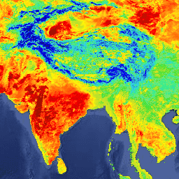
MOD11A1 V6.1 제품은 1200x1200km 그리드에서 일일 지표면 온도 (LST) 및 방사율 값을 제공합니다. 온도 값은 MOD11_L2 스와스 제품에서 파생됩니다. 위도 30도 이상에서는 맑은 하늘 기준을 충족하는 … 기후 일일 방사율 전역 lst modis -
MOD11A2.061 Terra Land Surface Temperature and Emissivity 8-Day Global 1km(MOD11A2.061 Terra 지표면 온도 및 방사율 8일 전 세계 1km)

MOD11A2 V6.1 제품은 1200x1200km 그리드에서 평균 8일 지표면 온도 (LST)를 제공합니다. MOD11A2의 각 픽셀 값은 해당 8일 기간 내에 수집된 모든 해당 MOD11A1 LST 픽셀의 단순 평균입니다. MOD11A2는 … 8일 기후 방사율 전역 lst mod11a2 -
MOD13A1.061 Terra Vegetation Indices 16-Day Global 500m

MOD13A1 V6.1 제품은 픽셀별로 식생 지수 (VI) 값을 제공합니다. 두 가지 주요 식생층이 있습니다. 첫 번째는 정규 식생 지수(NDVI)로, 기존 국립해양대기청(NOAA)의 … 16일 evi global modis nasa ndvi -
MOD13A2.061 Terra Vegetation Indices 16-Day Global 1km

MOD13A2 V6.1 제품은 정규 식생 지수 (NDVI)와 향상된 식생 지수 (EVI)라는 두 가지 식생 지수 (VI)를 제공합니다. NDVI는 기존 국립해양대기청-첨단 고해상 방사계 (NOAA-AVHRR)에서 파생된 NDVI에 대한 연속성 지수로 언급됩니다. … 16일 evi global modis nasa ndvi -
MOD13A3.061 식생 지수 월별 L3 전 세계 1km SIN 그리드

MOD13A3 V6.1 제품 데이터는 1km 공간 해상도로 매월 제공됩니다. 이 월별 제품을 생성할 때 알고리즘은 해당 월과 겹치는 모든 MOD13A2 제품을 수집하고 가중 시간 평균을 사용합니다. 식생 지수는 전 세계 식생 모니터링에 사용됩니다. evi global modis monthly nasa ndvi -
MOD13C1.061: Terra Vegetation Indices 16-Day L3 Global 0.05 Deg Climate Modeling Grid

Terra Moderate Resolution Imaging Spectroradiometer (MODIS) Vegetation Indices 16-Day (MOD13C1) 버전 6.1 제품은 픽셀별로 식생 지수 (VI) 값을 제공합니다. 두 가지 주요 식생층이 있습니다. 첫 번째는 정규 식생 지수 (NDVI)로, … 16일 global nasa terra usgs vegetation -
MOD13Q1.061 Terra 식생 지수 16일 전 세계 250m

MOD13Q1 V6.1 제품은 픽셀당 기준으로 식생 지수 (VI) 값을 제공합니다. 두 가지 주요 식생층이 있습니다. 첫 번째는 정규 식생 지수(NDVI)로, 기존 국립해양대기청(NOAA)의 … 16일 evi global modis nasa ndvi -
MOD14A1.061: Terra Thermal Anomalies & Fire Daily Global 1km(Terra 열 이상 및 화재 일일 전 세계 1km)
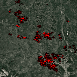
MOD14A1 V6.1 데이터 세트는 MODIS 4 및 11마이크로미터 복사휘도에서 파생된 1km 해상도의 일일 화재 마스크 컴포지트를 제공합니다. 화재 감지 전략은 화재의 절대 감지 (화재 강도가 감지할 수 있을 만큼 충분한 경우)와 …에 대한 상대적 감지를 기반으로 합니다. daily fire global modis nasa terra -
MOD14A2.061: Terra Thermal Anomalies & Fire 8-Day Global 1km(Terra 열 이상 및 화재 8일 전역 1km)
MOD14A2 V6.1 데이터 세트는 1km 해상도의 8일 화재 마스크 컴포지트를 제공합니다. 합성 기간 동안 개별 픽셀 클래스의 최댓값을 포함합니다. 화재 마스크와 함께 관련 품질 정보 레이어도 제공됩니다. 문서: 사용자 가이드 알고리즘 이론적 근거… 8일 화재 전역 modis nasa terra -
MOD15A2H.061: Terra Leaf Area Index/FPAR 8-Day Global 500m(Terra 잎 면적 지수/FPAR 8일 전 세계 500m)

MOD15A2H V6.1 MODIS 결합 잎 면적 지수 (LAI) 및 광합성 활성 방사선 비율 (FPAR) 제품은 500m 해상도의 8일 복합 데이터 세트입니다. 알고리즘은 8일 기간 내에 Terra 센서에서 획득한 모든 데이터 중에서 사용 가능한 '최고'의 픽셀을 선택합니다. … 8일 fpar 전역 lai modis nasa -
MOD17A2H.061: Terra 총 일차 생산량 8일 글로벌 500m

MOD17A2H V6.1 총 일차 생산성 (GPP) 제품은 500m 픽셀 크기의 누적 8일 컴포지트입니다. 이 제품은 방사선 사용 효율성 개념을 기반으로 하며, 데이터 모델의 입력으로 사용하여 지상 에너지, 탄소, 물 순환 프로세스 등을 계산할 수 있습니다. 8일 전역 gpp modis nasa 광합성 -
MOD17A2HGF.061: Terra 총 일차 생산량 8일 글로벌 500m

MOD17A2HGF 버전 6.1 총 일차 생산성 (GPP) 제품은 지상 에너지, 탄소, 물을 계산하는 데이터 모델의 입력으로 잠재적으로 사용될 수 있는 방사선 사용 효율성 개념을 기반으로 하는 500미터 (m) 픽셀 크기의 누적 8일 복합 값입니다. 8일 전역 gpp modis nasa 광합성 -
MOD17A3HGF.061: Terra Net Primary Production Gap-Filled Yearly Global 500m

MOD17A3HGF V6.1 제품은 500m 픽셀 해상도의 연간 총 및 순 일차 생산량 (GPP 및 NPP)에 관한 정보를 제공합니다. 연간 NPP는 지정된 연도의 모든 8일 순 광합성(PSN) 제품 (MOD17A2H)의 합계에서 파생됩니다. PSN 값은 다음의 차이입니다. 전역 gpp nasa npp 광합성 지구 생산성 -
MOD21A1D.061 Terra 지표면 온도 및 3밴드 방사율 일일 전역 1km

MOD21A1D 데이터 세트는 1,000m의 공간 해상도로 일간 레벨 2 그리드 (L2G) 중간 LST 제품에서 매일 생성됩니다. L2G 프로세스는 일일 MOD21 스와스 과립을 사인 곡선 MODIS 그리드에 매핑하고 그리드 셀에 속하는 모든 관측치를 저장합니다. 기후 일일 방사율 전역 lst nasa -
MOD21A1N.061 Terra 지표면 온도 및 3밴드 방사율 일일 전역 1km

MOD21A1N 데이터 세트는 1,000미터의 공간 해상도로 야간 레벨 2 그리드 (L2G) 중간 LST 제품에서 매일 생성됩니다. L2G 프로세스는 일일 MOD21 스와스 과립을 사인 곡선 MODIS 그리드에 매핑하고 그리드 셀에 속하는 모든 관측치를 저장합니다. 기후 일일 방사율 전역 lst nasa -
MOD21C1.061 Terra 지표면 온도 및 3밴드 방사율 일일 L3 전역 0.05도 CMG

MOD21C1 데이터 세트는 일간 레벨 2 그리드 (L2G) 중간 LST 제품에서 0.05도 (적도에서 5,600미터) 기후 모델링 그리드 (CMG)로 생성됩니다. L2G 프로세스는 일일 MOD21 스와스 그레뉼을 사인파 MODIS 그리드에 매핑하고 모든 … 기후 일일 방사율 전역 lst nasa -
MOD21C2.061 Terra 지표면 온도 및 3밴드 방사율 8일 L3 전역 0.05도 CMG

MOD21C2 데이터 세트는 단순 평균 방법을 기반으로 하는 알고리즘을 사용하는 8일 합성 LST 제품입니다. 알고리즘은 8일 기간의 모든 클라우드 무료 MOD21A1D 및 MOD21A1N 일일 획득에서 평균을 계산합니다. MOD21A1 데이터 세트와 달리 … 기후 방사율 전역 lst nasa 표면 온도 -
MOD21C3.061 Terra 지표면 온도 및 3밴드 방사율 월별 L3 전역 0.05도 CMG

MOD21C3 데이터 세트는 간단한 평균 방법 기반 알고리즘을 사용하는 월별 합성 LST 제품입니다. 알고리즘은 8일 기간의 모든 클라우드 무료 MOD21A1D 및 MOD21A1N 일일 획득에서 평균을 계산합니다. MOD21A1 데이터 세트와 달리 … 기후 방사율 전역 lst 월별 nasa -
MOD44B.061 Terra Vegetation Continuous Fields Yearly Global 250m

Terra MODIS 식생 연속 필드 (VCF) 제품은 전 세계 표면 식생 피복 추정치의 하위 픽셀 수준 표현입니다. 지구의 육상 표면을 기본 식생 특성의 비율로 지속적으로 나타내도록 설계되었으며, 3가지 표면 피복 구성요소(트리 캐노피 비율, …)의 그라데이션을 제공합니다. annual geophysical global landuse-landcover modis nasa -
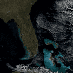
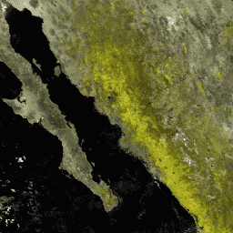
MODOCGA.006 Terra 해양 반사율 일일 전 세계 1km

MODOCGA V6 해양 반사율 제품은 Terra MODIS 대역 8~16의 1km 반사율 데이터로 구성됩니다. 제품은 밴드 8~16이 주로 해양 제품을 생성하는 데 사용되므로 해양 반사율이라고 하지만 타일이 … daily global modis nasa oceans reflectance