Page Summary
-
The Copernicus Global Land Service (CGLS) provides bio-geophysical products on land surface status and evolution globally.
-
Proba-V is a satellite mission mapping land cover and vegetation growth, continuing the VGT instrument series.
-
The Proba-V sensor collects data in VNIR and SWIR bands.
-
Copernicus Global Land Cover Layers: CGLS-LC100 Collection 3
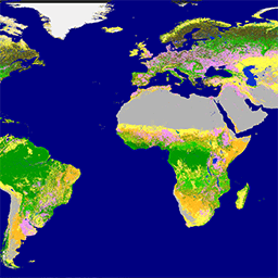
The Copernicus Global Land Service (CGLS) is earmarked as a component of the Land service to operate a multi-purpose service component that provides a series of bio-geophysical products on the status and evolution of land surface at global scale. The Dynamic Land Cover map at … copernicus eea esa eu landcover landuse-landcover -
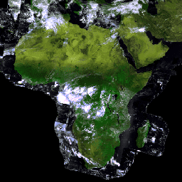
PROBA-V C1 Top Of Canopy Daily Synthesis 100m

Proba-V is a satellite mission tasked to map land cover and vegetation growth. It was designed to provide continuity for the VGT optical instrument from the SPOT-4 and SPOT-5 missions. The sensor collects data in three VNIR (visible and near-infrared) bands and one SWIR (short-wave … esa multispectral nir proba probav satellite-imagery -
PROBA-V C1 Top Of Canopy Daily Synthesis 333m
Proba-V is a satellite mission tasked to map land cover and vegetation growth. It was designed to provide continuity for the VGT optical instrument from the SPOT-4 and SPOT-5 missions. The sensor collects data in three VNIR (visible and near-infrared) bands and one SWIR (short-wave … esa multispectral nir proba probav satellite-imagery