Page Summary
-
The CORINE Land Cover inventory standardizes land data collection in Europe for environmental policy.
-
The Copernicus Global Land Service provides bio-geophysical land surface products globally.
-
EUCROPMAP offers European crop type maps derived from Sentinel and LUCAS data.
-
Sentinel missions provide various datasets including SAR, multi-spectral imagery, cloud probability, and atmospheric composition data.
-
LUCAS provides triennial in-situ land cover and land use data across the EU.
-
Copernicus CORINE Land Cover
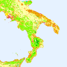
The CORINE (coordination of information on the environment) Land Cover (CLC) inventory was initiated in 1985 to standardize data collection on land in Europe to support environmental policy development. The project is coordinated by the European Environment Agency (EEA) in the frame of the EU … copernicus eea esa eu landcover landuse-landcover -
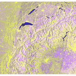
Copernicus Global Land Cover Layers: CGLS-LC100 Collection 3
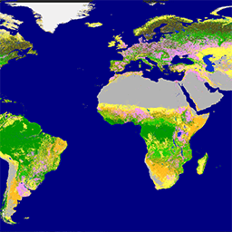
The Copernicus Global Land Service (CGLS) is earmarked as a component of the Land service to operate a multi-purpose service component that provides a series of bio-geophysical products on the status and evolution of land surface at global scale. The Dynamic Land Cover map at … copernicus eea esa eu landcover landuse-landcover -
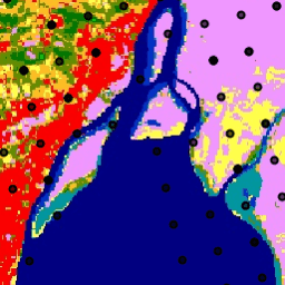
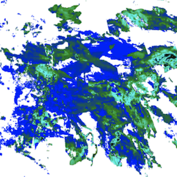
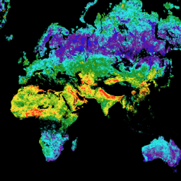
EUCROPMAP
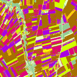
European crop type maps based on Sentinel-1 and LUCAS Copernicus 2018 in-situ observations for 2018, and a combination of Sentinel-1, Sentinel-2, and auxiliary data with LUCAS Copernicus 2022 observations for 2022. Based on the unique LUCAS 2018 Copernicus in-situ survey, this dataset represents the first … agriculture crop eu jrc lucas sentinel1-derived -
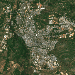
Harmonized Sentinel-2 MSI: MultiSpectral Instrument, Level-1C (TOA)
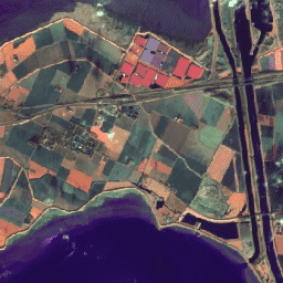
After 2022-01-25, Sentinel-2 scenes with PROCESSING_BASELINE '04.00' or above have their DN (value) range shifted by 1000. The HARMONIZED collection shifts data in newer scenes to be in the same range as in older scenes. Sentinel-2 is a wide-swath, high-resolution, multi-spectral imaging mission supporting Copernicus … copernicus esa eu msi radiance satellite-imagery -
Harmonized Sentinel-2 MSI: MultiSpectral Instrument, Level-2A (SR)
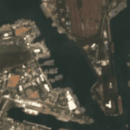
After 2022-01-25, Sentinel-2 scenes with PROCESSING_BASELINE '04.00' or above have their DN (value) range shifted by 1000. The HARMONIZED collection shifts data in newer scenes to be in the same range as in older scenes. Sentinel-2 is a wide-swath, high-resolution, multi-spectral imaging mission supporting Copernicus … copernicus esa eu msi reflectance satellite-imagery -
LUCAS Copernicus (Polygons with attributes, 2018) V1
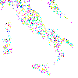
The Land Use/Cover Area frame Survey (LUCAS) in the European Union (EU) was set up to provide statistical information. It represents a triennial in-situ landcover and land-use data-collection exercise that extends over the whole of the EU's territory. LUCAS collects information on land cover and … copernicus eu jrc landcover landuse landuse-landcover -
LUCAS Harmonized (Theoretical Location, 2006-2018) V1
The Land Use/Cover Area frame Survey (LUCAS) in the European Union (EU) was set up to provide statistical information. It represents a triennial in-situ landcover and land-use data-collection exercise that extends over the whole of the EU's territory. LUCAS collects information on land cover and … eu jrc landcover landuse landuse-landcover lucas -
LUCAS THLOC (Points with attributes, 2022) V1
The Land Use/Cover Area frame Survey (LUCAS) in the European Union (EU) was set up to provide statistical information. It represents a triennial in-situ landcover and land-use data-collection exercise that extends over the whole of the EU's territory. LUCAS collects information on land cover and … eu jrc landcover landuse landuse-landcover lucas -
Sentinel-1 SAR GRD: C-band Synthetic Aperture Radar Ground Range Detected, log scaling
The Sentinel-1 mission provides data from a dual-polarization C-band Synthetic Aperture Radar (SAR) instrument at 5.405GHz (C band). This collection includes the S1 Ground Range Detected (GRD) scenes, processed using the Sentinel-1 Toolbox to generate a calibrated, ortho-corrected product. The collection is updated daily. New … backscatter copernicus esa eu polarization radar -
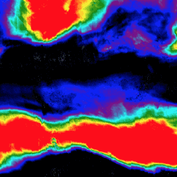
Sentinel-2: Cloud Probability
The S2 cloud probability is created with the sentinel2-cloud-detector library (using LightGBM). All bands are upsampled using bilinear interpolation to 10m resolution before the gradient boost base algorithm is applied. The resulting 0..1 floating point probability is scaled to 0..100 and stored as an UINT8. … cloud copernicus esa eu msi radiance -
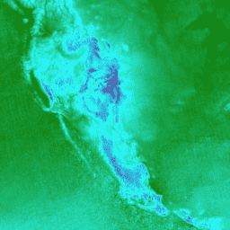
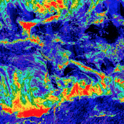
Sentinel-3 OLCI EFR: Ocean and Land Color Instrument Earth Observation Full Resolution
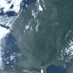
The Ocean and Land Color Instrument (OLCI) Earth Observation Full Resolution (EFR) dataset contains top of atmosphere radiances at 21 spectral bands with center wavelengths ranging between 0.4µm and 1.02µm at spatial resolution of 300m with worldwide coverage every ~2 days. OLCI is one of … copernicus esa eu radiance satellite-imagery sentinel -
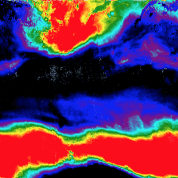
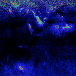
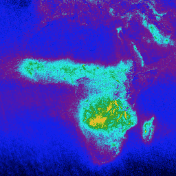
Sentinel-5P NRTI AER AI: Near Real-Time UV Aerosol Index
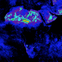
NRTI/L3_AER_AI This dataset provides near real-time high-resolution imagery of the UV Aerosol Index (UVAI), also called the Absorbing Aerosol Index (AAI). The AAI is based on wavelength-dependent changes in Rayleigh scattering in the UV spectral range for a pair of wavelengths. The difference between observed … aai aerosol air-quality atmosphere copernicus esa -
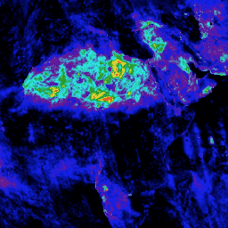
Sentinel-5P NRTI AER LH: Near Real-Time UV Aerosol Layer Height
NRTI/L3_AER_LH This dataset provides offline high-resolution imagery of the UV Aerosol Index (UVAI), also called the Absorbing Layer Height (ALH). The ALH is very sensitive to cloud contamination. However, aerosols and clouds can be difficult to distinguish, and ALH is computed for all FRESCO effective … aerosol air-quality alh atmosphere copernicus esa -
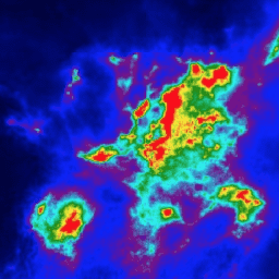
Sentinel-5P NRTI CLOUD: Near Real-Time Cloud Properties

NRTI/L3_CLOUD This dataset provides near real-time high-resolution imagery of cloud parameters. The TROPOMI/S5P cloud properties retrieval is based on the OCRA and ROCINN algorithms currently being used in the operational GOME and GOME-2 products. OCRA retrieves the cloud fraction using measurements in the UV/VIS spectral … atmosphere cloud copernicus dlr esa eu -
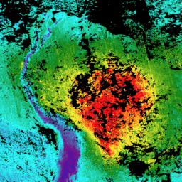
Sentinel-5P NRTI CO: Near Real-Time Carbon Monoxide
NRTI/L3_CO This dataset provides near real-time high-resolution imagery of CO concentrations. Carbon monoxide (CO) is an important atmospheric trace gas for understanding tropospheric chemistry. In certain urban areas, it is a major atmospheric pollutant. Main sources of CO are combustion of fossil fuels, biomass burning, … air-quality atmosphere carbon-monoxide copernicus esa eu -
Sentinel-5P NRTI HCHO: Near Real-Time Formaldehyde

NRTI/L3_HCHO This dataset provides near real-time high-resolution imagery of atmospheric formaldehyde (HCHO) concentrations. Formaldehyde is an intermediate gas in almost all oxidation chains of non-methane volatile organic compounds (NMVOC), leading eventually to CO2. Non-Methane Volatile Organic Compounds (NMVOCs) are, together with NOx, CO and CH4, … air-quality atmosphere bira copernicus dlr esa -
Sentinel-5P NRTI NO2: Near Real-Time Nitrogen Dioxide
NRTI/L3_NO2 This dataset provides near real-time high-resolution imagery of NO2 concentrations. Nitrogen oxides (NO2 and NO) are important trace gases in the Earth's atmosphere, present in both the troposphere and the stratosphere. They enter the atmosphere as a result of anthropogenic activities (notably fossil fuel … air-quality atmosphere copernicus esa eu knmi -
Sentinel-5P NRTI O3: Near Real-Time Ozone
NRTI/L3_O3 This dataset provides near-real-time high-resolution imagery of total column ozone concentrations. See also COPERNICUS/S5P/OFFL/L3_O3_TCL for the tropospheric column data. In the stratosphere, the ozone layer shields the biosphere from dangerous solar ultraviolet radiation. In the troposphere, it acts as an efficient cleansing agent, but … air-quality atmosphere copernicus esa eu o3 -
Sentinel-5P NRTI SO2: Near Real-Time Sulfur Dioxide
NRTI/L3_SO2 This dataset provides near real-time high-resolution imagery of atmospheric sulfur dioxide (SO2) concentrations. Sulfur dioxide (SO2) enters the Earth's atmosphere through both natural and anthropogenic processes. It plays a role in chemistry on a local and global scale and its impact ranges from short-term … air-quality atmosphere bira copernicus dlr esa -
Sentinel-5P OFFL AER AI: Offline UV Aerosol Index
OFFL/L3_AER_AI This dataset provides offline high-resolution imagery of the UV Aerosol Index (UVAI), also called the Absorbing Aerosol Index (AAI). The AAI is based on wavelength-dependent changes in Rayleigh scattering in the UV spectral range for a pair of wavelengths. The difference between observed and … aai aerosol air-quality atmosphere copernicus esa -
Sentinel-5P OFFL AER LH: Offline UV Aerosol Layer Height
OFFL/L3_AER_LH This dataset provides offline high-resolution imagery of the UV Aerosol Index (UVAI), also called the Absorbing Layer Height (ALH). The ALH is very sensitive to cloud contamination. However, aerosols and clouds can be difficult to distinguish, and ALH is computed for all FRESCO effective … aerosol air-quality alh atmosphere copernicus esa -
Sentinel-5P OFFL CH4: Offline Methane
OFFL/L3_CH4 This dataset provides offline high-resolution imagery of methane concentrations. Methane (CH4) is, after carbon dioxide (CO2), the most important contributor to the anthropogenically enhanced greenhouse effect. Roughly three-quarters of methane emissions are anthropogenic and as such, it is important to continue the record of … atmosphere climate copernicus esa eu knmi -
Sentinel-5P OFFL CLOUD: Offline Cloud Properties
OFFL/L3_CLOUD This dataset provides offline high-resolution imagery of cloud parameters. The TROPOMI/S5P cloud properties retrieval is based on the OCRA and ROCINN algorithms currently being used in the operational GOME and GOME-2 products. OCRA retrieves the cloud fraction using measurements in the UV/VIS spectral regions … atmosphere cloud copernicus dlr esa eu -
Sentinel-5P OFFL CO: Offline Carbon Monoxide
OFFL/L3_CO This dataset provides offline high-resolution imagery of CO concentrations. Carbon monoxide (CO) is an important atmospheric trace gas for understanding tropospheric chemistry. In certain urban areas, it is a major atmospheric pollutant. Main sources of CO are combustion of fossil fuels, biomass burning, and … air-quality atmosphere carbon-monoxide copernicus esa eu -
Sentinel-5P OFFL HCHO: Offline Formaldehyde
OFFL/L3_HCHO This dataset provides offline high-resolution imagery of atmospheric formaldehyde (HCHO) concentrations. Formaldehyde is an intermediate gas in almost all oxidation chains of non-methane volatile organic compounds (NMVOC), leading eventually to CO2. Non-Methane Volatile Organic Compounds (NMVOCs) are, together with NOx, CO and CH4, among … air-quality atmosphere bira copernicus dlr esa -
Sentinel-5P OFFL NO2: Offline Nitrogen Dioxide
OFFL/L3_NO2 This dataset provides offline high-resolution imagery of NO2 concentrations. Nitrogen oxides (NO2 and NO) are important trace gases in the Earth's atmosphere, present in both the troposphere and the stratosphere. They enter the atmosphere as a result of anthropogenic activities (notably fossil fuel combustion … air-quality atmosphere copernicus esa eu knmi -
Sentinel-5P OFFL O3 TCL: Offline Tropospheric Ozone
OFFL/L3_O3_TCL This dataset provides offline tropospheric high-resolution imagery of ozone concentrations between 20N and 20S. See also COPERNICUS/S5P/OFFL/L3_O3 and COPERNICUS/S5P/NRTI/L3_O3 for the total column data. In the stratosphere, the ozone layer shields the biosphere from dangerous solar ultraviolet radiation. In the troposphere, it acts as … air-quality atmosphere copernicus esa eu o3 -
Sentinel-5P OFFL O3: Offline Ozone

OFFL/L3_O3 This dataset provides offline high-resolution imagery of total column ozone concentrations. See also COPERNICUS/S5P/OFFL/L3_O3_TCL for the tropospheric column data. In the stratosphere, the ozone layer shields the biosphere from dangerous solar ultraviolet radiation. In the troposphere, it acts as an efficient cleansing agent, but … air-quality atmosphere copernicus esa eu o3 -
Sentinel-5P OFFL SO2: Offline Sulfur Dioxide
OFFL/L3_SO2 This dataset provides offline high-resolution imagery of atmospheric sulfur dioxide (SO2) concentrations. Sulfur dioxide (SO2) enters the Earth's atmosphere through both natural and anthropogenic processes. It plays a role in chemistry on a local and global scale and its impact ranges from short-term pollution … air-quality atmosphere bira copernicus dlr esa