Datasets tagged phenology in Earth Engine
Mit Sammlungen den Überblick behalten
Sie können Inhalte basierend auf Ihren Einstellungen speichern und kategorisieren.
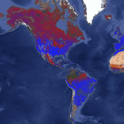
Das Datenprodukt „Terra and Aqua combined Moderate Resolution Imaging Spectroradiometer (MODIS) Land Cover Dynamics (MCD12Q2) Version 6.1“ enthält globale Phänologiemesswerte der Landoberfläche in Jahresintervallen. Das Datenprodukt „MCD12Q2 Version 6.1“ wird aus Zeitreihen des 2-Band-Erweiterten Vegetationsindexes (EVI2) abgeleitet. …
Das Datenprodukt „Land Cover Dynamics“ der Suomi National Polar-Orbiting Partnership (Suomi NPP) der NASA Visible Infrared Imaging Radiometer Suite (VIIRS) bietet GLSP-Messwerte (Global Land Surface Phenology) in Jahresabständen. Das Datenprodukt VNP22Q2 wird aus Zeitreihen des zweibändigen Enhanced Vegetation Index (EVI2) abgeleitet. …
[[["Leicht verständlich","easyToUnderstand","thumb-up"],["Mein Problem wurde gelöst","solvedMyProblem","thumb-up"],["Sonstiges","otherUp","thumb-up"]],[["Benötigte Informationen nicht gefunden","missingTheInformationINeed","thumb-down"],["Zu umständlich/zu viele Schritte","tooComplicatedTooManySteps","thumb-down"],["Nicht mehr aktuell","outOfDate","thumb-down"],["Problem mit der Übersetzung","translationIssue","thumb-down"],["Problem mit Beispielen/Code","samplesCodeIssue","thumb-down"],["Sonstiges","otherDown","thumb-down"]],[],[],["The provided data products, MCD12Q2 and VNP22Q2, both offer yearly global land surface phenology metrics. MCD12Q2 utilizes data from the Terra and Aqua MODIS, while VNP22Q2 uses Suomi NPP VIIRS data. Both products derive these metrics from time series of the two-band Enhanced Vegetation Index (EVI2). Key data elements are related to the onset of greenness, providing insight into land cover dynamics and phenology.\n"]]