-
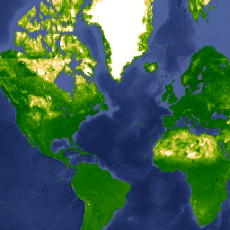
Oxford MAP EVI: Malaria Atlas Project Gap-Filled Enhanced Vegetation Index
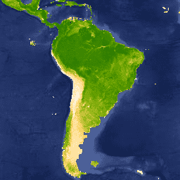
The underlying dataset for this Enhanced Vegetation Index (EVI) product is MODIS BRDF-corrected imagery (MCD43B4), which was gap-filled using the approach outlined in Weiss et al. (2014) to eliminate missing data caused by factors such as cloud cover. Gap-free outputs were then aggregated temporally and … evi map oxford vegetation -
Oxford MAP: Malaria Atlas Project Fractional International Geosphere-Biosphere Programme Landcover
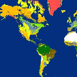
The underlying dataset for this landcover product is the IGBP layer found within the MODIS annual landcover product (MCD12Q1). This data was converted from its categorical format, which has a ≈500 meter resolution, to a fractional product indicating the integer percentage (0-100) of the output … landcover map oxford -
Oxford MAP LST: Malaria Atlas Project Gap-Filled Daytime Land Surface Temperature
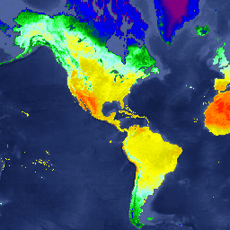
The underlying dataset for this daytime product is MODIS land surface temperature data (MOD11A2), which was gap-filled using the approach outlined in Weiss et al. (2014) to eliminate missing data caused by factors such as cloud cover. Gap-free outputs were then aggregated temporally and spatially … lst map oxford surface-temperature -
Oxford MAP LST: Malaria Atlas Project Gap-Filled Nighttime Land Surface Temperature
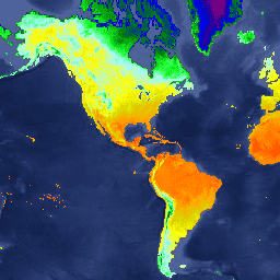
The underlying dataset for this nighttime product is MODIS land surface temperature data (MOD11A2), which was gap-filled using the approach outlined in Weiss et al. (2014) to eliminate missing data caused by factors such as cloud cover. Gap-free outputs were then aggregated temporally and spatially … lst map oxford surface-temperature -
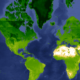
Oxford MAP TCB: Malaria Atlas Project Gap-Filled Tasseled Cap Brightness
This gap-filled Tasseled Cap Brightness (TCB) dataset was created by applying the tasseled-cap equations defined in Lobser and Cohen (2007) to MODIS BRDF-corrected imagery (MCD43B4). The resulting data were gap-filled using the approach outlined in Weiss et al. (2014) to eliminate missing data caused by … brightness map oxford tasseled-cap tcb -
Oxford MAP TCW: Malaria Atlas Project Gap-Filled Tasseled Cap Wetness
This gap-filled Tasseled Cap Wetness (TCW) dataset was created by applying the tasseled-cap equations defined in Lobser and Cohen (2007) to MODIS BRDF-corrected imagery (MCD43B4). The resulting data were gap-filled using the approach outlined in Weiss et al. (2014) to eliminate missing data caused by … map oxford tasseled-cap tcb -
Accessibility to Healthcare 2019
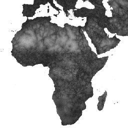
This global accessibility map enumerates land-based travel time (in minutes) to the nearest hospital or clinic for all areas between 85 degrees north and 60 degrees south for a nominal year 2019. It also includes "walking-only" travel time, using non-motorized means of transportation only. Major … accessibility jrc map oxford twente -
Global Friction Surface 2019
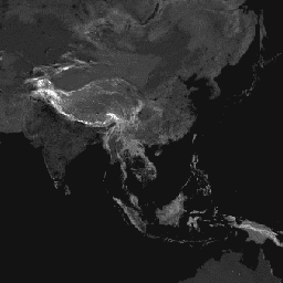
This global friction surface enumerates land-based travel speed for all land pixels between 85 degrees north and 60 degrees south for a nominal year 2019. It also includes "walking-only" travel speed, using non-motorized means of transportation only. This map was produced through a collaboration between … accessibility jrc map oxford twente
[{
"type": "thumb-down",
"id": "missingTheInformationINeed",
"label":"Missing the information I need"
},{
"type": "thumb-down",
"id": "tooComplicatedTooManySteps",
"label":"Too complicated / too many steps"
},{
"type": "thumb-down",
"id": "outOfDate",
"label":"Out of date"
},{
"type": "thumb-down",
"id": "samplesCodeIssue",
"label":"Samples / code issue"
},{
"type": "thumb-down",
"id": "otherDown",
"label":"Other"
}]
[{
"type": "thumb-up",
"id": "easyToUnderstand",
"label":"Easy to understand"
},{
"type": "thumb-up",
"id": "solvedMyProblem",
"label":"Solved my problem"
},{
"type": "thumb-up",
"id": "otherUp",
"label":"Other"
}]