-
แบบจำลองความสูงของเรือนยอด NEON (CHM)

ความสูงของยอดเรือนยอดเหนือพื้นดิน (โมเดลความสูงของเรือนยอด หรือ CHM) CHM ได้มาจากกลุ่มจุด LiDAR ของ NEON และสร้างขึ้นโดยการสร้างพื้นผิวต่อเนื่องของค่าประมาณความสูงของเรือนยอดทั่วทั้งโดเมนเชิงพื้นที่ของการสำรวจ LiDAR The … airborne canopy forest forest-biomass highres lidar -
ปริมาณไนโตรเจนในชั้นเรือนยอดของ NEON (CNC)
ความเข้มข้นของไนโตรเจนในเรือนยอดที่จำลองขึ้นโดยปรับเทียบกับการสังเกตทางเคมีของใบไม้ในพืชของ NEON และคาดการณ์ด้วยการสะท้อนแบบทิศทางของพื้นผิว L1 ซึ่งได้มาจากสเปกโทรมิเตอร์แบบถ่ายภาพ (NIS) ของ NEON แถบประกอบด้วย 1) เปอร์เซ็นต์ไนโตรเจนของเรือนยอด 2) ความไม่แน่นอนของโมเดลไนโตรเจนของเรือนยอด 3) ผลการจัดประเภทสำหรับโมเดลเข็มเทียบกับโมเดลที่ไม่ใช่เข็ม และอื่นๆ airborne canopy forest highres hyperspectral neon -
แบบจำลองระดับความสูงเชิงเลข (DEM) ของ NEON

แบบจำลองดิจิทัลของพื้นผิว (DSM) และภูมิประเทศ (DTM) ที่ได้มาจากข้อมูล LiDAR ของ NEON DSM: ลักษณะพื้นผิว (ข้อมูลภูมิประเทศที่มีพืชพรรณและโครงสร้างที่มนุษย์สร้างขึ้น) DTM: ความสูงของพื้นดินเปล่า (ข้อมูลภูมิประเทศที่นำพืชพรรณและโครงสร้างที่มนุษย์สร้างขึ้นออกแล้ว) รูปภาพแสดงเป็นเมตรเหนือระดับน้ำทะเลโดยเฉลี่ย … airborne dem elevation-topography forest highres lidar -
ภาพจากกล้อง RGB ของ NEON

ภาพจากกล้องความละเอียดสูงแบบ Red-Green-Blue (RGB) ที่ผ่านการปรับแก้ภาพให้ตั้งฉากแล้วนำมาต่อกันเป็นภาพโมเสกและส่งออกไปยังตารางเชิงพื้นที่แบบคงที่และสม่ำเสมอโดยใช้การสุ่มตัวอย่างใหม่แบบเพื่อนบ้านที่ใกล้ที่สุด ความละเอียดเชิงพื้นที่คือ 0.1 ม. กล้องดิจิทัลเป็นส่วนหนึ่งของชุดเครื่องมือบนแพลตฟอร์มการสังเกตการณ์ทางอากาศ (AOP) ของ NEON ซึ่งรวมถึง … airborne forest highres neon neon-prod-earthengine orthophoto -
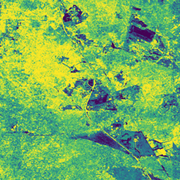
การสะท้อนแบบ 2 ทิศทางของพื้นผิว NEON

การสะท้อนแบบสองทิศทางของพื้นผิว AOP ของ NEON เป็นผลิตภัณฑ์ข้อมูล VSWIR (อินฟราเรดที่มองเห็นได้ถึงคลื่นสั้น) แบบไฮเปอร์สเปกตรัล ซึ่งมี 426 แถบที่ครอบคลุมความยาวคลื่นตั้งแต่ประมาณ 380 นาโนเมตรถึง 2510 นาโนเมตร การสะท้อนแสงจะปรับขนาดตามปัจจัย 10000 ความยาวคลื่นระหว่าง 1340-1445 นาโนเมตร และ 1790-1955 นาโนเมตร จะตั้งค่าเป็น … airborne forest highres hyperspectral neon neon-prod-earthengine -
การสะท้อนแบบมีทิศทางของพื้นผิว NEON

การสะท้อนแบบทิศทางของพื้นผิว AOP ของ NEON เป็นผลิตภัณฑ์ข้อมูล VSWIR (อินฟราเรดที่มองเห็นได้ถึงคลื่นสั้น) แบบไฮเปอร์สเปกตรัล ซึ่งมี 426 แถบที่ครอบคลุมความยาวคลื่นตั้งแต่ประมาณ 380 นาโนเมตรถึง 2510 นาโนเมตร การสะท้อนแสงจะปรับขนาดตามปัจจัย 10000 ความยาวคลื่นระหว่าง 1340-1445 นาโนเมตร และ 1790-1955 นาโนเมตร จะตั้งค่าเป็น … airborne forest hyperspectral neon neon-prod-earthengine publisher-dataset