2018년의 경우 Sentinel-1 및 LUCAS Copernicus 2018 현장 관측을 기반으로 하고 2022년의 경우 Sentinel-1, Sentinel-2, 보조 데이터와 LUCAS Copernicus 2022 관측을 조합한 유럽 작물 유형 지도입니다. 고유한 LUCAS 2018 Copernicus 현장 조사에 기반한 이 데이터 세트는 …
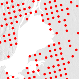
유럽 연합 (EU)의 토지 이용/피복 면적 프레임 설문조사 (LUCAS)는 통계 정보를 제공하기 위해 설정되었습니다. EU 전역에 걸쳐 3년마다 실시되는 현장 토지 피복 및 토지 이용 데이터 수집 활동을 나타냅니다. LUCAS는 토지 피복 및 …에 관한 정보를 수집합니다.
유럽 연합 (EU)의 토지 이용/피복 면적 프레임 설문조사 (LUCAS)는 통계 정보를 제공하기 위해 설정되었습니다. EU 전역에 걸쳐 3년마다 실시되는 현장 토지 피복 및 토지 이용 데이터 수집 활동을 나타냅니다. LUCAS는 토지 피복 및 …에 관한 정보를 수집합니다.
유럽 연합 (EU)의 토지 이용/피복 면적 프레임 설문조사 (LUCAS)는 통계 정보를 제공하기 위해 설정되었습니다. EU 전역에 걸쳐 3년마다 실시되는 현장 토지 피복 및 토지 이용 데이터 수집 활동을 나타냅니다. LUCAS는 토지 피복 및 …에 관한 정보를 수집합니다.
[[["이해하기 쉬움","easyToUnderstand","thumb-up"],["문제가 해결됨","solvedMyProblem","thumb-up"],["기타","otherUp","thumb-up"]],[["필요한 정보가 없음","missingTheInformationINeed","thumb-down"],["너무 복잡함/단계 수가 너무 많음","tooComplicatedTooManySteps","thumb-down"],["오래됨","outOfDate","thumb-down"],["번역 문제","translationIssue","thumb-down"],["샘플/코드 문제","samplesCodeIssue","thumb-down"],["기타","otherDown","thumb-down"]],[],[],[]]