Page Summary
-
The Landscape Change Monitoring System (LCMS) data suite includes products showing modeled change, land cover, and land use classes annually.
-
LCMS is a remote sensing-based system designed for mapping and monitoring landscape change throughout the United States.
-
Different versions of the LCMS data cover specific geographic areas, such as Puerto Rico/US Virgin Islands and the Conterminous US/Southeastern Alaska.
-
USFS Landscape Change Monitoring System v2020.6 (Puerto Rico - US Virgin Islands only)
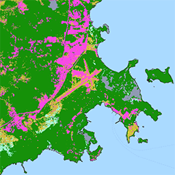
This product is part of the Landscape Change Monitoring System (LCMS) data suite. It shows LCMS-modeled change, land cover, and/or land use classes for each year. LCMS is a remote sensing-based system for mapping and monitoring landscape change across the United States. Its objective is … change change-detection forest gtac landcover landsat-derived -
USFS Landscape Change Monitoring System v2021.7 (Conterminous United States and Southeastern Alaska)
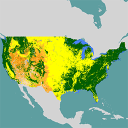
This product is part of the Landscape Change Monitoring System (LCMS) data suite. It shows LCMS-modeled change, land cover, and/or land use classes for each year. LCMS is a remote sensing-based system for mapping and monitoring landscape change across the United States. Its objective is … change change-detection forest gtac landcover landsat-derived -
USFS Landscape Change Monitoring System v2022.8 (Conterminous United States and Southeastern Alaska)
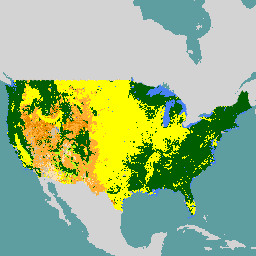
This product is part of the Landscape Change Monitoring System (LCMS) data suite. It shows LCMS-modeled change, land cover, and/or land use classes for each year. LCMS is a remote sensing-based system for mapping and monitoring landscape change across the United States. Its objective is … change change-detection forest gtac landcover landsat-derived