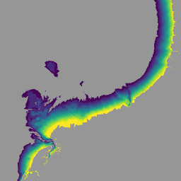
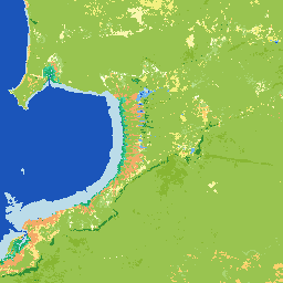
National Intertidal Digital Elevation Model(NIDEM; Bishop-Taylor 他 2018、2019)は、オーストラリアの露出した潮間帯の大陸規模の標高データセットです。NIDEM は、オーストラリアの潮間帯の砂浜と海岸、干潟、岩礁とサンゴ礁を 25 m の解像度で 3 次元で表現した最初のデータセットです。
[[["わかりやすい","easyToUnderstand","thumb-up"],["問題の解決に役立った","solvedMyProblem","thumb-up"],["その他","otherUp","thumb-up"]],[["必要な情報がない","missingTheInformationINeed","thumb-down"],["複雑すぎる / 手順が多すぎる","tooComplicatedTooManySteps","thumb-down"],["最新ではない","outOfDate","thumb-down"],["翻訳に関する問題","translationIssue","thumb-down"],["サンプル / コードに問題がある","samplesCodeIssue","thumb-down"],["その他","otherDown","thumb-down"]],[],[],["The datasets provide geospatial information about Australia, focusing on land and water features. The National Intertidal Digital Elevation Model (NIDEM) offers a 25m-resolution, 3D representation of Australia's intertidal zone. Several datasets analyze Landsat data, providing annual \"average\" cloud-free images and change metrics. The Land Cover dataset uses satellite imagery to classify Australia's land annually, utilizing the Food and Agriculture Organisation's Land Cover Classification System. Water Observations Statistics classifies each pixel as 'wet', 'dry', or 'invalid'.\n"]]