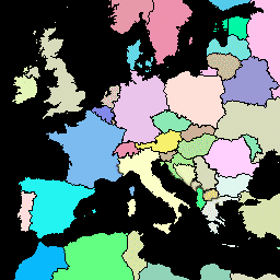
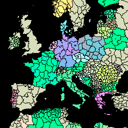
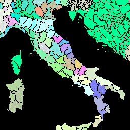
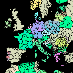
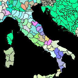
This version of GAUL dataset is simplified at 500m. The Global Administrative Unit Layers (GAUL) compiles and disseminates the best available information on administrative units for all the countries in the world, providing a contribution to the standardization of the spatial dataset representing administrative units. …
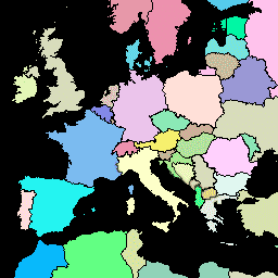
The Global Administrative Unit Layers (GAUL) compiles and disseminates the best available information on administrative units for all the countries in the world, providing a contribution to the standardization of the spatial dataset representing administrative units. The GAUL always maintains global layers with a unified …
[[["Easy to understand","easyToUnderstand","thumb-up"],["Solved my problem","solvedMyProblem","thumb-up"],["Other","otherUp","thumb-up"]],[["Missing the information I need","missingTheInformationINeed","thumb-down"],["Too complicated / too many steps","tooComplicatedTooManySteps","thumb-down"],["Out of date","outOfDate","thumb-down"],["Samples / code issue","samplesCodeIssue","thumb-down"],["Other","otherDown","thumb-down"]],[],[[["\u003cp\u003eThe Global Administrative Unit Layers (GAUL) dataset provides standardized boundaries for administrative units at the country, first-level (e.g., states/provinces), and second-level (e.g., counties/districts) administrative levels for all countries worldwide.\u003c/p\u003e\n"],["\u003cp\u003eGAUL aims to standardize the representation of administrative units globally, contributing to improved data sharing and analysis.\u003c/p\u003e\n"],["\u003cp\u003eBoth standard and a simplified 500m resolution version of the GAUL dataset are available, allowing for flexibility in use cases depending on the required level of detail.\u003c/p\u003e\n"],["\u003cp\u003eThe datasets are compiled from the best available information and are actively maintained to ensure accuracy and relevance.\u003c/p\u003e\n"],["\u003cp\u003eUsers can access GAUL data through Earth Engine for various applications, such as spatial analysis, mapping, and research related to administrative boundaries.\u003c/p\u003e\n"]]],[],null,["-\n\n |-------------------------------------------------------------------------------------------------------------------------------------------------------------------------------------------------------------------------------------------------------------------------------------------------------------------------------------|\n | [FAO GAUL 500m Simplified: Global Administrative Unit Layers 2015, Country Boundaries](/earth-engine/datasets/catalog/FAO_GAUL_SIMPLIFIED_500m_2015_level0) |\n | This version of GAUL dataset is simplified at 500m. The Global Administrative Unit Layers (GAUL) compiles and disseminates the best available information on administrative units for all the countries in the world, providing a contribution to the standardization of the spatial dataset representing administrative units. ... |\n | [borders](/earth-engine/datasets/tags/borders) [countries](/earth-engine/datasets/tags/countries) [fao](/earth-engine/datasets/tags/fao) [gaul](/earth-engine/datasets/tags/gaul) [infrastructure-boundaries](/earth-engine/datasets/tags/infrastructure-boundaries) [table](/earth-engine/datasets/tags/table) |\n\n-\n\n |-------------------------------------------------------------------------------------------------------------------------------------------------------------------------------------------------------------------------------------------------------------------------------------------------------------------------------------|\n | [FAO GAUL 500m Simplified: Global Administrative Unit Layers 2015, First-Level Administrative Units](/earth-engine/datasets/catalog/FAO_GAUL_SIMPLIFIED_500m_2015_level1) |\n | This version of GAUL dataset is simplified at 500m. The Global Administrative Unit Layers (GAUL) compiles and disseminates the best available information on administrative units for all the countries in the world, providing a contribution to the standardization of the spatial dataset representing administrative units. ... |\n | [borders](/earth-engine/datasets/tags/borders) [departments](/earth-engine/datasets/tags/departments) [fao](/earth-engine/datasets/tags/fao) [gaul](/earth-engine/datasets/tags/gaul) [infrastructure-boundaries](/earth-engine/datasets/tags/infrastructure-boundaries) [provinces](/earth-engine/datasets/tags/provinces) |\n\n-\n\n |-------------------------------------------------------------------------------------------------------------------------------------------------------------------------------------------------------------------------------------------------------------------------------------------------------------------------------------|\n | [FAO GAUL 500m Simplified: Global Administrative Unit Layers 2015, Second-Level Administrative Units](/earth-engine/datasets/catalog/FAO_GAUL_SIMPLIFIED_500m_2015_level2) |\n | This version of GAUL dataset is simplified at 500m. The Global Administrative Unit Layers (GAUL) compiles and disseminates the best available information on administrative units for all the countries in the world, providing a contribution to the standardization of the spatial dataset representing administrative units. ... |\n | [borders](/earth-engine/datasets/tags/borders) [county](/earth-engine/datasets/tags/county) [districts](/earth-engine/datasets/tags/districts) [fao](/earth-engine/datasets/tags/fao) [gaul](/earth-engine/datasets/tags/gaul) [infrastructure-boundaries](/earth-engine/datasets/tags/infrastructure-boundaries) |\n\n-\n\n |----------------------------------------------------------------------------------------------------------------------------------------------------------------------------------------------------------------------------------------------------------------------------------------------------------------------------------------|\n | [FAO GAUL: Global Administrative Unit Layers 2015, Country Boundaries](/earth-engine/datasets/catalog/FAO_GAUL_2015_level0) |\n | The Global Administrative Unit Layers (GAUL) compiles and disseminates the best available information on administrative units for all the countries in the world, providing a contribution to the standardization of the spatial dataset representing administrative units. The GAUL always maintains global layers with a unified ... |\n | [borders](/earth-engine/datasets/tags/borders) [countries](/earth-engine/datasets/tags/countries) [fao](/earth-engine/datasets/tags/fao) [gaul](/earth-engine/datasets/tags/gaul) [infrastructure-boundaries](/earth-engine/datasets/tags/infrastructure-boundaries) [table](/earth-engine/datasets/tags/table) |\n\n-\n\n |----------------------------------------------------------------------------------------------------------------------------------------------------------------------------------------------------------------------------------------------------------------------------------------------------------------------------------------|\n | [FAO GAUL: Global Administrative Unit Layers 2015, First-Level Administrative Units](/earth-engine/datasets/catalog/FAO_GAUL_2015_level1) |\n | The Global Administrative Unit Layers (GAUL) compiles and disseminates the best available information on administrative units for all the countries in the world, providing a contribution to the standardization of the spatial dataset representing administrative units. The GAUL always maintains global layers with a unified ... |\n | [borders](/earth-engine/datasets/tags/borders) [departments](/earth-engine/datasets/tags/departments) [fao](/earth-engine/datasets/tags/fao) [gaul](/earth-engine/datasets/tags/gaul) [infrastructure-boundaries](/earth-engine/datasets/tags/infrastructure-boundaries) [provinces](/earth-engine/datasets/tags/provinces) |\n\n-\n\n |----------------------------------------------------------------------------------------------------------------------------------------------------------------------------------------------------------------------------------------------------------------------------------------------------------------------------------------|\n | [FAO GAUL: Global Administrative Unit Layers 2015, Second-Level Administrative Units](/earth-engine/datasets/catalog/FAO_GAUL_2015_level2) |\n | The Global Administrative Unit Layers (GAUL) compiles and disseminates the best available information on administrative units for all the countries in the world, providing a contribution to the standardization of the spatial dataset representing administrative units. The GAUL always maintains global layers with a unified ... |\n | [borders](/earth-engine/datasets/tags/borders) [county](/earth-engine/datasets/tags/county) [districts](/earth-engine/datasets/tags/districts) [fao](/earth-engine/datasets/tags/fao) [gaul](/earth-engine/datasets/tags/gaul) [infrastructure-boundaries](/earth-engine/datasets/tags/infrastructure-boundaries) |"]]