-
GOES-16 FDCC Series ABI Level 2 Fire/Hot Spot Characterization CONUS

ผลิตภัณฑ์ไฟ (HSC) มีรูปภาพ 4 รูป โดยรูปภาพ 1 รูปอยู่ในรูปแบบของหน้ากากไฟ และอีก 3 รูปมีค่าพิกเซลที่ระบุอุณหภูมิของไฟ พื้นที่ไฟ และกำลังแผ่รังสีของไฟ มาสก์ข้อมูลเมตา FHS ระดับ L2+ ของ ABI จะกำหนด Flag ให้กับพิกเซลที่ไปยังส่วนต่างๆ ของโลกทุกพิกเซลที่ … abi fdc fire goes goes-16 goes-east -
ดิสก์เต็มของภาพระดับ 2 ของ ABI ซีรีส์ FDCF จาก GOES-16 สำหรับลักษณะไฟ/จุดร้อน

ผลิตภัณฑ์ไฟ (HSC) มีรูปภาพ 4 รูป โดยรูปภาพ 1 รูปอยู่ในรูปแบบของหน้ากากไฟ และอีก 3 รูปมีค่าพิกเซลที่ระบุอุณหภูมิของไฟ พื้นที่ไฟ และกำลังแผ่รังสีของไฟ มาสก์ข้อมูลเมตา FHS ระดับ L2+ ของ ABI จะกำหนด Flag ให้กับพิกเซลที่ไปยังส่วนต่างๆ ของโลกทุกพิกเซลที่ … abi fdc fire goes goes-16 goes-east -
GOES-17 FDCC Series ABI Level 2 Fire/Hot Spot Characterization CONUS

ผลิตภัณฑ์ไฟ (HSC) มีรูปภาพ 4 รูป โดยรูปภาพ 1 รูปอยู่ในรูปแบบของหน้ากากไฟ และอีก 3 รูปมีค่าพิกเซลที่ระบุอุณหภูมิของไฟ พื้นที่ไฟ และกำลังแผ่รังสีของไฟ มาสก์ข้อมูลเมตา FHS ระดับ L2+ ของ ABI จะกำหนด Flag ให้กับพิกเซลที่ไปยังส่วนต่างๆ ของโลกทุกพิกเซลที่ … abi fdc fire goes goes-17 goes-s -
ดิสก์เต็มของภาพระดับ 2 ของ ABI ซีรีส์ FDCF จาก GOES-17 สำหรับลักษณะไฟ/จุดร้อน

ผลิตภัณฑ์ไฟ (HSC) มีรูปภาพ 4 รูป โดยรูปภาพ 1 รูปอยู่ในรูปแบบของหน้ากากไฟ และอีก 3 รูปมีค่าพิกเซลที่ระบุอุณหภูมิของไฟ พื้นที่ไฟ และกำลังแผ่รังสีของไฟ มาสก์ข้อมูลเมตา FHS ระดับ L2+ ของ ABI จะกำหนด Flag ให้กับพิกเซลที่ไปยังส่วนต่างๆ ของโลกทุกพิกเซลที่ … abi fdc fire goes goes-17 goes-s -
GOES-18 FDCC Series ABI Level 2 Fire/Hot Spot Characterization CONUS
ผลิตภัณฑ์ไฟ (HSC) มีรูปภาพ 4 รูป โดยรูปภาพ 1 รูปอยู่ในรูปแบบของหน้ากากไฟ และอีก 3 รูปมีค่าพิกเซลที่ระบุอุณหภูมิของไฟ พื้นที่ไฟ และกำลังแผ่รังสีของไฟ มาสก์ข้อมูลเมตา FHS ระดับ L2+ ของ ABI จะกำหนด Flag ให้กับพิกเซลที่ไปยังส่วนต่างๆ ของโลกทุกพิกเซลที่ … abi fdc fire goes goes-18 goes-t -
ดิสก์เต็มของภาพระดับ 2 ของ ABI จากซีรีส์ FDCF ของ GOES-18 สำหรับลักษณะไฟ/ฮอตสปอต

ผลิตภัณฑ์ไฟ (HSC) มีรูปภาพ 4 รูป โดยรูปภาพ 1 รูปอยู่ในรูปแบบของหน้ากากไฟ และอีก 3 รูปมีค่าพิกเซลที่ระบุอุณหภูมิของไฟ พื้นที่ไฟ และกำลังแผ่รังสีของไฟ มาสก์ข้อมูลเมตา FHS ระดับ L2+ ของ ABI จะกำหนด Flag ให้กับพิกเซลที่ไปยังส่วนต่างๆ ของโลกทุกพิกเซลที่ … abi fdc fire goes goes-18 goes-t -
GOES-19 FDCC Series ABI Level 2 Fire/Hot Spot Characterization CONUS

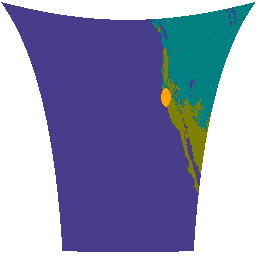
ดาวเทียม GOES เป็นดาวเทียมตรวจอากาศแบบอยู่กับที่ที่ NOAA เป็นผู้ดำเนินการ ผลิตภัณฑ์ไฟ (HSC) มีรูปภาพ 4 รูป โดยรูปภาพ 1 รูปอยู่ในรูปแบบของหน้ากากไฟ และอีก 3 รูปมีค่าพิกเซลที่ระบุอุณหภูมิของไฟ พื้นที่ไฟ และกำลังแผ่รังสีของไฟ ข้อมูลเมตา FHS ระดับ L2+ ของ ABI … abi fdc fire goes goes-19 goes-east -
GOES-19 FDCF Series ABI ระดับ 2 ลักษณะไฟ/จุดร้อนทั้งดิสก์

ผลิตภัณฑ์ไฟ (HSC) มีรูปภาพ 4 รูป โดยรูปภาพ 1 รูปอยู่ในรูปแบบของหน้ากากไฟ และอีก 3 รูปมีค่าพิกเซลที่ระบุอุณหภูมิของไฟ พื้นที่ไฟ และกำลังแผ่รังสีของไฟ มาสก์ข้อมูลเมตา FHS ระดับ L2+ ของ ABI จะกำหนด Flag ให้กับพิกเซลที่ไปยังส่วนต่างๆ ของโลกทุกพิกเซลที่ … abi fdc fire goes goes-19 goes-east