Page Summary
-
Several datasets offer evapotranspiration data globally, with varying spatial and temporal resolutions (e.g., 8-day, monthly) derived from sources like MODIS and Landsat.
-
Some datasets specifically provide evapotranspiration data for Australia or the continental United States (CONUS).
-
Multiple OpenET datasets provide monthly evapotranspiration for CONUS based on different models and satellite inputs, including an ensemble value.
-
Several datasets combine evapotranspiration information with other climate and drought-related variables or provide drought indices derived from evapotranspiration.
-
The Breathing Earth System Simulator (BESS) and PML_V2 datasets couple evapotranspiration with other Earth system processes like radiation and gross primary production (GPP).
-
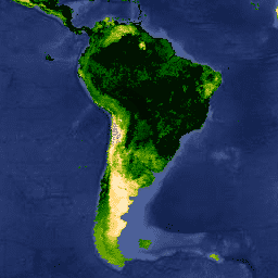
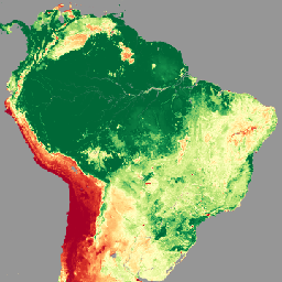
Actual Evapotranspiration for Australia (CMRSET Landsat V2.2)
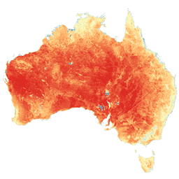
This dataset provides accurate actual evapotranspiration (AET or ETa) for Australia using the CMRSET algorithm. The AET band (named 'ETa') contains the average daily value from the CMRSET model for all cloud-free Landsat observations in that month (indicated with value 3 in the AET Data … agriculture australia csiro evaporation evapotranspiration landsat-derived -
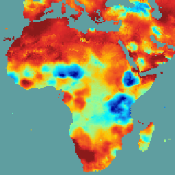
Breathing Earth System Simulator (BESS) Radiation v1
Breathing Earth System Simulator (BESS) is a simplified process-based model that couples atmosphere and canopy radiative transfers, canopy photosynthesis, transpiration, and energy balance. It couples an atmospheric radiative transfer model and artificial neural network with forcings from MODIS atmospheric products to generate 5-km daily products. … climate evapotranspiration gpp modis-derived par radiation -
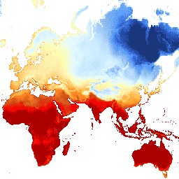
FLDAS: Famine Early Warning Systems Network (FEWS NET) Land Data Assimilation System
The FLDAS dataset (McNally et al. 2017), was designed to assist with food security assessments in data-sparse, developing country settings. It includes information on many climate-related variables including moisture content, humidity, evapotranspiration, average soil temperature, total precipitation rate, etc. There are multiple different FLDAS datasets; … climate cryosphere evapotranspiration humidity ldas monthly -
GRIDMET DROUGHT: CONUS Drought Indices
This dataset contains drought indices derived from the 4-km daily Gridded Surface Meteorological (GRIDMET) dataset. The drought indices provided include the standardized precipitation index (SPI), the evaporative drought demand index (EDDI), the standardized precipitation evapotranspiration index (SPEI), the Palmer Drought Severity Index (PDSI) and Palmer … climate conus crop drought evapotranspiration geophysical -
MOD16A2.061: Terra Net Evapotranspiration 8-Day Global 500m
The MOD16A2 Version 6.1 Evapotranspiration/Latent Heat Flux product is an 8-day composite product produced at 500 meter pixel resolution. The algorithm used for the MOD16 data product collection is based on the logic of the Penman-Monteith equation, which includes inputs of daily meteorological reanalysis data … 8-day evapotranspiration global mod16a2 modis nasa -
MOD16A2: MODIS Global Terrestrial Evapotranspiration 8-Day Global 1km
The MOD16A2 V105 product provides information about 8-day global terrestrial evapotranspiration at 1km pixel resolution. Evapotranspiration (ET) is the sum of evaporation and plant transpiration from the Earth's surface to the atmosphere. With long-term ET data, the effects of changes in climate, land use, and … 8-day evapotranspiration global mod16a2 modis water-vapor -
MOD16A2GF.061: Terra Net Evapotranspiration Gap-Filled 8-Day Global 500m
The Terra Moderate Resolution Imaging Spectroradiometer (MODIS) MOD16A2GF Version 6.1 Evapotranspiration/Latent Heat Flux (ET/LE) product is a year-end gap-filled 8-day composite dataset produced at 500 meter (m) pixel resolution. The algorithm used for the MOD16 data product collection is based on the logic of the … 8-day evapotranspiration global modis nasa water-vapor -
MYD16A2.061: Aqua Net Evapotranspiration 8-Day L4 Global 500m SIN Grid V061
The MYD16A2 Version 6.1 Evapotranspiration/Latent Heat Flux product is an 8-day composite product at 500 meter pixel resolution. The algorithm used for the MOD16 data product collection is based on the logic of the Penman-Monteith equation, which includes inputs of daily meteorological reanalysis data along … 8-day evapotranspiration global modis nasa water-vapor -
OpenET DisALEXI Monthly Evapotranspiration v2.0

Atmosphere-Land Exchange Inverse / Disaggregation of the Atmosphere-Land Exchange Inverse (ALEXI/DisALEXI). DisALEXI was ported to Google Earth Engine as part of the OpenET framework. The baseline ALEXI/DisALEXI model structure is described by Anderson et al. (2012, 2018). The ALEXI evapotranspiration (ET) model specifically uses time … evapotranspiration landsat-derived monthly openet publisher-dataset water -
OpenET DisALEXI Monthly Evapotranspiration v2.1

Atmosphere-Land Exchange Inverse / Disaggregation of the Atmosphere-Land Exchange Inverse (ALEXI/DisALEXI). DisALEXI was ported to Google Earth Engine as part of the OpenET framework. The baseline ALEXI/DisALEXI model structure is described by Anderson et al. (2012, 2018). The ALEXI evapotranspiration (ET) model specifically uses time … evapotranspiration landsat-derived monthly openet publisher-dataset water -
OpenET Ensemble Monthly Evapotranspiration v2.0

The OpenET dataset includes satellite-based data on the total amount of water that is transferred from the land surface to the atmosphere through the process of evapotranspiration (ET). OpenET provides ET data from multiple satellite-driven models, and also calculates a single "ensemble value" from the … evapotranspiration gridmet-derived landsat-derived monthly openet publisher-dataset -
OpenET Ensemble Monthly Evapotranspiration v2.1

The OpenET dataset includes satellite-based data on the total amount of water that is transferred from the land surface to the atmosphere through the process of evapotranspiration (ET). OpenET provides ET data from multiple satellite-driven models, and also calculates a single "ensemble value" from the … evapotranspiration gridmet-derived landsat-derived monthly openet publisher-dataset -
OpenET PT-JPL Monthly Evapotranspiration v2.0

Priestley-Taylor Jet Propulsion Laboratory (PT-JPL). The core formulation of the PT-JPL model within the OpenET framework has not changed from the original formulation detailed in Fisher et al. (2008). However, enhancements and updates to model inputs and time integration for PT-JPL were made to take … evapotranspiration gridmet-derived landsat-derived monthly openet publisher-dataset -
OpenET PT-JPL Monthly Evapotranspiration v2.1

Priestley-Taylor Jet Propulsion Laboratory (PT-JPL). The core formulation of the PT-JPL model within the OpenET framework has not changed from the original formulation detailed in Fisher et al. (2008). However, enhancements and updates to model inputs and time integration for PT-JPL were made to take … evapotranspiration gridmet-derived landsat-derived monthly openet publisher-dataset -
OpenET SIMS Monthly Evapotranspiration v2.0

Satellite Irrigation Management Support (SIMS). The NASA Satellite Irrigation Management Support (SIMS) model was originally developed to support satellite mapping of crop coefficients and evapotranspiration (ET) from irrigated lands and to increase access to this data to support use in irrigation scheduling and regional assessment … evapotranspiration gridmet-derived landsat-derived monthly openet publisher-dataset -
OpenET SIMS Monthly Evapotranspiration v2.1

Satellite Irrigation Management Support (SIMS). The NASA Satellite Irrigation Management Support (SIMS) model was originally developed to support satellite mapping of crop coefficients and evapotranspiration (ET) from irrigated lands and to increase access to this data to support use in irrigation scheduling and regional assessment … evapotranspiration gridmet-derived landsat-derived monthly openet publisher-dataset -
OpenET SSEBop Monthly Evapotranspiration v2.0

Operational Simplified Surface Energy Balance (SSEBop). The Operational Simplified Surface Energy Balance (SSEBop) model by Senay et al. (2013, 2017) is a thermal-based simplified surface energy model for estimating actual ET based on the principles of satellite psychrometry (Senay 2018). The OpenET SSEBop implementation uses … evapotranspiration gridmet-derived landsat-derived monthly openet publisher-dataset -
OpenET SSEBop Monthly Evapotranspiration v2.1

Operational Simplified Surface Energy Balance (SSEBop). The Operational Simplified Surface Energy Balance (SSEBop) model (Senay et al., 2013; 2023) is a thermal based approach for estimating actual evapotranspiration (ET) using the principles of satellite psychrometry (Senay, 2018). As one of the core models in the … evapotranspiration gridmet-derived landsat-derived monthly openet publisher-dataset -
OpenET eeMETRIC Monthly Evapotranspiration v2.0

Google Earth Engine implementation of the Mapping Evapotranspiration at high Resolution with Internalized Calibration model (eeMETRIC). eeMETRIC applies the advanced METRIC algorithms and process of Allen et al. (2007; 2015) and Allen et al. (2013b), where a singular relationship between the near surface air temperature … evapotranspiration gridmet-derived landsat-derived monthly openet publisher-dataset -
OpenET eeMETRIC Monthly Evapotranspiration v2.1

Google Earth Engine implementation of the Mapping Evapotranspiration at high Resolution with Internalized Calibration model (eeMETRIC). eeMETRIC applies the advanced METRIC algorithms and process of Allen et al. (2007; 2015) and Allen et al. (2013b), where a singular relationship between the near surface air temperature … evapotranspiration gridmet-derived landsat-derived monthly openet publisher-dataset -
OpenET geeSEBAL Monthly Evapotranspiration v2.0

Google Earth Engine implementation of the Surface Energy Balance Algorithm for Land (SEBAL) model. An overview of the current geeSEBAL version can be found in Laipelt et al. (2021), which is based on the original algorithms developed by Bastiaanssen et al. (1998). The OpenET geeSEBAL … evapotranspiration gridmet-derived landsat-derived monthly openet publisher-dataset -
OpenET geeSEBAL Monthly Evapotranspiration v2.1

Google Earth Engine implementation of the Surface Energy Balance Algorithm for Land (SEBAL) model. An overview of the current geeSEBAL version can be found in Laipelt et al. (2021), which is based on the original algorithms developed by Bastiaanssen et al. (1998). The OpenET geeSEBAL … evapotranspiration gridmet-derived landsat-derived monthly openet publisher-dataset -
PML_V2.2a: Coupled Evapotranspiration and Gross Primary Product (GPP)
The dataset is produced by the Large Scale Hydrology Lab, which specializes in advancing global and regional water cycle research by synthesizing multi-source Earth observations with process-based modeling. The PML-V2.2a product provides 500m 8-day resolution global terrestrial evapotranspiration (ET) and gross primary production (GPP) from … evapotranspiration gpp plant-productivity publisher-dataset water-vapor -
SPEIbase: Standardised Precipitation-Evapotranspiration Index database, Version 2.11
The Global SPEI database (SPEIbase) offers long-time robust information about drought conditions at the global scale, with a 0.5 degree pixel size and monthly cadence. It provides SPEI time scales from 1 to 48 months. The Standardized Precipitation-Evapotranspiration Index (SPEI) expresses, as a standardized variate … climate climate-change drought evapotranspiration global monthly -
TerraClimate: Monthly Climate and Climatic Water Balance for Global Terrestrial Surfaces, University of Idaho
TerraClimate is a dataset of monthly climate and climatic water balance for global terrestrial surfaces. It uses climatically aided interpolation, combining high-spatial resolution climatological normals from the WorldClim dataset, with coarser spatial resolution, but time-varying data from CRU Ts4.0 and the Japanese 55-year Reanalysis (JRA55). … climate drought evapotranspiration geophysical global merced