Page Summary
-
Annual crop type digital maps for Canada started in 2009, focusing on the Prairie Provinces initially.
-
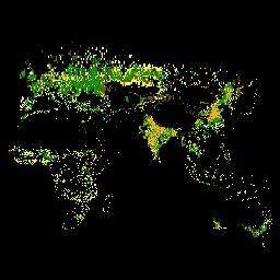
Probability models for cocoa, coffee, palm, and rubber trees provide estimated per-pixel probability at 10-meter resolution, though these are not yet peer-reviewed.
-
The ESA WorldCereal project provides global-scale annual and seasonal crop maps and confidence levels at 10m resolution, along with a global stratification into Agro-Ecological Zones and active cropland markers.
-
EUCROPMAP offers European crop type maps based on Sentinel imagery and LUCAS Copernicus observations for 2018 and 2022.
-
GFSAD provides high-resolution global cropland data and water use information for food security analysis, derived from multi-sensor remote sensing data and field data.
-
A dataset containing drought indices derived from daily gridded meteorological data is available for the continental United States.
-
A 10m global map of industrial and smallholder oil palm plantations for 2019 is available, created using Sentinel-1 and Sentinel-2 data.
-
The USDA NASS Cropland Data Layer provides annual crop-specific land cover data for the continental United States using satellite imagery and ground truth data.
-
Canada AAFC Annual Crop Inventory
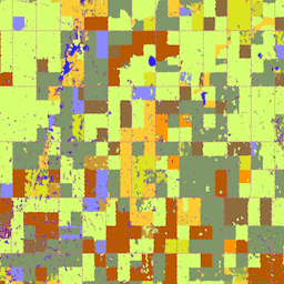
Starting in 2009, the Earth Observation Team of the Science and Technology Branch (STB) at Agriculture and Agri-Food Canada (AAFC) began the process of generating annual crop type digital maps. Focusing on the Prairie Provinces in 2009 and 2010, a Decision Tree (DT) based methodology … agriculture canada crop landcover -
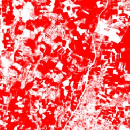
Cocoa Probability model 2025a

This image collection provides estimated per-pixel probability that the underlying area is occupied by the commodity. The probability estimates are provided at 10 meter resolution, and have been generated by a machine learning model. For details, see the technical documentation on the Forest Data Partnership … agriculture biodiversity cocoa conservation crop eudr -
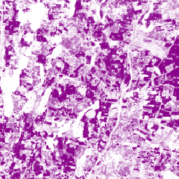
Cocoa Probability model 2025b
This image collection provides estimated per-pixel probability that the underlying area is occupied by the commodity. The probability estimates are provided at 10 meter resolution, and have been generated by a machine learning model. For details, see the technical documentation on the Forest Data Partnership … agriculture alphaearth-derived biodiversity cocoa conservation crop -
Coffee Probability model 2025a
This image collection provides estimated per-pixel probability that the underlying area is occupied by the commodity. The probability estimates are provided at 10 meter resolution, and have been generated by a machine learning model. For details, see the technical documentation on the Forest Data Partnership … agriculture biodiversity coffee conservation crop eudr -
Coffee Probability model 2025b
This image collection provides estimated per-pixel probability that the underlying area is occupied by the commodity. The probability estimates are provided at 10 meter resolution, and have been generated by a machine learning model. For details, see the technical documentation on the Forest Data Partnership … agriculture alphaearth-derived biodiversity coffee conservation crop -
ESA WorldCereal 10 m v100
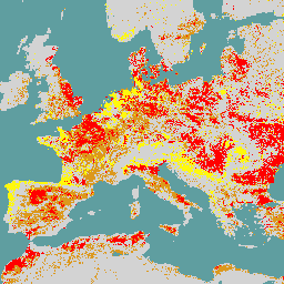
The European Space Agency (ESA) WorldCereal 10 m 2021 product suite consists of global-scale annual and seasonal crop maps and their related confidence. They were generated as part of the ESA-WorldCereal project. More information on the content of these products and the methodology used to … agriculture copernicus crop esa global landcover -
ESA WorldCereal AEZ v100
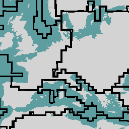
The European Space Agency (ESA) WorldCereal classification system aims for product generation within one month after the end of a particular growing season. Due to the dynamic nature of these growing seasons across the globe, a global stratification into Agro-Ecological Zones (AEZ) was performed based … agriculture boundaries crop esa global table -
ESA WorldCereal Active Cropland 10 m v100
The European Space Agency (ESA) WorldCereal Active Cropland 10 m 2021 product suite contains global-scale seasonal active cropland markers. They were generated as part of the ESA-WorldCereal project. The active cropland products indicate whether or not a pixel identified as temporary crops has been actively … agriculture copernicus crop esa global landcover -
EUCROPMAP
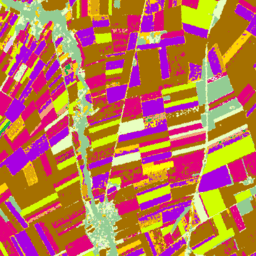
European crop type maps based on Sentinel-1 and LUCAS Copernicus 2018 in-situ observations for 2018, and a combination of Sentinel-1, Sentinel-2, and auxiliary data with LUCAS Copernicus 2022 observations for 2022. Based on the unique LUCAS 2018 Copernicus in-situ survey, this dataset represents the first … agriculture crop eu jrc lucas sentinel1-derived -
GFSAD1000: Cropland Extent 1km Multi-Study Crop Mask, Global Food-Support Analysis Data
The GFSAD is a NASA-funded project to provide high-resolution global cropland data and their water use that contributes towards global food security in the twenty-first century. The GFSAD products are derived through multi-sensor remote sensing data (e.g., Landsat, MODIS, AVHRR), secondary data, and field-plot data … agriculture crop landcover usgs -
GRIDMET DROUGHT: CONUS Drought Indices
This dataset contains drought indices derived from the 4-km daily Gridded Surface Meteorological (GRIDMET) dataset. The drought indices provided include the standardized precipitation index (SPI), the evaporative drought demand index (EDDI), the standardized precipitation evapotranspiration index (SPEI), the Palmer Drought Severity Index (PDSI) and Palmer … climate conus crop drought evapotranspiration geophysical -
Global Map of Oil Palm Plantations
The dataset is a 10m global industrial and smallholder oil palm map for 2019. It covers areas where oil palm plantations were detected. The classified images are the output of a convolutional neural network based on Sentinel-1 and Sentinel-2 half-year composites. See article for additional … agriculture biodiversity conservation crop global landuse -
Palm Probability model 2025a

This image collection provides estimated per-pixel probability that the underlying area is occupied by the commodity. The probability estimates are provided at 10 meter resolution, and have been generated by a machine learning model. For details, see the technical documentation on the Forest Data Partnership … agriculture biodiversity conservation crop eudr forestdatapartnership -
Palm Probability model 2025b
This image collection provides estimated per-pixel probability that the underlying area is occupied by the commodity. The probability estimates are provided at 10 meter resolution, and have been generated by a machine learning model. For details, see the technical documentation on the Forest Data Partnership … agriculture alphaearth-derived biodiversity conservation crop eudr -
Rubber Probability model 2025b
This image collection provides estimated per-pixel probability that the underlying area is occupied by the commodity. The probability estimates are provided at 10 meter resolution, and have been generated by a machine learning model. For details, see the technical documentation on the Forest Data Partnership … agriculture alphaearth-derived biodiversity conservation crop eudr -
Rubber Tree Probability model 2025a
This image collection provides estimated per-pixel probability that the underlying area is occupied by the commodity. The probability estimates are provided at 10 meter resolution, and have been generated by a machine learning model. For details, see the technical documentation on the Forest Data Partnership … agriculture biodiversity conservation crop eudr forestdatapartnership -
USDA NASS Cropland Data Layers
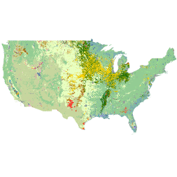
The Cropland Data Layer (CDL) is a crop-specific land cover data layer created annually for the continental United States using moderate resolution satellite imagery and extensive agricultural ground truth. The CDL is created by the USDA, National Agricultural Statistics Service (NASS), Research and Development Division, … agriculture crop landcover usda