Page Summary
-
Datasets are available providing estimated probabilities of land being occupied by commodities like Cocoa, Coffee, Palm, and Rubber Trees at 10-meter resolution.
-
Global maps of forest cover and forest types for 2020 are available at 10-meter resolution.
-
A dataset indicating the per-pixel score of undisturbed forest in 2020 is provided.
-
A global map of natural forest probability for 2020 at 10-meter resolution is available and supports initiatives like the EU Deforestation Regulation.
-
Several datasets are noted as not yet peer-reviewed, with more information available on GitHub.
-
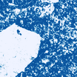
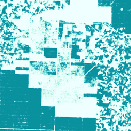
Cocoa Probability model 2025a

This image collection provides estimated per-pixel probability that the underlying area is occupied by the commodity. The probability estimates are provided at 10 meter resolution, and have been generated by a machine learning model. For details, see the technical documentation on the Forest Data Partnership … agriculture biodiversity cocoa conservation crop eudr -
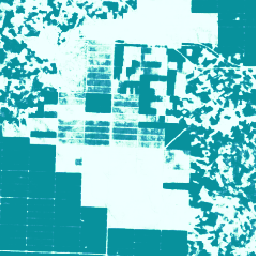
Cocoa Probability model 2025b
This image collection provides estimated per-pixel probability that the underlying area is occupied by the commodity. The probability estimates are provided at 10 meter resolution, and have been generated by a machine learning model. For details, see the technical documentation on the Forest Data Partnership … agriculture alphaearth-derived biodiversity cocoa conservation crop -
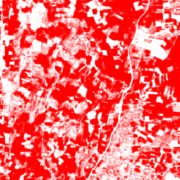
Coffee Probability model 2025a

This image collection provides estimated per-pixel probability that the underlying area is occupied by the commodity. The probability estimates are provided at 10 meter resolution, and have been generated by a machine learning model. For details, see the technical documentation on the Forest Data Partnership … agriculture biodiversity coffee conservation crop eudr -
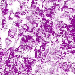
Coffee Probability model 2025b
This image collection provides estimated per-pixel probability that the underlying area is occupied by the commodity. The probability estimates are provided at 10 meter resolution, and have been generated by a machine learning model. For details, see the technical documentation on the Forest Data Partnership … agriculture alphaearth-derived biodiversity coffee conservation crop -
EC JRC global map of forest cover 2020, V3
The global map of forest cover provides a spatially explicit representation of forest presence and absence for the year 2020 at 10m spatial resolution. The year 2020 corresponds to the cut-off date of the Regulation from the European Union "on the making available on the … eudr forest forest-biomass jrc -
EC JRC global map of forest types 2020, V1
The global map of forest types provides a spatially explicit representation of primary forest, naturally regenerating forest and planted forest (including plantation forest) for the year 2020 at 10m spatial resolution. The base layer for mapping these forest types is the extent of forest cover … eudr forest forest-biomass jrc landcover primary-forest -
Forest Persistence v0

This image provides a per-pixel score (in [0, 1]) that indicates whether the pixel area is occupied by undisturbed forest in year 2020. These scores are provided at 30 meter resolution, and have been generated by a convergence of evidence approach to combining multiple forest … biodiversity conservation deforestation eudr forest-biomass forestdatapartnership -
Forest Typology (ForTy) 2020 v1.0

The Forest Typology (ForTy) v1 dataset consists of a global per-class probability map at 10 m resolution covering all land areas between 65°S and 84°N latitude for the year 2020. The six-class typology is aligned with FAO and EU Deforestation Regulation (EUDR) definitions: Class 1 … alphaearth-derived biodiversity climate conservation deforestation eudr -
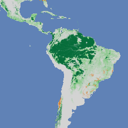
Natural Forests of the World 2020

Natural Forests of the World 2020, provides a global map of natural forest probability for the year 2020 at a 10-meter resolution. It was developed to support initiatives like the European Union's Deforestation Regulation (EUDR) and other efforts for forest conservation and monitoring. The map … biodiversity climate conservation deforestation eudr forest -
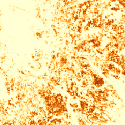
Palm Probability model 2025a
This image collection provides estimated per-pixel probability that the underlying area is occupied by the commodity. The probability estimates are provided at 10 meter resolution, and have been generated by a machine learning model. For details, see the technical documentation on the Forest Data Partnership … agriculture biodiversity conservation crop eudr forestdatapartnership -
Palm Probability model 2025b
This image collection provides estimated per-pixel probability that the underlying area is occupied by the commodity. The probability estimates are provided at 10 meter resolution, and have been generated by a machine learning model. For details, see the technical documentation on the Forest Data Partnership … agriculture alphaearth-derived biodiversity conservation crop eudr -
Rubber Probability model 2025b
This image collection provides estimated per-pixel probability that the underlying area is occupied by the commodity. The probability estimates are provided at 10 meter resolution, and have been generated by a machine learning model. For details, see the technical documentation on the Forest Data Partnership … agriculture alphaearth-derived biodiversity conservation crop eudr -
Rubber Tree Probability model 2025a
This image collection provides estimated per-pixel probability that the underlying area is occupied by the commodity. The probability estimates are provided at 10 meter resolution, and have been generated by a machine learning model. For details, see the technical documentation on the Forest Data Partnership … agriculture biodiversity conservation crop eudr forestdatapartnership