Page Summary
-
Global maps of aboveground and belowground biomass carbon density are available for 2010 at 300-m resolution, integrating various remotely sensed land-cover biomass maps.
-
OpenLandMap provides soil bulk density at 6 standard depths and 250 m resolution, excluding Antarctica.
-
Global Aboveground and Belowground Biomass Carbon Density Maps
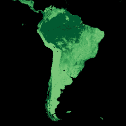
This dataset provides temporally consistent and harmonized global maps of aboveground and belowground biomass carbon density for the year 2010 at a 300-m spatial resolution. The aboveground biomass map integrates land-cover specific, remotely sensed maps of woody, grassland, cropland, and tundra biomass. Input maps were … aboveground biomass carbon density forest forest-biomass -
OpenLandMap Soil Bulk Density
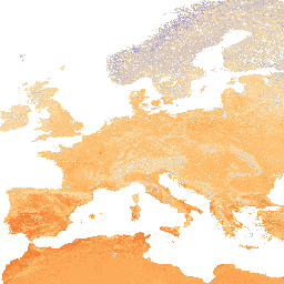
Soil bulk density (fine earth) 10 x kg / m3 at 6 standard depths (0, 10, 30, 60, 100 and 200 cm) at 250 m resolution. Processing steps are described in detail here. Antarctica is not included. To access and visualize maps outside of Earth … density envirometrix opengeohub openlandmap soil