Page Summary
-
The webpage features various datasets related to change detection, including Landsat-based land cover, global surface water mapping, and MODIS/VIIRS burned area products.
-
Google Global Landsat-based CCDC Segments provide precomputed results of land cover change detection from 1999-2019 using the CCDC algorithm.
-
JRC Global Surface Water Mapping Layers offer data on the location and temporal distribution of surface water globally from 1984 to 2021.
-
Burned area datasets from MODIS (MCD64A1) and VIIRS (VNP64A1) provide monthly global 500m products containing information on burned area and quality.
-
The USFS Landscape Change Monitoring System provides modeled change, land cover, and/or land use classes annually for the Conterminous United States and other areas.
-
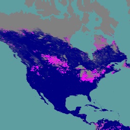
Google Global Landsat-based CCDC Segments (1999-2019)
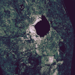
This collection contains precomputed results from running the Continuous Change Detection and Classification (CCDC) algorithm on 20 years of Landsat surface reflectance data. CCDC is a break-point finding algorithm that uses harmonic fitting with a dynamic RMSE threshold to detect breakpoints in time-series data. The … change-detection google landcover landsat-derived landuse landuse-landcover -
JRC Global Surface Water Mapping Layers, v1.4
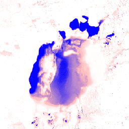
This dataset contains maps of the location and temporal distribution of surface water from 1984 to 2021 and provides statistics on the extent and change of those water surfaces. For more information see the associated journal article: High-resolution mapping of global surface water and its … change-detection geophysical google jrc landsat-derived surface -
MCD64A1.061 MODIS Burned Area Monthly Global 500m
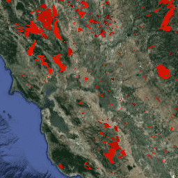
The Terra and Aqua combined MCD64A1 Version 6.1 Burned Area data product is a monthly, global gridded 500m product containing per-pixel burned-area and quality information. The MCD64A1 burned-area mapping approach employs 500m MODIS Surface Reflectance imagery coupled with 1km MODIS active fire observations. The algorithm … burn change-detection fire geophysical global mcd64a1 -
USFS Landscape Change Monitoring System v2025-11 (CONUS and OCONUS)
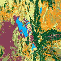
This product is part of the Landscape Change Monitoring System (LCMS) data suite. It shows LCMS-modeled change, land cover, and/or land use classes for each year and covers the Conterminous United States (CONUS) as well as areas outside the CONUS (OCONUS) including Alaska (AK), Puerto … change-detection forest gtac gtac-data-publish landcover landuse -
VNP64A1.002: Burned Area Monthly L4 Global 500m SIN Grid
The daily Suomi National Polar-Orbiting Partnership (Suomi NPP) NASA Visible Infrared Imaging Radiometer Suite (VIIRS) Burned Area (VNP64A1) Version 2 data product is a monthly, global gridded 500m product containing per-pixel burned area and quality information. The VNP64 burned area mapping approach employs 750m VIIRS … burn change-detection fire land nasa surface