Page Summary
-
The ALOS World 3D - 30m (AW3D30) dataset provides a global digital surface model with approximately 30 meters horizontal resolution.
-
The ALOS/AVNIR-2 ORI dataset contains orthorectified imagery from the AVNIR-2 sensor on the ALOS satellite.
-
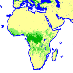
GHSL offers global building height data for 2018 at 100m resolution and global building volume data from 1975-2030 at 100m grid cell resolution, both utilizing ALOS DSM data.
-
Global PALSAR-2/PALSAR Forest/Non-Forest Maps are available in 3-class and 4-class versions generated from classifying SAR imagery.
-
Global PALSAR-2/PALSAR Yearly Mosaic datasets provide seamless global SAR images created by mosaicking SAR imagery strips.
-
ALOS DSM: Global 30m v4.1

ALOS World 3D - 30m (AW3D30) is a global digital surface model (DSM) dataset with a horizontal resolution of approximately 30 meters (1 arcsec mesh). The dataset is based on the DSM dataset (5-meter mesh version) of the World 3D Topographic Data. More details are … alos dem elevation elevation-topography geophysical jaxa -
ALOS/AVNIR-2 ORI
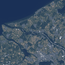
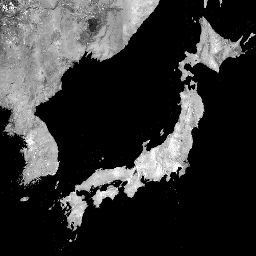
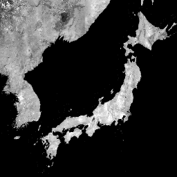
This dataset is contains orthorectified imagery from the Advanced Visible and Near Infrared Radiometer type 2 (AVNIR-2) sensor on-board the Advanced Land Observing Satellite (ALOS) "DAICHI". The AVNIR-2 ORI product was created from AVNIR-2 1B1 data after stereo matching with reference to ALOS's Panchromatic Remote-sensing … alos jaxa orthophoto satellite-imagery visible -
GHSL: Global building height 2018 (P2023A)
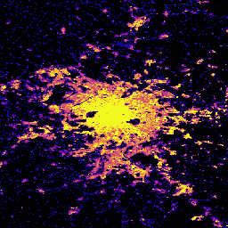
This spatial raster dataset depicts the global distribution of building heights at a resolution of 100 m, referred to the year 2018. The input data used to predict building heights are the ALOS Global Digital Surface Model (30 m), the NASA Shuttle Radar Topographic Mission … alos building built built-environment builtup copernicus -
GHSL: Global building volume 1975-2030 (P2023A)
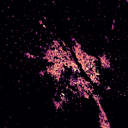
This raster dataset depicts the global distribution of building volume, expressed in cubic metres per 100 m grid cell. The dataset measures the total building volume and the building volume allocated to grid cells of predominant non-residential (NRES) use. Estimates are based on the built-up … alos building built-environment copernicus dem ghsl -
Global 3-class PALSAR-2/PALSAR Forest/Non-Forest Map
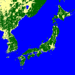
A newer version of this dataset with 4 classes for 2017-2020 can be found in JAXA/ALOS/PALSAR/YEARLY/FNF4 The global forest/non-forest map (FNF) is generated by classifying the SAR image (backscattering coefficient) in the global 25m resolution PALSAR-2/PALSAR SAR mosaic so that strong and low backscatter pixels … alos alos2 classification eroc forest forest-biomass -
Global 4-class PALSAR-2/PALSAR Forest/Non-Forest Map
The global forest/non-forest map (FNF) is generated by classifying the SAR image (backscattering coefficient) in the global 25m resolution PALSAR-2/PALSAR SAR mosaic so that strong and low backscatter pixels are assigned as "forest" and "non-forest", respectively. Here, "forest" is defined as the natural forest with … alos alos2 classification eroc forest forest-biomass -
Global PALSAR-2/PALSAR Yearly Mosaic, version 1
A newer version of this dataset with data for 2015-2021 can be found in JAXA/ALOS/PALSAR/YEARLY/SAR_EPOCH The global 25m PALSAR/PALSAR-2 mosaic is a seamless global SAR image created by mosaicking strips of SAR imagery from PALSAR/PALSAR-2. For each year and location, the strip data were selected … alos alos2 eroc jaxa palsar palsar2 -
Global PALSAR-2/PALSAR Yearly Mosaic, version 2.5.0
The global 25m PALSAR/PALSAR-2 mosaic is a seamless global SAR image created by mosaicking strips of SAR imagery from PALSAR/PALSAR-2. For each year and location, the strip data were selected through visual inspection of the browse mosaics available over the period, with those showing minimum … alos alos2 eroc jaxa palsar palsar2