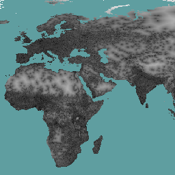
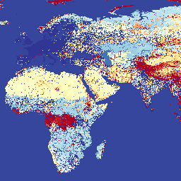
Friction Surface 2019'를 참고하세요. 이 전역 마찰 표면은 2015년의 지명 연도를 기준으로 북위 85도와 남위 60도 사이의 모든 육지 픽셀에 대한 육상 이동 속도를 열거합니다. 이 지도는 옥스퍼드 대학 말라리아 지도 프로젝트 (MAP), Google, …
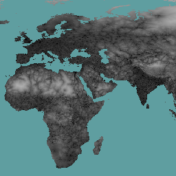
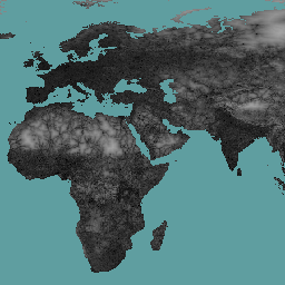
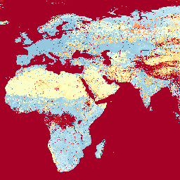
이 전역 마찰 표면은 2019년의 공칭 연도를 기준으로 북위 85도와 남위 60도 사이의 모든 육지 픽셀에 대한 육지 기반 이동 속도를 열거합니다. 이 지도는 MAP (옥스퍼드 대학교), Telethon Kids Institute (오스트레일리아 퍼스), Google, …
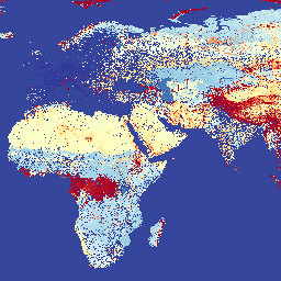
[[["이해하기 쉬움","easyToUnderstand","thumb-up"],["문제가 해결됨","solvedMyProblem","thumb-up"],["기타","otherUp","thumb-up"]],[["필요한 정보가 없음","missingTheInformationINeed","thumb-down"],["너무 복잡함/단계 수가 너무 많음","tooComplicatedTooManySteps","thumb-down"],["오래됨","outOfDate","thumb-down"],["번역 문제","translationIssue","thumb-down"],["샘플/코드 문제","samplesCodeIssue","thumb-down"],["기타","otherDown","thumb-down"]],[],[],["The data provides global land-based travel information between 85°N and 60°S. It details travel time to the nearest densely populated area (1,500+ inhabitants/km²) for 2015 and to healthcare facilities for 2019. It also includes a 2019 global friction surface map showing travel speed, including non-motorized options. The datasets are products of a collaboration and cover aspects of accessibility to cities, healthcare, and overall travel conditions.\n"]]