
- Catalog Owner
- Large Scale Hydrology Lab
- Dataset Availability
- 2012-01-25T00:00:00Z–2025-12-27T00:00:00Z
- Dataset Producer
- Large Scale Hydrology Lab PML_V2
- Cadence
- 8 Days
- Tags
Description
The dataset is produced by the Large Scale Hydrology Lab, which specializes in advancing global and regional water cycle research by synthesizing multi-source Earth observations with process-based modeling.
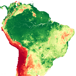
The PML-V2.2a (VIIRS Edition) product provides global terrestrial evapotranspiration (ET) and gross primary production (GPP) at a 500-m, 8-day resolution from 2012 to 2025. Forced by MSWEP and MSWX data, this version features an expanded bottom-up calibration using 208 flux sites and refined parameterizations that explicitly distinguish irrigated from rainfed croplands.
Validation confirms high accuracy across plant functional types (NSE > 0.60, absolute bias < 5%) and reliable basin-scale water-balance performance (NSE: 0.89–0.91). Optimized for high-resolution, near-present monitoring, this VIIRS-based record ensures seamless data continuity. For the 2000–2024 period, please refer to the companion MODIS Edition asset, which will no longer be updated due to satellite orbital drift.
This dataset is part of the broader PML-V2.2 suite, where the description paper is available at Earth System Science Data. please visit the TPDC data repository.
Bands
Bands
Pixel size: 500 meters (all bands)
| Name | Units | Min | Max | Scale | Pixel Size | Description |
|---|---|---|---|---|---|---|
GPP |
gC m-2 d-1 | 0* | 3901* | 0.01 | 500 meters | Gross primary production |
ET |
mm/d | 0* | 2011* | 0.01 | 500 meters | Evapotranspiration |
Ec |
mm/d | 0* | 1533* | 0.01 | 500 meters | Transpiration |
Es |
mm/d | 0* | 820* | 0.01 | 500 meters | Soil evaporation |
Ei |
mm/d | 0* | 1256* | 0.01 | 500 meters | Interception evaporation |
PET |
mm/d | 0* | 2011* | 0.01 | 500 meters | Potential evapotranspiration (PET) estimated using the Shuttleworth-simplified Penman equation. |
Ew |
mm/d | 0* | 2011* | 0.01 | 500 meters | Evaporation from water bodies, snow, and ice, estimated using the Penman equation with unlimited water supply. |
Terms of Use
Terms of Use
Acknowledgements Whenever PML datasets are used in a scientific publication, the given references should be cited.
License The dataset is licensed under the CC-BY 4.0 license.
Citations
Xu, Z., Zhang, Y., Kong, D., Ma, N., and Zhang, X., 2026. Extended global terrestrial evapotranspiration and gross primary production dataset from 1982 to near present. Earth Syst. Sci. Data, 18, 5663-5695, doi:10.5194/essd-18-5663-2026
Zhang, Y., Kong, D., Gan, R., Chiew, F.H.S., McVicar, T.R., Zhang, Q., and Yang, Y., 2019. Coupled estimation of 500m and 8-day resolution global evapotranspiration and gross primary production in 2002-2017. Remote Sens. Environ. 222, 165-182, doi:10.1016/j.rse.2018.12.031
Gan, R., Zhang, Y.Q., Shi, H., Yang, Y.T., Eamus, D., Cheng, L., Chiew, F.H.S., Yu, Q., 2018. Use of satellite leaf area index estimating evapotranspiration and gross assimilation for Australian ecosystems. Ecohydrology, doi:10.1002/eco.1974
Zhang, Y., Peña-Arancibia, J.L., McVicar, T.R., Chiew, F.H.S., Vaze, J., Liu, C., Lu, X., Zheng, H., Wang, Y., Liu, Y.Y., Miralles, D.G., Pan, M., 2016. Multi-decadal trends in global terrestrial evapotranspiration and its components. Sci. Rep. 6, 19124. doi:10.1038/srep19124
DOIs
Explore with Earth Engine
Code Editor (JavaScript)
var dataset = ee.ImageCollection('projects/pml_evapotranspiration/PML/OUTPUT/PML_V22a_VIIRS');

// Convert 8-day averages to annual estimate with 0.01 scale factor
var image = dataset.filterDate('2025-01-01', '2025-12-31')
    .select('GPP')
    .mean()
    .multiply(365)
    .multiply(0.01);

// Final unit: gC m-2 yr-1
var visualization = {
  bands: ['GPP'],
  min: 0.0,
  max: 3600,
  palette: [

   "#A50026", "#D31527", "#F03E33", "#FA6F46", "#FD9D5D", "#FECA81", "#FFFFAC",
   "#E3F399", "#C1E57A", "#96D35F", "#64BC56", "#34A048", "#12823A", "#006837"

  ]
};

Map.setCenter(0.0, 15.0, 2);

Map.addLayer(
    image, visualization, 'PML_V2.2a Gross Primary Production (GPP)');