- Katalog Sahibi
- Planet
- Veri Kümesi Kullanılabilirliği
- 2015-12-01T00:00:00Z–2026-06-01T00:00:00Z
- Veri Kümesi Üreticisi
- Planet
- Etiketler
Açıklama
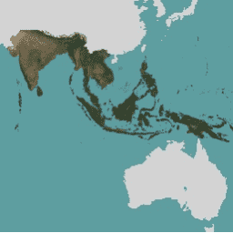
Bu görüntü koleksiyonu, tropikal ormanların kaybını azaltmak ve tersine çevirmek, iklim değişikliğiyle mücadeleye katkıda bulunmak, biyolojik çeşitliliği korumak, ormanların yeniden büyümesine, restorasyonuna ve iyileştirilmesine katkıda bulunmak ve sürdürülebilir kalkınmayı kolaylaştırmak gibi temel amaçlarla tropik bölgelerin yüksek çözünürlüklü uydu takibine erişim sağlar. Tüm bu amaçlar ticari olmayan kullanım kapsamındadır.
Temel haritalara nasıl erişeceğinizi öğrenmek için buradaki kayıt talimatlarını uygulayın.
NICFI Uydu Verileri Programı mozaikleri (Planet-NICFI mozaikleri olarak da bilinir), 6 ayda bir oluşturulan hem aylık hem de iki yılda bir toplanan verileri içerir. Mozaik türü, "cadence" adlı resim meta verileri alanında depolanır. İstediğiniz görüntüleri bulmak için bu alanı her mozaik için başlangıç ve bitiş tarihiyle birlikte kullanın.
Temel haritalarla ilgili tüm ayrıntılar NICFI Uydu Verileri Programı Temel Harita spesifikasyonunda yer almaktadır.
NICFI (Norveç'in Uluslararası İklim ve Orman Girişimi) Uydu Veri Programı ve sunulan veriler hakkında daha fazla bilgi için lütfen programın web sitesini ziyaret edin.
NICFI'nin misyonunu desteklemek için bu verileri aşağıdakiler dahil ancak bunlarla sınırlı olmamak üzere çeşitli projelerde kullanabilirsiniz:
- Dünyadaki tropik ormanlar ve bu ormanların sağladığı kritik hizmetler hakkında bilimsel araştırmaları ilerletin.
- Gelişmekte olan tropikal orman ülkelerinde ve yargı alanlarında sürdürülebilir orman yönetimi ve arazi kullanımıyla ilgili politikaları uygulayın ve iyileştirin.
- Tropik bölgelerde şeffaflığı ve hesap verebilirliği artırın.
- Tropikal ormanların bulunduğu ülkelerde yerli halkların ve yerel toplulukların haklarını korumak ve iyileştirmek.
- Küresel emtia ve finansal piyasaların ormanlar üzerindeki baskısını azaltmaya yönelik çözümler geliştirin.
Bantlar
Bantlar
Piksel boyutu: 4,77 metre (tüm bantlar)
| Ad | Min. | Maks. | Ölçek | Piksel Boyutu | Açıklama |
|---|---|---|---|---|---|
B |
0 | 10.000 | 0,0001 | 4,77 metre | Mavi |
G |
0 | 10.000 | 0,0001 | 4,77 metre | Yeşil |
R |
0 | 10.000 | 0,0001 | 4,77 metre | Kırmızı |
N |
0 | 10.000 | 0,0001 | 4,77 metre | Kızılötesine yakın |
Resim Özellikleri
Görüntü Özellikleri
| Ad | Tür | Açıklama |
|---|---|---|
| adım frekansı | Dize | Mozaikin kapsadığı aralık: aylık veya iki yılda bir |
Kullanım Şartları
Kullanım Şartları
Bu veriler, NICFI Uydu Veri Programı'nın amacını desteklemek için kullanım, çoğaltma ve dağıtım kısıtlamalarına tabidir. Lisans sözleşmesinin tamamına buradan ulaşabilirsiniz.
Telif hakkı bildirimi:
Resim © 20xx Planet Labs PBC (burada xx, kullanılan içeriğin yılını belirtir)
Alıntılar
Planet Team (2017). Planet Application Program Interface: In Space for Life on Earth. San Francisco, CA. https://api.planet.com
Earth Engine ile Keşif
Kod Düzenleyici (JavaScript)
// This collection is not publicly accessible. To sign up for access,
// please see https://developers.planet.com/docs/integrations/gee/nicfi
var nicfi = ee.ImageCollection('projects/planet-nicfi/assets/basemaps/asia');

// Filter basemaps by date and get the first image from filtered results
var basemap= nicfi.filter(ee.Filter.date('2021-03-01','2021-07-01')).first();

Map.setCenter(107, 10, 4);

var vis = {'bands':['R','G','B'],'min':64,'max':5454,'gamma':1.8};

Map.addLayer(basemap, vis, '2021-03 mosaic');
Map.addLayer(
    basemap.normalizedDifference(['N','R']).rename('NDVI'),
    {min:-0.55,max:0.8,palette: [
        '8bc4f9', 'c9995c', 'c7d270','8add60','097210'
    ]}, 'NDVI', false);