- Catalog Owner
- PKURELAB
- Dataset Availability
- 1992-04-01T00:00:00Z–2021-08-31T00:00:00Z
- Dataset Producer
- PKURELAB
- Contact
- sltao@pku.edu.cn
- Tags
Description
The LHScat dataset is the first long-term (since 1992), high-resolution (∼8.9 km) monthly C-band satellite radar backscatter dataset over global land areas. It integrated signals from the European Remote Sensing satellite (ERS; 1992–2001; C-band; 5.3 GHz), Quick Scatterometer (QSCAT, 1999–2009; Ku-band; 13.4 GHz), and the Advanced Scatterometer (ASCAT; since 2007; C-band; 5.255 GHz). The 6-year data gap between C-band ERS and ASCAT was filled by modelling a substitute C-band signal during 1999–2009 from Ku-band QSCAT signals and climatic information. The quality of the merged radar signal was assessed by computing the Pearson correlation coefficient (Pearson\'s r) and root mean square error (RMSE) between the C-band and the corrected Ku-band signals in the overlapping years (1999–2001 and 2007–2009). To facilitate storage, the radar signals were scaled by a factor of 100 and converted to unsigned Int16. For more detailed information, please refer to the paper describing LHScat dataset(https://essd.copernicus.org/articles/15/1577/2023/).
Bands
Bands
Pixel size: 8900 meters (all bands)
| Name | Scale | Pixel Size | Description |
|---|---|---|---|
radar_signals |
0.01 | 8900 meters | Observed radar backscatter values (dB) |
Image Properties
Image Properties
| Name | Type | Description |
|---|---|---|
| Satellite | INT | The satellite source of the signal. The values are as follows: 1 = ERS; 2 = ERS and QSCAT; 3 = QSCAT; 4 = ASCAT and QSCAT; 5 = ASCAT. |
Terms of Use
Terms of Use
Citations
Tao, S., Ao, Z., Wigneron, J.-P., Saatchi, S., Ciais, P., Chave, J., Le Toan, T., Frison, P.-L., Hu, X., Chen, C., Fan, L., Wang, M., Zhu, J., Zhao, X., Li, X., Liu, X., Su, Y., Hu, T., Guo, Q., Wang, Z., Tang, Z., Liu, Y. Y., and Fang, J.: A global long-term, high-resolution satellite radar backscatter data record (1992-2022+): merging C-band ERS/ASCAT and Ku-band QSCAT, Earth Syst. Sci. Data, 15, 1577-1596, https://doi.org/10.5194/essd-15-1577-2023, 2023. Tao, S., Chave, J., Frison, P.-L., Le Toan, T., Ciais, P., Fang, J., Wigneron, J.-P., Santoro, M., Yang, H., Li, X., Labrière, N., and Saatchi, S.: Increasing and widespread vulnerability of intact tropical rainforests to repeated droughts, Proc. Natl. Acad. Sci. USA, 119, e2116626119, https://doi.org/10.1073/pnas.2116626119, 2022.
Explore with Earth Engine
Code Editor (JavaScript)
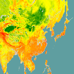
// Load the LHScat ImageCollection and filter it to a specific time window.
var LHScat = ee.ImageCollection("projects/ee-pkurelab/assets/LHScat")
               .filterDate("2020-03-01", "2020-04-01");

// Reduce the collection to a single representative image.
var signals = LHScat.mean();

var region = ee.Geometry.Rectangle([73, 8, 150, 54]);

// Visualization parameters for the radar signals.
var visParams_signals = {
  min: -2000,
  max: 500,
  palette: ['green', 'yellow', 'red', 'firebrick']
};

// Center the map on the image footprint.
Map.centerObject(region, 4);

// Add the layer to the map for interactive preview.
Map.addLayer(signals, visParams_signals, 'LHScat radar signals (2020-03)');